

We arrived at the Little Wenatchee Ford trailhead at around 7am to find only a few cars at the trailhead. The road to get to the trailhead (FS6500) was paved up until the last few miles. Once the pavement ends, it's a bit of a bumpy road with rocks and a few turnouts, but thankfully no major potholes or obstacles. My small Hyundai sedan did just fine. Our plan for the day was to head north on the PCT to White Mountain / White Pass to get a nice view of Glacier Peak, then return back to the car on the Little Wenatchee Trail just east of Cady Ridge. About a 30 mile trip in total.
We began our hike on the Cady Ridge trail, which is a nicely maintained path that climbs upward toward the PCT. A good portion of this is basic forested switchbacks, but begins to open up after a few miles to give you some serene meadows and previews of the peaks you'll see ahead. The Cady Ridge trail lasts roughly 6 miles and meets at the PCT junction.
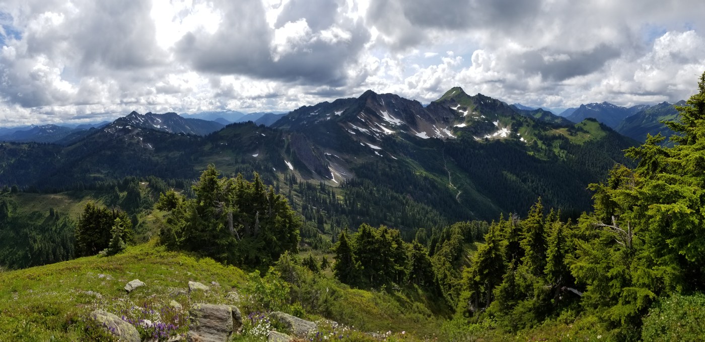
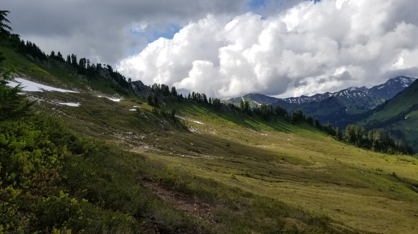
Once on the Pacific Crest Trail, it is smooth sailing all the way up to White Mountain. Very little elevation is gained or lost, and the trail grants some incredible views of the nearby river valleys, meadows, and surrounding peaks. We ran into a decent amount of backpackers on the trail, and we appeared to be some of the only people day-hiking this section. Up ahead, there are junctions that allow small side trips to Blue Lake, Kodak Peak, etc. Near the west side of Indian Head Peak, there are two trailheads that head in an eastbound direction. Indian Creek trail and the White River trail, respectively. Both of these trails are officially closed, according to the ranger's posting at the trailhead we saw at the parking lot.
From the Cady Ridge junction to White Pass is just under 9 miles. From here, the views of Glacier Peak were stunning. Unfortunately, the true peak was lost in the clouds, but the majority of the mountain and the glaciers at its base were in full view. We turned around where the PCT intersects with the North Fork Sauk trail to the west. The majority of the trail at this time provided plenty of water sources for filling up. Heading back south, we opted to take the bootpath to the top of Kodak Peak which looks down on Meander Meadow below. It's a short but fairly steep climb to the top, but well worth the panoramic views at the top. So long as it's relatively clear, this is a wonderful opportunity to get a view of Glacier Peak, Indian Head Peak, and Johnson Mountain all in one sitting.
To return to the car, we opted to take the Little Wenatchee trail just south of Kodak Peak and head back down the valley instead of backtracking to Cady Ridge. The trail is certainly overgrown nearly the whole way down, but is navigable if you really feel like taking it. We found that the small amount of mileage it saved probably isn't worth the hassle of bushwhacking. We arrived at the car just before 8pm.
Overall, this was an incredible 13 hour day of hiking while totally 29.7 miles or so. For someone who would want a shorter trip with similar views, turning around at Kodak Peak would still give you great views with a lot less mileage.

Comments