
A couple friends and I wanted a quick, close overnight trip and having done this before in the summer, it came to mind as a possible late spring option. We were unsure what snow conditions would be like but we're all comfortable and experienced on mixed terrain and decided to give it a shot.
I was last up here in 2017 and the trailhead and trail were both in rough shape then. Besides the repaired road washout, things haven't gotten any better. I would definitely recommend high clearance for any vehicle, since deep, small potholes would likely be hard to pass in a lower vehicle. The trail itself has been obscured by overgrowth and LOTS of blowdowns. Having a GPS track to follow makes navigation much easier, and we ran into another hiker who said he had gotten off-trail while routing around a large downed tree and wandered lost for a little while before finding the trail again. I can absolutely see how this could happen with the number and size of the blowdowns. Some work has been done to route over/around these trees and to mark the new route with tape, but these can be easy to lose if you're not paying very close attention.
Snow begins just before you reach Pinnacle Lake, the the trail has deep mud at this section but can be avoided by sticking to the edges of the trail. The stream/lake crossings at the east end of Pinnacle are high, and the trail is pretty consistently challenging after this point. Pinnacle still has a fair bit of snow on it (especially along the western part of the lake), and most of the shoreline is still snow-covered as well. Navigating around the lake is a combination of picking carefully along steep-ish snow slopes and veggie-belaying yourself across the recently melted out sections (that are a mix of pretty sturdy bushes and devil's club, so prepare for some fun! There really isn't any other way through this section than to grab on for dear life so that if your feet slip you at least stay out of the water. All three of us ended up with at least one foot in the lake at this point, but it was kind of expected.
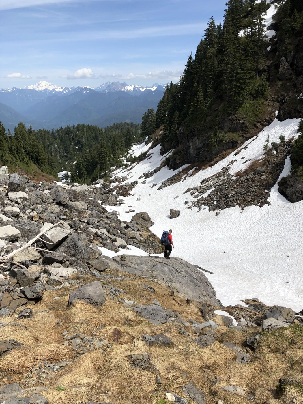
The start of the boulder field leading into Iodine Gulch is melting out quickly, leaving rotten snow, snow bridges, and some fun surprise drops if you don't test your footing. We stuck to the normal trail that crosses the creek to the far side of the gulch, which just like the lakeside trail is a mess of matted-down shrubbery that has been exposed by recent snowmelt. The gulch sucks. More veggie belays, devils club, snow bridges, and steep, loose terrain. The snow up the middle of the gulch didn't look reliable enough to ascend, and there is a significant amount of water running underneath. The guys stuck to the right of the rock outcropping and reported that it was "sketchy as f*ck" with sections that were slick and offered essentially no traction or protection. I tucked left along the rock and found some reasonable steps up boulders that while slick and muddy, still allowed for reasonably safe passage. The snow crossing at the top of the gulch was pretty solid still, although having an ice axe for self-arrest would be ideal (we did) since a slip here would send you a long way down into a soft, boulder-y landing. 10/10 would not recommend.
From here on out it's snow.We had microspikes but never used them; the snow is a little soft but consolidates well underfoot. There is definitely some water running under the snow as you pass the first couple tiny tarns and I imagine these creeks will really start melting out soon. We made camp on the ridge above the first (easternmost) lakes and found a nice little trickle of water running down the block so we didn't have to melt snow or trudge down to the creek below for water. Overnight wind was minimal and temps reasonable, making camping on the ridge enjoyable.
We took the morning to explore around the lakes which are JUST starting to melt out. There were one 2 tiny patches were rock was visible, besides those it's still that gorgeous teal alpine lake snowmelt/slush. We trudged around for a little, took some pictures, then packed up camp and headed out.
After testing the snow and terrain, we chose to glissade down the UPPER portion of the gulch. The lower portion definitely didn't look safe enough and none of us really felt like a boulder up the arse sounded like a fun saturday afternoon. On the descent, we stuck closer to the snowfield for much of the way and that actually made the trip a little easier. There are cairns marking the way, so as long as you look for them they lead along a pretty reasonable path.
Made it back in time to stop for dinner in Granite Falls and night shift work at 10pm. The sunburn is real and I now look like a lizard, but it was so worth it.
I'd give this maybe a week before the snow gets really bad, but that means the melt isn't far behind. This trail always feel so much longer than it is and I'm convinced my GPS lied to me (even though we all tracked it similarly). The poor shape of the trail, the rerouting, navigating snowfields and veggie belays, and the steep gain of the gulch just make this slow going. Including a jaunt around some of the upper lakes, I clocked this at 7.01 miles and ~2300 feet of gain.

Comments