Apparently I hadn't gotten enough of this area over the last few days!
When climbing Mount Ruth last week, I took a shining to Steamboat Prow and wanted to have a go at getting to the "summit" of this little outcropping. Fortunately, it lies below 10,000', so I was able to do it without a solo permit. Having quite a bit of time to dedicate to the outing, I decided I would wander around after getting up this little summit but had no real plan of where.
Glacier Basin trail is changing daily. It is now pretty much snow free almost two miles in and you can avoid a lot of the snow as it doesn't cover the entire trail. The little "shortcut" you can take near the three mile distance that follows the river bed is getting tricky now with the snowbridges over the creek being out so you have to get creative if you don't want to get wet. If you don't want to bother, just continue on the normal trail. It is snow covered from here on out so make sure you are comfortable with navigation.
Unlike last week, the snow was firm and I made quick time up Glacier Basin and onto the Interglacier. A weekend worth of climbers had made a nice little staircase up the glacier that made for easy cruising. I did throw my spikes on about halfway up just so I wouldn't slide around and waste energy. Of special note here, I forgot my helmet at home and regretted it as the area was very active with rockfall. Fortunately, a good portion of the kick stepped path was out of the fall line.
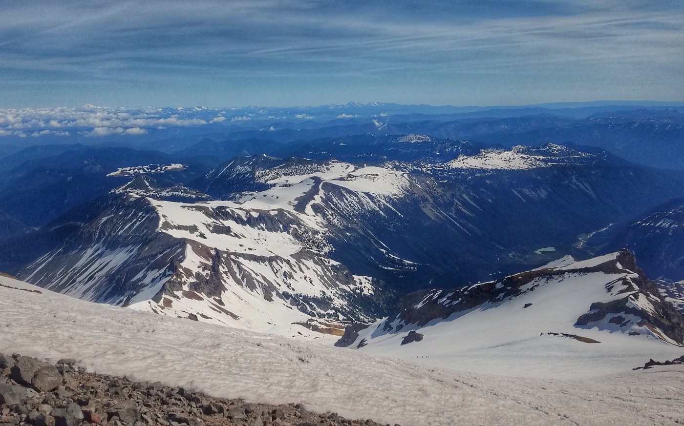
I reached the summit of Steamboat Prow about two and a half hours in and was promptly nearly knocked over by the wind. So i dropped down off the summit, took in the sites for a few minutes then traversed over towards Ruth. On this traverse, the snow became very firm and I was glad to have my ice axe along. After snapping a few shots from Ruth, I looked across the valley and decided the Burroughs needed a visit!
Glissaded and plunge stepped down back to the Glacier Basin Trail and after trying to find the junction with the Sunrise Trail, I eventually gave up and just headed up. It was long though and I found the tell tale signs of where the trail was (cut logs). The trail is completely snow covered down low so again, navigation skills are a must.
Eventually as you climb into the trees, you get longer stretches of bare trail. But the snow is firm so if you are use to wearing spikes, I would make sure to have them along. Eventually the trees thin out but the snow coverage remains despite the fact that the slopes are south facing. There are a few sections in the upper basin where you must traverse steep, exposed slopes. So if you are not comfortable with this, wait until the trail melts out.
Made my way to Second Burroughs (didn't have time for the Third). Soaked in the views and headed down to First Burroughs. I decided here that the conditions looked more favorable if I headed on the south side of the Burroughs Trail as the north side had some cornices and very steep exposed slopes.
While a good portion of the south side of the trail is clear on the upper portions of the mountain. There is one particularly steep traverse that is very exposed. I climbed up and over part of it and then faced in and downclimbed. Again, if you are not comfortable with steep snow, best to avoid this trail for a while.
Curling around towards Shadow Lake, the trail is completely covered in snow again as is most of this area of Sunrise. I know this section well and made quick time to the junction with the Wonderland. Most of the upper portion of the Wonderland is snow covered and there is one undercut section that you have to cross right below the waterfall. At about 1,600', the snow clears out and it was easy cruising from there.
27 kilometers, 2,350 meters of gain in 7:15.
Trip Report
Glacier Basin, Inter Glacier, Steamboat Prow, Mount Ruth, White River to Sunrise, Burroughs Mountain & Shadow Lake - Sunrise Camp Loop — Tuesday, Jun. 4, 2019
 Mount Rainier Area > NE - Sunrise/White River


Comments
Maddy on Steamboat Prow, Mount Ruth, Wonderland Trail - White River to Sunrise, Burroughs Mountain, Shadow Lake - Sunrise Camp Loop, Glacier Basin, Inter Glacier
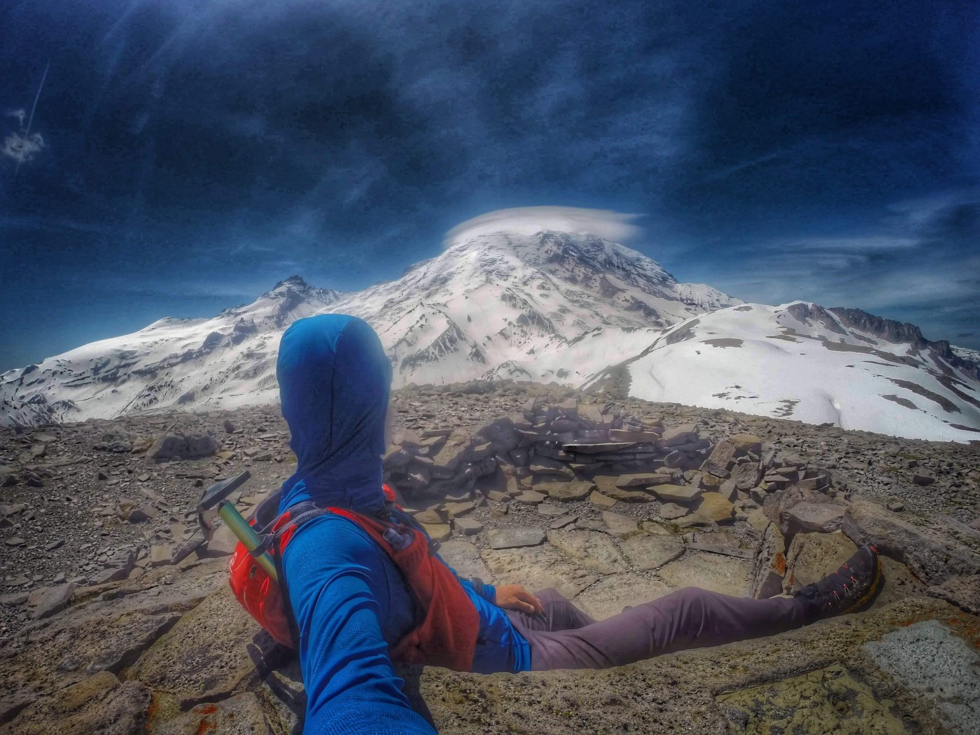
Love the lenticular cloud. Great pics as always but your pics look a bit funky. Dirty lens?
Posted by:
Maddy on Jun 05, 2019 05:38 AM
Stuke Sowle on Steamboat Prow, Mount Ruth, Wonderland Trail - White River to Sunrise, Burroughs Mountain, Shadow Lake - Sunrise Camp Loop, Glacier Basin, Inter Glacier
Thank you! Yep, had a coating of sunscreen on the lens. Tried to fix them up as best I could. Lesson learned!
Posted by:
Stuke Sowle on Jun 05, 2019 06:43 AM
post production technique
Ha - I was thinking it was post production tweaking, they look so surreal and glowy. Thanks once again for reminding us all we'd rather be up there than where we are currently. :)
Posted by:
wafflesnfalafel on Jun 05, 2019 11:24 AM
post production technique
Ha - I was thinking it was post production tweaking, they look so surreal and glowy. Thanks once again for reminding us all we'd rather be up there than where we are currently. :)
Posted by:
wafflesnfalafel on Jun 05, 2019 11:24 AM
Likes2Hike on Steamboat Prow, Mount Ruth, Wonderland Trail - White River to Sunrise, Burroughs Mountain, Shadow Lake - Sunrise Camp Loop, Glacier Basin, Inter Glacier
Hi Stuke,
Another great detailed trip report with amazing pictures !!!
I almost thought thought you used some kind of filter on purpose to give the mountain a dreamy look !
A couple of questions about the trail coming down from Burroughs - to avoid the steep snowfields on the southern slopes is it possible to take the trail down towards frozen lake or that is the one which has cornices and exposed slopes as well ? Also the wonderland trail undercut section right below the waterfall - how difficult is it ? I have read on other reports about a sketchy snowbridge crossing at that waterfall - is that out ?
Thanks in advance !
Posted by:
Likes2Hike on Jun 05, 2019 09:53 AM
Stuke Sowle on Steamboat Prow, Mount Ruth, Wonderland Trail - White River to Sunrise, Burroughs Mountain, Shadow Lake - Sunrise Camp Loop, Glacier Basin, Inter Glacier
Thank you! They do have a bit of a "dreamy" look to them so it isn't all a loss.
The northern side of the Burroughs has the cornice which could be avoided but also has a steep exposed snow slope that you would have to negotiate. The exposed section on the southern slope can be worked around but it requires some dealing with loose chossy slopes so it is kind of a pick your "adventure" on that side.
The undercut section I am referring to is at the waterfall so apologies for any confusion there. If you can wait five or six days, I suspect it will be melted out by then. It is enough of a hazard that punching through could have some ugly consequences.
Posted by:
Stuke Sowle on Jun 05, 2019 10:04 AM
ngie on Steamboat Prow, Mount Ruth, Wonderland Trail - White River to Sunrise, Burroughs Mountain, Shadow Lake - Sunrise Camp Loop, Glacier Basin, Inter Glacier
Thank you Stu! I learned a new mountaineering term today for something I've been doing lately: the heel plunge step!
I hope to aspire to your level someday: these pictures looks serenely exquisite.
Posted by:
ngie on Jun 06, 2019 12:40 PM
Stuke Sowle on Steamboat Prow, Mount Ruth, Wonderland Trail - White River to Sunrise, Burroughs Mountain, Shadow Lake - Sunrise Camp Loop, Glacier Basin, Inter Glacier
You are most welcome and thank you for the kind words!
Yes! Love the heel plunge step!
Posted by:
Stuke Sowle on Jun 06, 2019 07:10 PM