
The elevation gain on this hike is comparable to one of WA's big 5. It's no joke. This hike makes the trek up Aasgard Pass look tame.
As one may suspect from the dearth of trip reports, this is not a frequented trail. Indeed, excepting my friend and fellow backpacker with whom I shared the hike, I saw only 2 other souls the entire day on McGregor.
For such a lack of traffic the trail is surprisingly well-maintained. It is not until the talus slope that any guess work in routing is required.
Now I hiked McGregor as a day-hike, leaving from the Tumwater campground in the upper Stehekin Valley. Tumwater served as a great base camp for my multi-day North Cascades backpacking trip; if you would like to read more about this trip, you can find it here:
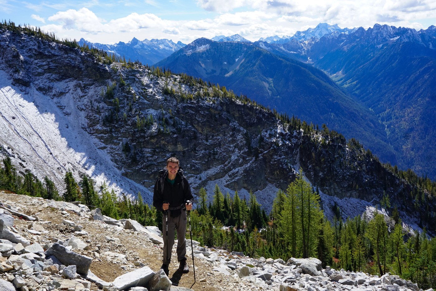
Leaving Tumwater campground at a bit past 8:30am we arrived at the TH at around 9am - a distance of ~1.5 miles. Stopping only once on the way up - to snack at a vista and watch eagles ride the termals - we arrived at Heaton camp by 1:15pm, having ascended a vertical mile in just over 4 hours. Here we lunched and rested our legs for what we hoped would be a summit push.
Just before Heaton we chatted up the only 2 people we would see all day as they were coming down the trail; they informed us that when they tried to summit (about 2 hours prior) a dusting of snow discouraged them, but they reckoned it was now possible in the mid-afternoon sun. The two of them, having left Stehekin at 4:30am (locals with their own transport), noted that when they started the trail and attempted their summit, "[We] were in a totally different season. It was winter everywhere."
My sense after hiking this trail and reading past trip reports is that McGregor is best hiked in August/early-September, so as to maximize a successful summit while minimizing the need for gear and/or technical experience.
Tidying up lunch, we arrived at the talus slop by 2pm - a perfect time to summit with the sun high and the snow low. Eyeing on a hunch what I thought the route to be [Hint: look for and follow an old wire, seeminly to nowhere, that appears to dead-end at the base of the wall] we found the first of the red arrows that direct the way. To my surprise the first of the arrows points to the right, where a small path opens. This path immediately switches left and then begins winding it's way up to the summit along a rock wall.
Be aware, there is exposure on this path - enough to keep my friend from following me. Going at it alone, I diligently made my way through the first four arrows observing, upon looking back, that it would be easy to lose the proper route back without taking care to make mental note along the way.
At probably 200' shy of the summit, I took in the view, checked my watch (2:30pm), and decided to turn around. It was a phenomenal day to summit, you could not ask for better conditions, but I was weary of going at it alone and the climb up combined with the prior days of backpacking had left me exhausted.
I hope to bag the true summit someday but I left with my head held high and my feet begging for mercy.


Comments