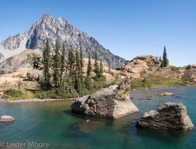
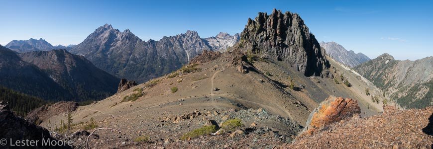
This two-night trip was a lollipop route starting and ending at Ingalls Creek trailhead. Day 1 went up and over Stuart Pass after a side trip to Ingalls Lake, then down upper Jack Creek to camp at the Van Epps creek junction (22 mi, 4500’ gain). Day 2 was up Van Epps creek to the Pass, over to Lake Ann, down Esmerelda Basin, up the Iron Peak trail, along County Line trail 1226.1 past Volcanic Neck and Navaho Pass, a side trip up Navaho Peak, then down into upper Falls Creek to camp (23mi, 8000’ gain). Day 3 was down Falls Creek back to Ingalls Creek and out to the trailhead (8 mi, 200’ gain).
There were numerous ripe thimbleberries and the colors were changing on the huckleberry bushes and other vegetation on higher parts of the Ingalls Creek trail. Bugs were nearly gone, except for an occasional fly and frequent bees or hornets (thankfully only one mild sting on this trip).
Trail conditions
Ingalls Creek:
logged the whole way up to Stuart Pass. Frequently the trail is overgrown with moderate amounts of vegetation, but not enough to slow you down. All trail junctions are well signed. After the first few dry miles, streams begin to cross the trail at fairly regular intervals most of the way up to Ingalls Pass.
Lake Ingalls - Stuart Pass way trail:
There are 3 “trail” junctions toward Ingalls Lake leaving the main trail up to Stuart pass. The first (bottom most) option goes through a campsite into the large meadow at 6050’ - I turned around at this point. The second option leaves the main trail just a bit higher up the hill at about 6160’, contouring West to a meadow, then steeply up SW through a notch/ramp in the rock bands, then along the bench to the lake (a few moves on Class II rock). The third and highest option is just a short ways above option 2, just below Stuart Pass and was not explored (looks like more side hilling than option 2).
Jack Creek (Stuart Pass to Van Epps junction):
A mile or so of the Jack Creek trail is recently burned and the trail has been largely obliterated through the burn area. It’s amazing how deep the ground gets burned and eroded away through such areas - several inches to a foot or more gone - enough to wipe away the grade of a trail. With a careful eye, most of the burned trail can be followed thanks to recent foot prints, but in a few areas it becomes completely lost in the ash. Plan some extra time to navigate through this section. Above and below the burn the trail is in pretty good shape and was recently logged. The Van Epps trail junction is clearly signed. There are a few creek crossings running well from the Pass down to Van Epps junction.
Van Epps trail and Van Epps Pass:
This very lightly used and overgrown trail was also recently burned for about a mile. I found it impossible to discern the trail through most of the burn area. This section of the trail was bushwhacking over lots of burnt fallen trees and through deep ash. While reading the map got me close, checking GPS coordinates allowed a quick and efficient way to find the trail again where it reenters unburned forest at approximately 4750’. The trail become obscure right before you reach an old road bed - just follow the road uphill to the mine area, where the main road from Van Epps Pass juts off to the left (South).
There’s no water along this trail between the bottom near Jack Creek until you are most of the way up to the mine, above the burn area. There are a few good flowing water sources along the road from the mine to Van Epps Pass.
Van Epps Pass to Lake Ann:
A short way below the Pass, check your map closely and stay left, then right at road junctions, and then take a final left onto the signed trail junction for Esmeralda Basin. The trail is easy to follow - just a few wet areas and an occasional downed tree. There are a few places to get water before you reach Lake Ann.
Lake Ann to Esmeralda Basin trailhead:
Well used, easy to follow trail with signed junctions. After you descend a ways South down from the pass above Lake Ann, there are with frequent water sources most of the way to the trailhead.
Esmeralda Basin trailhead to Iron Peak trailhead cutoff trail:
This dusty and rocky horse trail gets you about a mile south to the Iron Peak trailhead without having to walk along the even dustier road. Even with a map and a good estimate of my pace, I likely would have missed the left turn going 100 yards up to the road and the Iron Peak trailhead had it not been for my GPS. There’s some purple flagging marking this left turn, but not much of a trail that I could see.
Iron Peak trail and County Line 1226.1:
Iron Peak trail is well-graded and maintained with no water most of the way up to the pass. On the East side of the pass at about 5800’, there’s a faint unsigned trail junction contouring off to the right - stay left at this unmarked intersection. If you’re interested in Turnpike Creek trail, I did not notice a left turn or a sign for it, even though I was watching out for it. There’s water running at the camp area at the Fourth Creek junction, which is well signed.
The trail from the top of Fourth Creek over to Volcanic Neck was well signed and in pretty good condition with a few water sources. From Volcanic Neck pass through upper Hardscrabble basin, and then up to the next pass East, the trail is less used and more rustic but there are water sources - just follow rock cairns where the trail fades through meadows.
After you go over the next pass to the East (about 800’ SW of point 6680’), the trail is hard to follow, but it’s open country and easy to see where you want to go - the Stafford Creek/Cascade creek trail is clearly visible below you. I could hear water not far down to the right (South) just below Navaho Pass.
From Navaho Pass, there’s a well-used trail going to the summit. However, I missed the cutoff trail going toward Negro Creek/Falls Creek. After summiting Navaho, I just bushwhacked down the SE ridge of Navaho to regain a faint trail at the next pass (steep and loose much of the way). From there, the trail is faint but follow-able to Falls Creek/Negro Creek pass. No water on this segment of trails.
Falls Creek:
The top of the trial is faint in places, but easy enough to follow downward if you pay attention. At about 5300’ the trail becomes lost in a large open flat area with a lot of avalanche debris. The trail picks up again on the West side of the creek at about 5200’ in some open meadows marked with rock cairns. From here down the trail is marked with cairns where it fades in meadows but fairly easy to follow until you get near the bottom. There are a lot of downed trees of all varieties - enough to noticeably slow you down. At the bottom, just before reaching Ingalls Creek, the trail becomes confused in the rocky bed where you cross Falls Creek. After crossing Falls Creek at some rock cairns, I simply went straight down to Ingalls Creek and quickly found a nice log to cross. After crossing Ingalls Creek, it was 100 feet of thick bushwhacking up to Ingalls Creek trail.


Comments
BistariBistari on Ingalls Creek, Lake Ingalls, Jack Creek, Fortune Creek-Van Epps, Lake Ann, Iron Peak, County Line, Volcanic Neck, Navaho Peak, Navaho Pass, Falls Creek
Hi, great trip report! Im looking to go over Van Epps Pass to Jack Creek. You mentioned a gps file for that trail, where did you find that? Thanks!
Posted by:
BistariBistari on Sep 05, 2018 01:00 PM
lesmoore on Ingalls Creek, Lake Ingalls, Jack Creek, Fortune Creek-Van Epps, Lake Ann, Iron Peak, County Line, Volcanic Neck, Navaho Peak, Navaho Pass, Falls Creek
Hi Bistari,
I don't use GPS tracks or files - I just look at the GPS coordinates on my InReach satellite communicator and match them to a paper map. The position of the Van Epps trail seemed pretty accurate on the 7.5" maps as it helped me find the trail where it enters unburned forest pretty quickly. Looking at the map now, the best guess of the coordinates for this point (WGS84 UTM coordinates) on the trail is 5263000 0654500.
Posted by:
lesmoore on Sep 05, 2018 01:24 PM
CamiLaura on Ingalls Creek, Lake Ingalls, Jack Creek, Fortune Creek-Van Epps, Lake Ann, Iron Peak, County Line, Volcanic Neck, Navaho Peak, Navaho Pass, Falls Creek
Where was your first picture taken (with the lake)? Where is that? Thanks!
Posted by:
CamiLaura on Jul 09, 2019 10:27 AM
lesmoore on Ingalls Creek, Lake Ingalls, Jack Creek, Fortune Creek-Van Epps, Lake Ann, Iron Peak, County Line, Volcanic Neck, Navaho Peak, Navaho Pass, Falls Creek
The caption says Lake Ingalls, which is correct.
Posted by:
lesmoore on Jul 09, 2019 10:45 AM