
Three of us hiked the Loowitt trail counter clockwise on a 3 night 4 day backpack trip and had a great time. One member of our party admitted her fear of heights halfway to the trailhead and by the end of the trip had conquered it! We started at June Lake because it was the shortest feeder trail to the Loowitt and had good road access. The first day was the easiest, around 8 miles total to Pumice Butte campsite. Not too many obstacles and there was water in both Shoestring Creek and Muddy river. We did not have to take off our shoes at either crossing. Can't guarantee that there will be water at either later in the year. There are about 8 or 9 tent sites at Pumice butte and good water for filtering, also fantastic views of Mt. Adams.
Day 2:
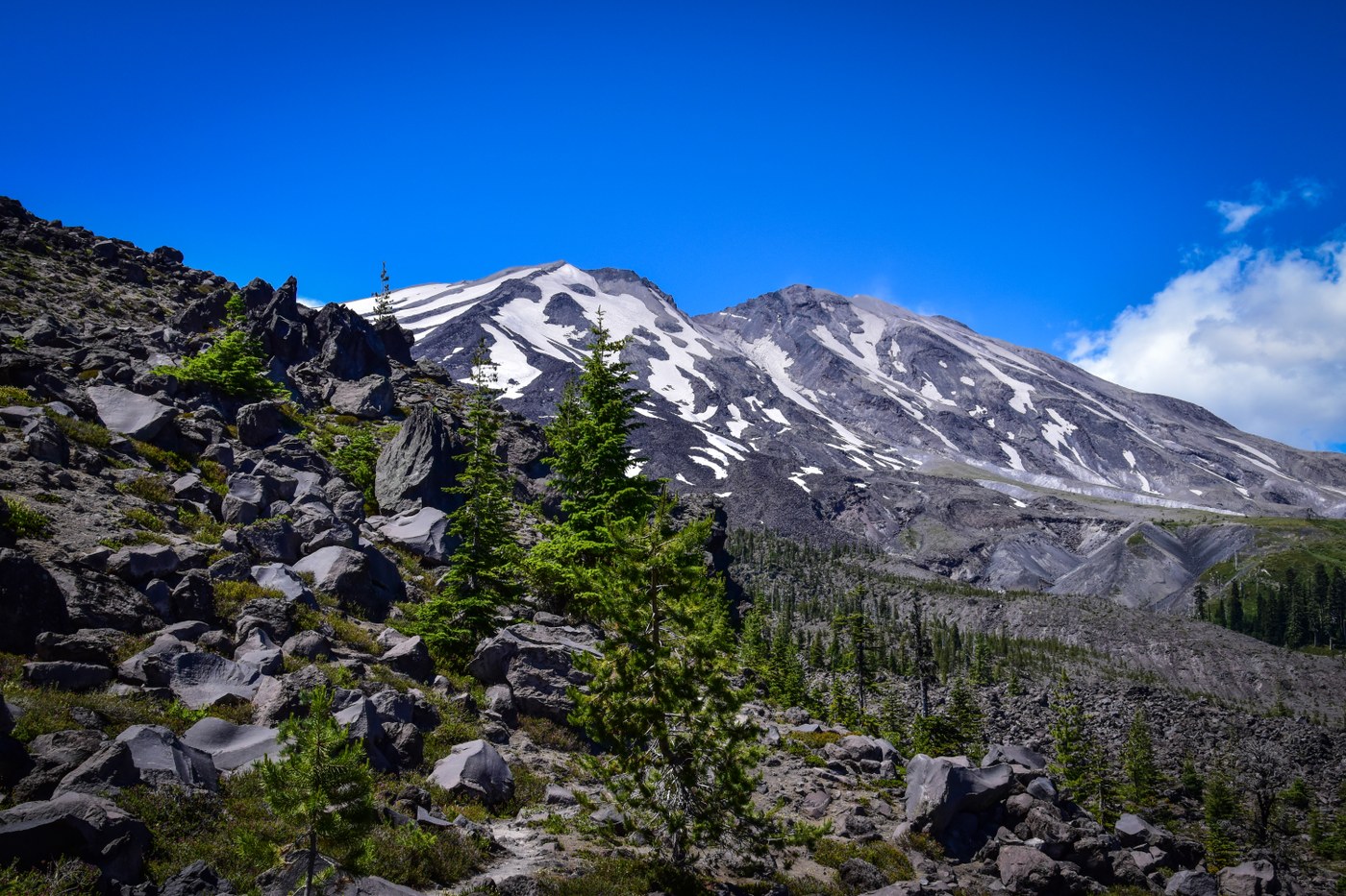
We had rain overnight (not in the forecast!) and the second day saw misty conditions and intermittent showers, no views of the mountain until evening but probably a good thing all in all because this is the crossing of the blast zone which can be very hot, no shade and a 12 mile day. I think we all agreed that the most difficult part of the entire circuit was going up Windy Pass, it is not a long or particularly steep section but the trail is very very loose pumice and it is fairly exposed. When you get to Windy Pass if you look up you will see a post, thats a viewpoint, not the trail, the trail leads over and down. The tread here is exposed, but the footing is good, and we saw a couple of goats. After the pass you will cross two green areas, the second of which has good water (at least for now). We opted to take the short side trip to Loowit falls dropping our packs at the junction. Resuming the trail, we crossed Loowit creek and for the first time had to take off our boots, it was just wide and deep enough, and we didn't want to jump onto potentially unstable boulders on the other side. No real obstacles the rest of the day until we came to the Toutle River. The approach to the river looks intimidating as it switchbacks down a steep pumice slope but once on it you realize the tread is fairly good. Some saintly person has installed ropes on the final drop to the Toutle river. Looks intimidating but its a solid rope with knots for handholds and really posed no problems. The Toutle was another shoes off crossing. There is good camping on either side of the river as well as on the level above the river on the far side. (counter clockwise). If you go up the first yellow rope to the first 'shelf' above the river and walk about 100 yards (basically all of the way back) and then go toward the hillside you will find a flat sandy campsite amid a lot of scrub alder. This would easily hold 3 tents, you won't see it until you are upon it due to the Alder.
Day 3
Starts with a big climb to Crescent butte, you will see a small campsite just after the 2nd yellow rope. Most of this climb is under tree cover so even with sunny hot weather it was not too difficult. This is the day with the least amount of water, there is nothing between the North fork Toutle and Chocolate falls. There is one river wash where there are another set of ropes, a little more challenging than yesterdays but doable. The second one (climbing out of the wash) would be a bit challenging for a short person to reach, we are all over 5'8'' and just barely able to grab it from below, and then there is a 10 foot vertical wall to get up, (Funky Winkerbean style for all of you over 40), this one would probably be easier going down. We did the first two of three boulder fields on this day. We had been hearing a lot of hype about them but in the end found them not too bad at all, and much preferred them over Windy pass. The best advice is some beta we got from a fellow we met crossing the Toutle. "Follow the posts" when you get to a post look for the next one. It truly is the best route, if you try to make your own route even if it looks better it will end up being more difficult. The first boulder field is quite short and not too challenging, the second one is longer but also not bad, just be careful of the tippy rocks. We camped at Chocolate falls the third night and it was the sweetest campsite ever! We had it to ourselves, but there is room for three tents just after crossing the creek and there is room for about 7 tents down below and to the right. Unfortunately this is the first place on the entire Loowit trail that we encountered bad human behavior, lots and lots of toilet paper and surface pooping back in the trees, gross! Bury the shit and pack out the toilet paper people! I suspect that this is an area that gets lots of day trippers or short overnighters who are not experienced backpackers (its only about 3 miles from June Lake trailhead), so don't be a surface pooper!
Day 4.
Final boulder field, this was the longest one but really no more difficult than the first two. Quick morning hike back to the car and onwards to a burger and onion rings! All in all a great trip.


Comments