Trip Report
Glacier Peak Meadows, North Fork Sauk River — Tuesday, Sep. 13, 2016
 North Cascades > Mountain Loop Highway
Type of Hike
Multi-night backpackTrail Conditions
Trail in good conditionRoad
Road suitable for all vehiclesBugs
No bugsSnow
Snow free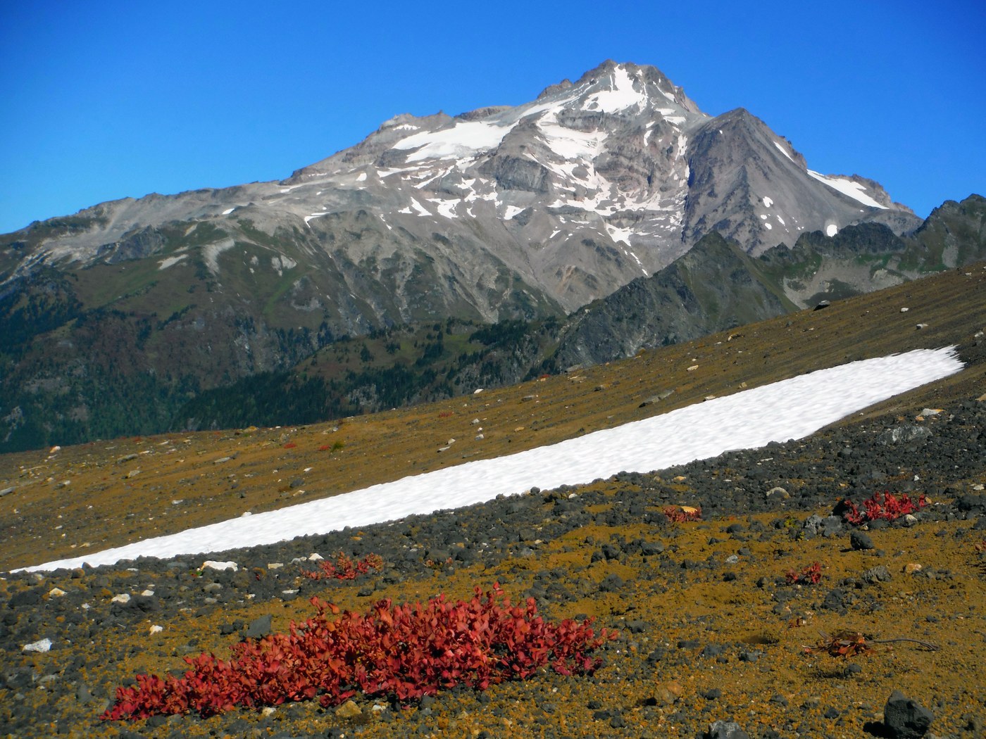
We hiked to Glacier Peak Meadows 43 km round trip over 3 days. Started at 600 meters and gained 1400 meters to Red Pass at 2000 meters. Descended into the valley and camped by a the silty stream fed by the white chuck glacier. Saw many silver-back marmots along the trail and heard their shriek whistles. White-tailed ptarmigan and mule deer crossed our trail on occasion. We were mostly to ourselves except for the short section of the pacific Crest trail where we saw a dozen through hikers headed north going fast. Took a side trip to the white chuck cinder cone, remnants of a volcano. Stratovolcano Glacier Peak 3,213m can’t be seen from any highway in Washington despite it being 3,200 meters high. Under bright blue cloudless sky, from the highest point on our trek we could see Mount Rainier (4,392m high), 141 km to the south and Mount Baker (3,286m high) 90 km to the North.
Comments
Glacier is definitely the most remote volcano in the Northwest. Your statement that it can't be seen from any highway in Washington is not really accurate however. It can be seen from I-5 near the Everett area and one of the best views is going east bound on the 520 bridge. I'm pretty sure that it's also visible from the I-90 floating bridge.
Any other pictures from this hike? This is one of the most beautiful areas in the state.
Posted by:
Maddy on Sep 18, 2016 06:32 AM
It can also be seen in one of the pastures just before Darrington
Posted by:
AndrewCwa on Jul 12, 2017 06:01 PM