
Type of Hike
OvernightTrail Conditions
Minor obstacles posing few problemsRoad
Road rough but passableBugs
No bugsSnow
Snow free
Rachel Lake to Rampart Lake to Lila Lake trail:
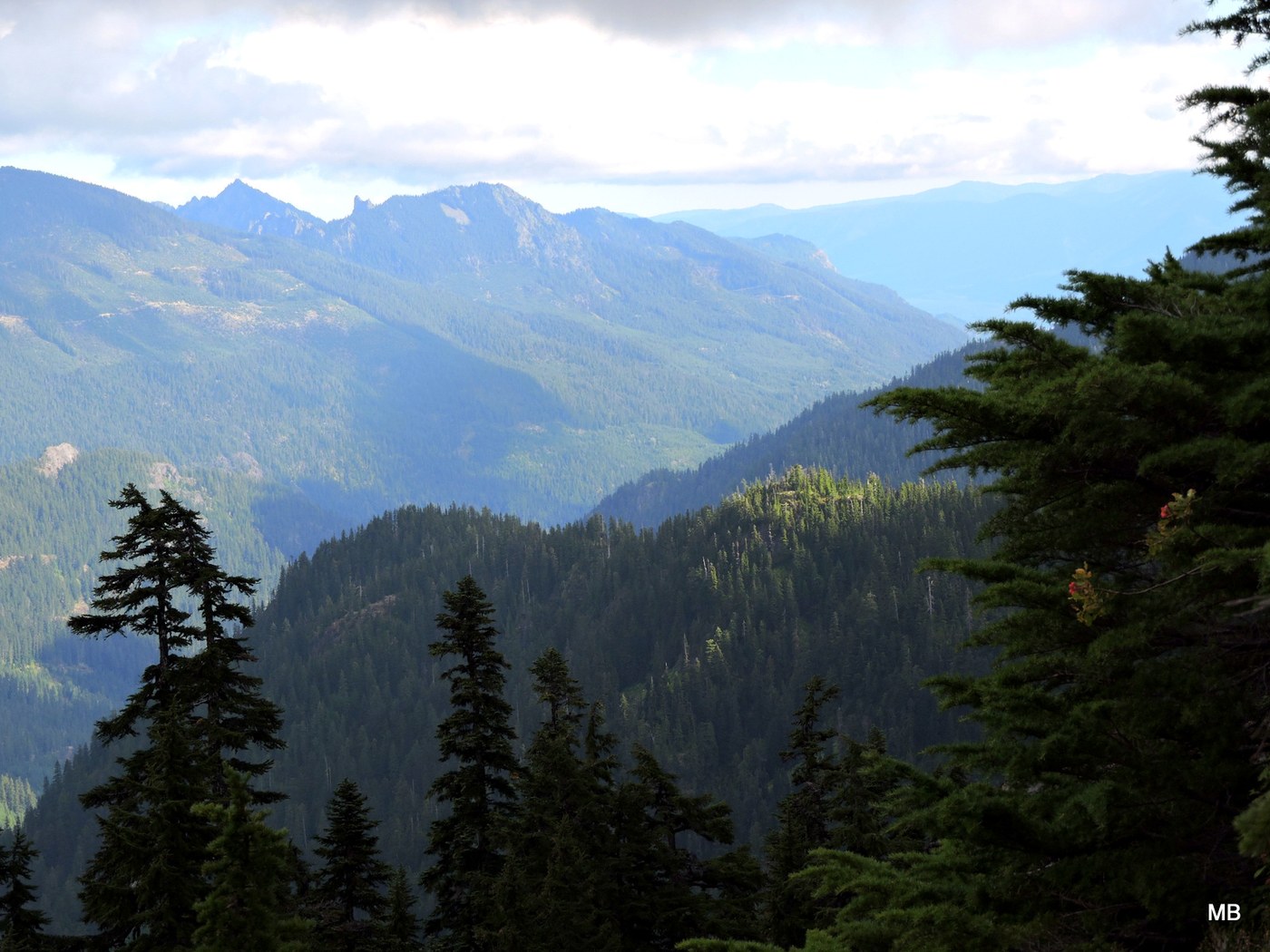
The road to the trailhead is harder than the trail itself, but only just by a wince or two for the car’s underbelly. The route to Rachel Lake starts out well behaved; sort of a honeymoon period which doesn’t last. Soon enough you will be walking on the roots of trees and apologizing to the trees as you do. In dry weather, clamoring over creek beds, slippery rocks, and roots does have its charms but would not want to do this in serious rainfall. Coming down these already slick slopes in a storm would be even worse. If you are doing this on a hot day and going past Rachel –do it early as heat will not be your friend up on Rampart Ridge.
Hiking midweek was jolly and trail traffic was sparse. Thankfully the trail was not completely deserted: I needed help staying on the right path. There are so many forks on the way, I ran out of silverware. Heading up past Rachel Lake I took one wrong turn after another, first coming out to a few viewpoint dead ends and then somehow heading briefly down the wrong way. I ran into Greg who redirected me upwards after first explaining to me I was heading back to the parking lot again. Greg and Sally, and their two intrepid friends would later help me get out of Lila Lake on the way home when I managed to get stuck circling Rampart a few times. More on that below.
There is a fairly steep grade between Rachel and Rampart Ridge above but it does not last long. The last time I came up and did it in the hot sun and it was hard, but this time it was cool and overcast which was lovely.
I misunderstood the right turn arrow for Lila Lake and ended up clamoring half way down to Rampart. (yes even after being here before) meeting 2 fellows coming up and deciding it would be wiser to stop hiking alone, I trailed them back up as they were going to the real Lila Lake next.
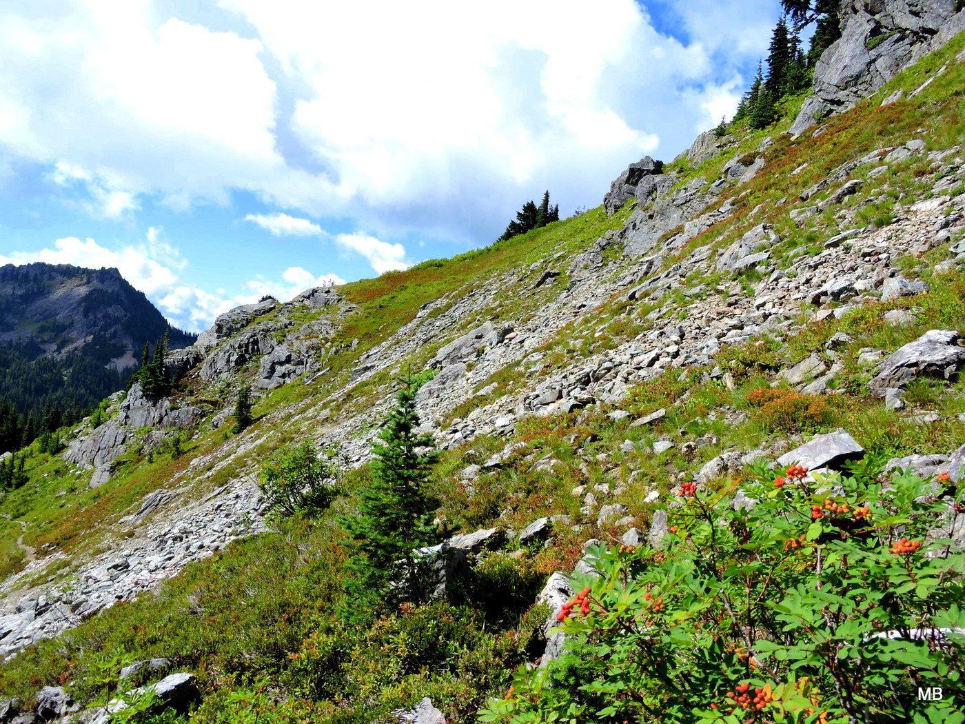
Lila waited a bit longer while I took another wrong fork and headed up a steep climb toward Alta. Not on purpose of course. Alta was left and marked by a large cairn. In my pocket were directions to go right. Directions do not work if you don’t read them; they don’t float to your brain on their own.
Save yourself if you want to get to Lila. The cairn marks the hike to Alta—bear right for Lila. Not left. Sigh. The other fellows had wisely sorted it out themselves and were reconnoitering to head in the proper direction.
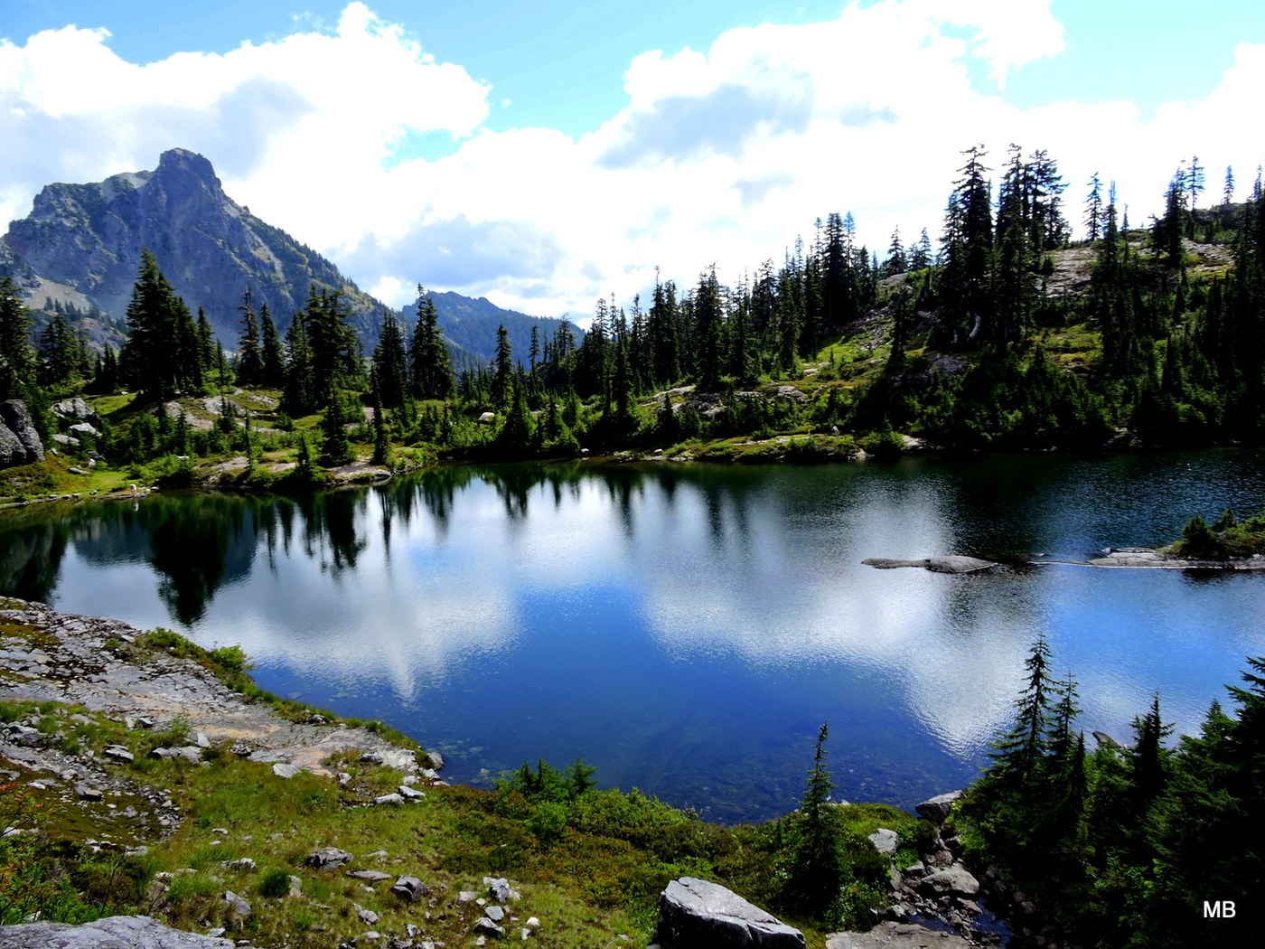
If you go to Lila Lake it is worth to circle round to the back of the lake—or even camp there. Be sure to climb the rocky route in the back. There is a small trail which wanders in and out and gradually slides gently up to a peak with astounding views. Wind cuts here so dress warmly, the lakes remotely are far below, glimmering amongst the dark evergreens and the sky is wide across the jutted mountains in every way you can turn. As an added treat or dismay, cell phone service pops on here too.
I left early the next day and bushwhacked northwest of Lila and Rampart Lakes toward Hibox mountain. Gradually I noted the abundant ripe blueberry bushes became stripped bare but did not put it together until suddenly there was a bear and her yearling in front of me. I was about 90 minutes walk from the regular trail. It ended uneventfully in the end but for several minutes, the yearling’s curiosity kept coming at me. The unfortunate side effect was that the increasingly nervous mother came too. When a mother bear is nervous, I get much more nervous too. I shifted up a few minor cliffs and slid back down a few too. Already unusually directionless, I became completely scrambled—not really a very rare state to be honest. I found my way back to Rampart in an up and down meandering till I was circumnavigating Rampart Lake trying to figure out which was the right trail out. Of all the welcome sights for me (though I doubt for them) were my previous trail guides Greg(g), Sally, and their 2 friends. They showed me the creek I had passed hours ago and got me turned around the right way. I wonder if they are still shaking their heads.
A really wonderful haul around several mountain lakes and up some hard hills. The high mountains were quiet with only an occasional backpacker. Remarkable for this trail—so busy in summertime. The blueberries are in season and abundant (unless you meander to that bear area well far from the trail)
I rate the hike to Lila Lake hard if you are carrying a backpack for overnight.
[And yes, I carry a compass, I own a GPS (bad at both]. I know it is bad to hike alone. I have overnighted or multi nighted most weekends for years. I carry the 10 essentials and more. I usually survey tape myself in and out. Some people, like myself, just never learn...]
Comments