Trip Report
Cady Ridge, Dishpan Gap & Lake Sally Ann — Saturday, Aug. 31, 2013
 Central Cascades > Stevens Pass - East

Matt & I hiked up Cady Ridge over Labor Day weekend, using FR 6700 to reach the open portion of FR 6500. It took about an hour to navigate the forest roads. 6700 was in moderate condition. 6500 began with smooth pavement, but the last few miles were very rough gravel. On the way out, we encountered a car that had blown a tire on this road, so be careful. There were relatively few cars at the trailhead, a welcome change from the overcrowded trails of previous trips.
The hike begins with a steep downhill to a bridge, then a steep and partially overgrown uphill. After this warm-up, the trail mellows out quite a bit with little incline. One of the first things we noticed was the variety of mushrooms lining the trail. The mellow flatness transitioned into some mellow switchbacks, uphill, but nothing too crazy. This area was loaded with flies and bees.
After completing the switchbacks, we skirted to a side of the ridge and prepared ourselves for the steep section of the trail. The steep grade and erosion made this part exhausting and tricky. Our legs were burning after this, so the more gradual uphill that followed didn’t feel like much of an improvement. Certain sections of the trail on the ridge were overgrown, but the trail was still followable. This ridge hike also provided some stunning views of Glacier Peak and other surrounding mountains.
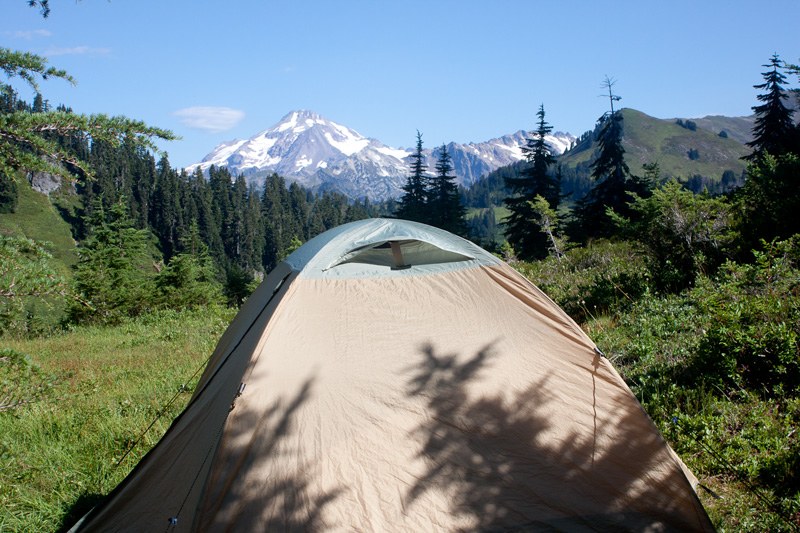
The trail was loaded with delicious blueberries and other berries that I couldn’t identify. Despite the plethora of berries, we saw no bears. About a mile out from the PCT, we had an awesome view of Mt. Rainier dominating a vast ridgeline. We camped at the last site on Cady Ridge just before it intersects with the PCT (as marked on the Green Trails map). The site was in great shape and offered an unobstructed view of Glacier Peak. That night, the moon was nowhere to be seen and the stars and Milky Way were out in full force. This was perhaps the best night sky we’ve had while backpacking.
We left our camp the next morning to explore the PCT without our full packs. Our first stop was Lake Sally Ann to filter water. The lake itself looked pretty clear, but was full of fish and bugs swarming the surface. We instead filtered from an inlet stream just up the hill from the scree on the southern edge of the lake. After filtering, we hiked up just past Dishpan Gap before heading back towards our camp. We were able to filter water from an unmapped stream on the PCT just north of the Cady Ridge junction. We were hoping for a colorful view of Glacier Peak as the sun set, but the peak was quickly hidden by clouds. The night’s sky was just as impressive as the previous evening’s, with no clouds to be seen.
We began hiking out the next morning, departing our site around 10am. The steep and eroded downhill section was especially rough on our already tired legs and feet; we were excited to reach the tamer switchbacks. We reached the car around 2pm and were swiftly on our way out.
For more details on our experience hiking Cady Ridge, please check out my blog post at http://curioushungry.blogspot.com/2013/09/backpack-cady-ridge-august-31-september.html


Comments