Trip Report
Josephine Lake (Skagit) — Sunday, Jun. 26, 2011
 Puget Sound and Islands > Bellingham Area

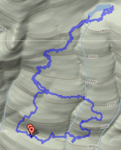
It's been 6 months since we were at Josephine Lake so it was time to return. Sunny, not too hot day. The lower trail head had a modest number of horse trailers. We drove up to the marked trail head (well, there is an official DNR sign there) and did the loop. Saw signs of donkeys(?) and llamas in the mud, but did not actually meet any.
Trail was muddy but not slippery -- an acceptable state. And we had no slips or falls (I was not using poles). Trip was as usual -- lovely. We decided to follow the trail to the other end of the lake. We did not bring equipment to cut a path to the upper lake (next time); but we did red tape the trail to make it easier to follow next time.
The stats were 18% grade. T
Total Distance: 8.04 km (5.0 mi)
Total Time: 2:19:51
Moving Time: 49:12
Average Speed: 3.45 km/h (2.1 mi/h)
Average Moving Speed: 9.81 km/h (6.1 mi/h)
Max Speed: 12.04 km/h (7.5 mi/h)
Min Elevation: 524 m (1720 ft)
Max Elevation: 880 m (2886 ft)
Elevation Gain: 679 m (2227 ft)
The route is available here: http://maps.google.com/maps/ms?msid=209230341623457241109.0004a6a26dd66c375bfb8&msa=0&ll=48.582683,-121.959572&spn=0.018965,0.052357


Comments
Thank you & question
Do you know which pass is required?
Posted by:
"Suz557" on Apr 13, 2014 06:13 PM