Trip Report
Boundary West, Quartz Creek & French Creek — Thursday, Sep. 3, 2009
 South Cascades > Mount St. Helens

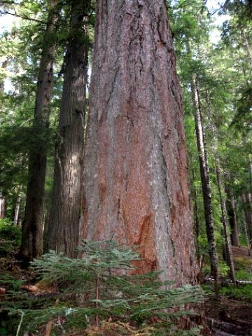
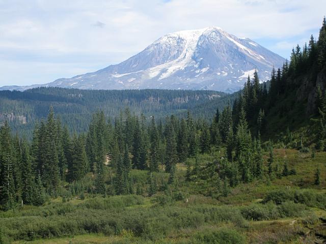
I dubbed this the "Best of the Dark Divide Roadless Area" hike because the loop took us past huge, ancient Douglas-fir trees in the French Creek and Quartz Creek valleys and then into open views of Mount Adams, the Goat Rocks and Mount Rainier from the Boundary Trail.
This loop was 10.9 miles with nearly 3,000 feet of elevation gain and 2,700 feet of elevation loss. Plan on a long day, but it is worth it.
From Randle, we drove south on Roads 23 and 28 (paved) about 10 miles total and then Road 29 (gravel) for the last 15 miles to the end. The spur access to the Boundary Trail starts where the road ends and has been converted to trail. It is about .5 mile to the intersection with the Boundary Trail. We crossed the ridge-top Boundary Trail and continued down the other side into the head of French Creek. There are no signs for the French Creek Trail; we just followed the obvious path. The true trail starts in about .25 mile when it drops down into a recovering clearcut, then eventually into virgin forest.
This is where the big trees begin. One after another, huge, ancient trees on both sides of the trail. We couldn't help exclaiming over many of them and trying to capture their images in pixels. The French Creek Trail was built by the Sierra Club a few years ago and is in good shape. Although it is designated only for hikers, horses and mountain bikes, motorcycle riders have been using it and have logged out all but three trees that had fallen across the trail.
At about 2 miles, the valley flattens out and there is a nice campsite next to French Creek. We ate lunch beside the creek, then continued another mile to the junction with the Quartz Creek Trail. This intersection is unsigned but obvious.
We turned left and began ascending upward back to the ridgetop and the Boundary Trail. The Quartz Creek Trail, possibly a relict of miners in the late 19th century, is narrower and much steeper than the French Creek Trail. Like the French Creek Trail, this one is designated non-motorized but shows obvious signs of motorcycle use. The use is less than on the French Creek Trail because this one is much more challenging.
At about 6 miles into the hike, we reached the junction with the Boundary Trail. We turned left again, this time in a deeply rutted trail because it is open to motorized use, and headed towards Dark Meadows. Views began to open up as we neared the meadows: Juniper Ridge, Mount Adams, the Goat Rocks. The huckleberry bushes were loaded with fruit and lots of American robins and dark-eyed juncos feeding on the berries.
From Dark Meadows, the trail climbed steeply through a saddle and down the other side back to the junction with the spur trail and then back to the car. As we neared the end, we had views of Mount Rainier down the McCoy Creek valley.


Comments