


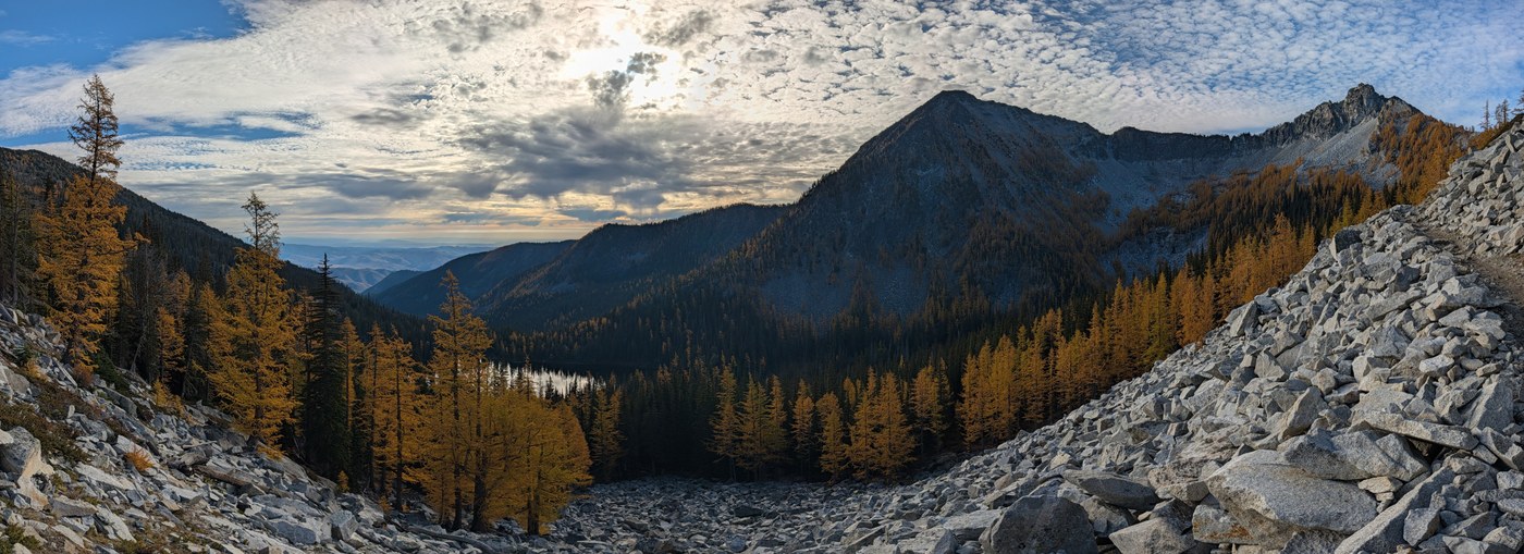
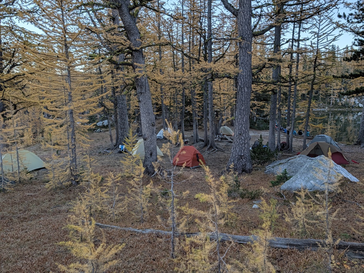
Amazing colors! Crazy amount of people but with some cozy camping everyone got a spot to sleep. The trail did not feel crowded, just the camps. Trail is in great shape, just one water crossing that was largish and a potential for wet feet but wasn't bad. Lots of mountain bikers and a couple dirt bikes. Everyone was super friendly. Water was flowing at all the major creeks, the only long dry stretch is Angel's Staircase. There are many intersections and not all are marked so bring a map/track. For better or worse we had no service on the road/the but some on the trail at high points (AT&T & Verizon). Found a hat and bag that I think is a trail running quiver.
Road/Parking: Parking was full at 1 on Friday and we parked about 1/4 mile done the road. Cars were at least a mile down (adds elevation too) when we left sun and several were in the no parking areas and had tickets. Vault toilet was relatively clean and stocked. Road has some decent holes and lots of washboard but most vehicles would probably do ok in most areas. My 8.7 inches of clearance was welcome but not essential.
Itinerary:
Day 1 - Crater TH to Upper Eagle Lake - ~6.2 miles, 2450 ft gain, 3.5 hours moving, 3.75 hours total with a moderate paced group.
Day 2 - Upper Eagle Lake to Boiling Lake to Angles Staircase to Cooney Lake - ~8.7, 2150 ft gain, 2000 ft loss, 5 hours moving, 7 hours total with a moderate paced group.
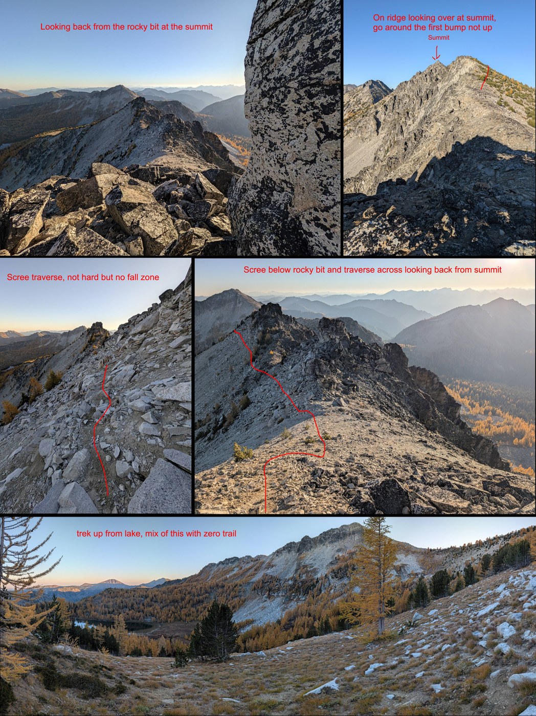
+ Martin Peak from Cooney Lake (track below) - ~2 miles, 1000 ft gain/loss, 1.3 hours moving, 1.5 hours total solo as a moderate/fast paced hiker.
Day 3 - Cooney Lake to Martin Lakes to TH - ~9.9 miles, 650 ft gain, 3200 ft loss, 4 hours moving, 5 hours total with a moderate paced group.
- Martin Lake was roughly a miles and 300 ft addition, which is included in the total above.
Trail:
TH to Upper Eagle Lake - You can see larches faintly right from the parking lot. The trail dips in and out of the forest, mostly shaded dirt trail in great shape with occasional rocky sections. It is a bike trail so it sometimes has the bike camber to it, but only a little. You pop into the larches just a little before the lake.
Upper Eagle Lake - Has a toilet box sign on a tree to the left near the horse camp. Campsites can be found both in both directions around the lake.
Upper Eagle to Boiling Lake - One of the best larch sections! The views from just past the Eagle Lake intersection were some of my favorite (see top photo). Terrain and grade were pretty mild and enjoyable.
Boiling Lake - Some camping options. We just passed through and didn't investigate
Boiling Lake up Angle's Staircase to Cooney Lake - Burn time! There is water at a few steams but once you get on Angle's Staircase it is pretty dry, minus a couple seeps. Very pretty and as you climb the distant mountain views replace the shrubbery. You can see Glacier Peak, Bonanza, and into the North Cascades with peaks like Black Peak. We enjoyed a break at the top and spotted a weasel bouncing by. Going down was much steeper and slick in some areas, a place I'm glad I had poles.
Cooney Lake - Has a not so private toilet box in good shape. Lots of camping in both directions, still very busy but a little more room to spread out if you are willing to really hunt and sleep on less flat spots. The south side of the lake got some heavy frost the night we were there.
Martin Peak - From Cooney Lake it was mostly a walk up with route finding and some exposure mixed with scree. There were a couple hands required spots near the end but not technical. I made the mistake on the way up of heading all the way to the ridge (which wasn't bad for the views) and followed that until if cliffed out, then had to drop back down for the traverse to the true peak. The traverse was the only section with a bit of a boot pack, getting the ridge was 100% choose your own adventure. The traverse over was on the side of a steep scree/rock slope and a fall here would be rough. It had an upper and lower route. I took the lower going and the upper coming back and highly preferred the upper, more solid but still some mobile rocks. There was a short switchback up to the summit and then a couple boulders to climb to achieve the top. Lots of cool rock formations that looked awesome in the evening light but the lighting on the lakes and surrounding peaks wasn't great.
Cooney Lake to Martin Lake - Semi forested mellow walk with at least one water source with a bridge to cross it.
Martin Lake - Some trees down on the trail to the lake and a little elevation but trees are easy to get over and trail is generally in great shape. Limited lakefront access when you reach the lake but may be more farther around the lake. Has camping and a toilet box (or at least a sign). We just passed through and didn't investigate.
Martin Lake to TH - One significant slow moving water crossing with water only about ankle deep or so. It was rock hop-able on side and there was a slightly submerged log on the other side that both were usable, log might be a little better, both required a leap at the end. Otherwise the trail was great, mostly in the forest. We spotted some fungi. The horse ford vs bridge intersection wasn't marked, go left for the bridge.

 Length
 Elevation Gain
Comments