


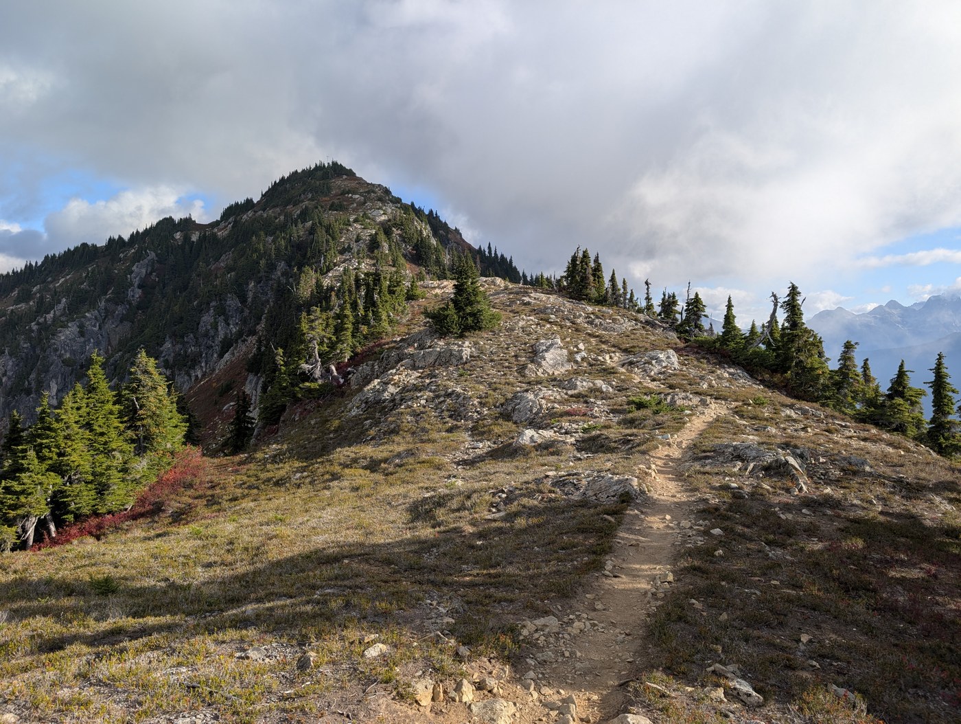
This was a 3-day counterclockwise solo backpack of the Copper Ridge Loop.
Looking for a gigantic trip report? You're in luck!
Looking for a much shorter one with just the useful hike info? You're still in luck! Head to the bottom of the long report.
ITINERARY
Day 1: Hannegan Pass trailhead to U.S. Cabin Camp - 10.5 miles
Day 2: U.S. Cabin Camp to Copper Lake - 12.5 miles
Day 3: Copper Lake to Hannegan Pass trailhead - 11.5 miles
Total: 34.5 miles
WHY THE LONG TRIP REPORT?
It's mainly for me. I like documenting my hikes on WTA, and this was a memorable one. I initially had plans to do this hike with a companion, but plans fell through, and to be honest, that turned out for the best. I needed to do this hike at my own pace, with how difficult some parts of it were. And this was my first solo backpacking trip in quite some time.
For lack of a better way to put it, I got my ass properly handed to me, and it was pretty great.
Anyway, feel free to skip it if you're not interested in what's essentially my personal journal entry, but it will also contain all the useful hiking info (though I'll pull that out for the summary at the end).
The long report
THE ROAD / PARKING
The gravel forest road to the trailhead is in really good shape for a forest road. Yeah, it's got potholes, but they're largely avoidable. I drove to Royal Lake/Upper Dungeness trailhead last weekend, and the road to the Hannegan Pass trailhead was a dream in comparison. Your car will do great.
Getting to the Hannegan Pass trailhead at 9:30 on a Sunday meant it was pretty full already, so I parked on the side of the road.
Trailhead toilet looked open, though I didn't use it. There's a trailhead register, so be sure to sign it before you head up!
DAY 1: TRAILHEAD TO U.S. CABIN CAMP
Holy cow, the trail to U.S. Cabin Camp is a tough day with a heavy pack on! It was in part due to getting a later start; it got quite warm and the climb is exposed. I recommend getting an early morning start if you can swing it.
The climb to Hannegan Pass is a steady unrelenting climb, though not TOO steep (especially compared to what awaited me later...). Everything is downhill from the pass on Day 1, and all that descending is tough on the knees. I relied heavily on my poles and still slipped a couple of times on the marble-pebble bits, but that is because I have the balance of a baby fawn.
Trail: This trail section is real pretty and extremely well kept. No issues to speak of. The land managers have done an incredible job maintaining this season.
Water: There were a few water sources between the pass and camp, including a delightful waterfall about 1 mile past Boundary Camp, and Copper Creek, both of which go right over the trail.
Camp: U.S. Cabin Camp was much nicer than I expected. Sites are really roomy and separated. Privy is across the main trail from camp with some privacy. Camp is right on the Chilliwack River, which is rocky and sandy. Pop open a chair and nice book there for dinner. I brought a camping chair and did just that, but got sap on my leggings anyway as I briefly sat on a tree to change into camp shoes. Tragic.
Photos: U.S. Cabin Camp
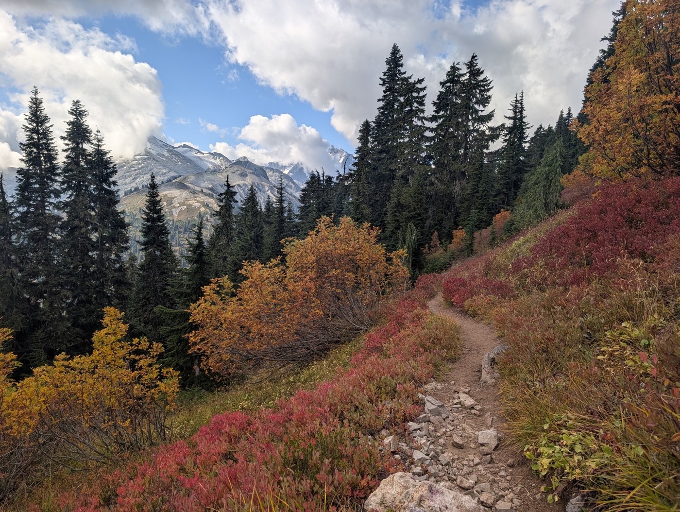
Overall Day 1 thoughts: I did not hate myself or my life decisions on Day 1. Hannegan Pass was very quintessentially North Cascades alpine-y and the fall colors were poppin', and heading down the valley, it became some real classic Cascades forest hiking; lovely on a hot day with its heavy canopy.
DAY 2: U.S. CABIN CAMP TO COPPER LAKE CAMP
If a hiker throws her backpack on the ground in a minor fit of exhaustion and no one is there to hear it, does she really make a sound? The world may never know. But we also maybe could have learned this on Day 2. Multiple times.
Because HOLY COW THE CLIMB UP TO COPPER LAKE IS A TOUGH DAY WITH A PACK ON. This was the hardest day on trail I can remember in a long, long time. To put it likely, that climb suuuuuuuuuuuucked.
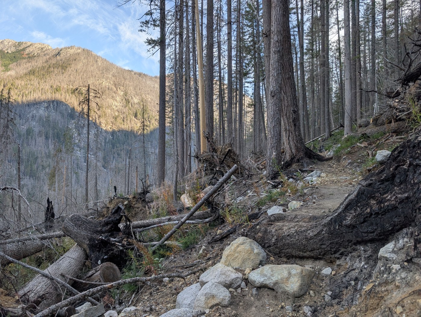
This day was the most... interesting day. It included the cable car, a wobbly suspension bridge, a creek ford, the world's worst climb, walking through a very recent burn scar and finally getting up to the ridge. The burn scar basically starts right after the junctionn with the Brush Creek Trail (at which point you also say goodbye to the PNT). There's a lot of signage from NPS telling hikers to be careful, and it's good they have it; I could hear creaking trees as I walked through the burn area.
If you look at the elevation profile of Day 2, it's basically mostly "flat" until after you break off the Chilliwack River trail and get on the Copper Ridge Trail.
The day basically looked like this:
- Cable car
- Suspension bridge (this is Indian Creek Camp)
- Indian Creek ford (brr)
- climb climb climb
Cable car: It's quite the novelty! On the south side, there's a ladder, and I will say I'm glad I had to climb it rather than going down it with a full pack. I mentioned above how my balance is that of a baby fawn and so is my upper body strength! Pulling myself over was interesting, but not too bad, even with my fear of heights. I didn't use gloves and didn't miss them. I DID have a bit of a time getting out of the car; with weight in it, it really wants to start sliding away. Having another person around would have been nice to anchor the car. I managed. My palms are getting sweaty even typing this.
Photos: Cable car
Suspension bridge: While my palms are already sweaty… Talk about wobbly! I had an iron grip on the Indian Creek suspension bridge. I did not like it. You could definitely just fall through the side of the bridge. Let's move on. There’s easy water access on the north side of the bridge; a sign points to the water access, next to the camp turnoff.
Photo: Indian Creek suspension bridge
Water: This was my main concern because of the big climb of the day. I filled up at Indian Creek Camp with 3L. But you CAN fill up closer to the climb at the Indian Creek ford about 1 mile past the camp, or there was water flowing in a section 1.5 miles past Indian Creek Camp (0.5 mile past the ford) where there is a bunch of flagging for a washed out section. After this though, there isn't much reliable water until Copper Lake. There was a stream flowing over the trail 2.5 miles past the Chilliwack/Copper Ridge junction at the time I hiked it.
The ford is easy enough, but I recommend sandals because there is no way to cross this thing without getting your feet wet.
Photo: Indian Creek ford
Trail: The trail itself is in great shape overall. Around the Indian Creek crossing pass Indian Creek Camp, some washout sections require following flags/cairns, but it's not too bad, and poles are helpful. Getting to walk through the Chilliwack burn scar was really cool in a sketchy way. I think I had to walk over one very minor blowdown. The land managers have done a remarkable job bringing the trail back here.
Photos: The trail, the burn scar in particular
Near the top of the climb, where you start peeking the ridge, there's some overgrowth that is a bit tough to walk through. I was getting pushed off the trail somewhat, and nearly fell off the trail at one point just due to unsteady legs. Just something to be aware of. It's not too bad.
More trail notes: The shapeliness of the trail, however, was not my issue with it. The trail here is steep. Like STEEP. Steep steep. Maybe not as steep with a day pack on somehow. Is trail grade relative like time? Anyway, it's steep. And for like 4.5 miles, except it feels like 12, which makes me think mileage is also relative, like trail grade and time. I'd plan for this section to take longer than usual (but perhaps you are much stronger than me, and this will be much easier for you!).
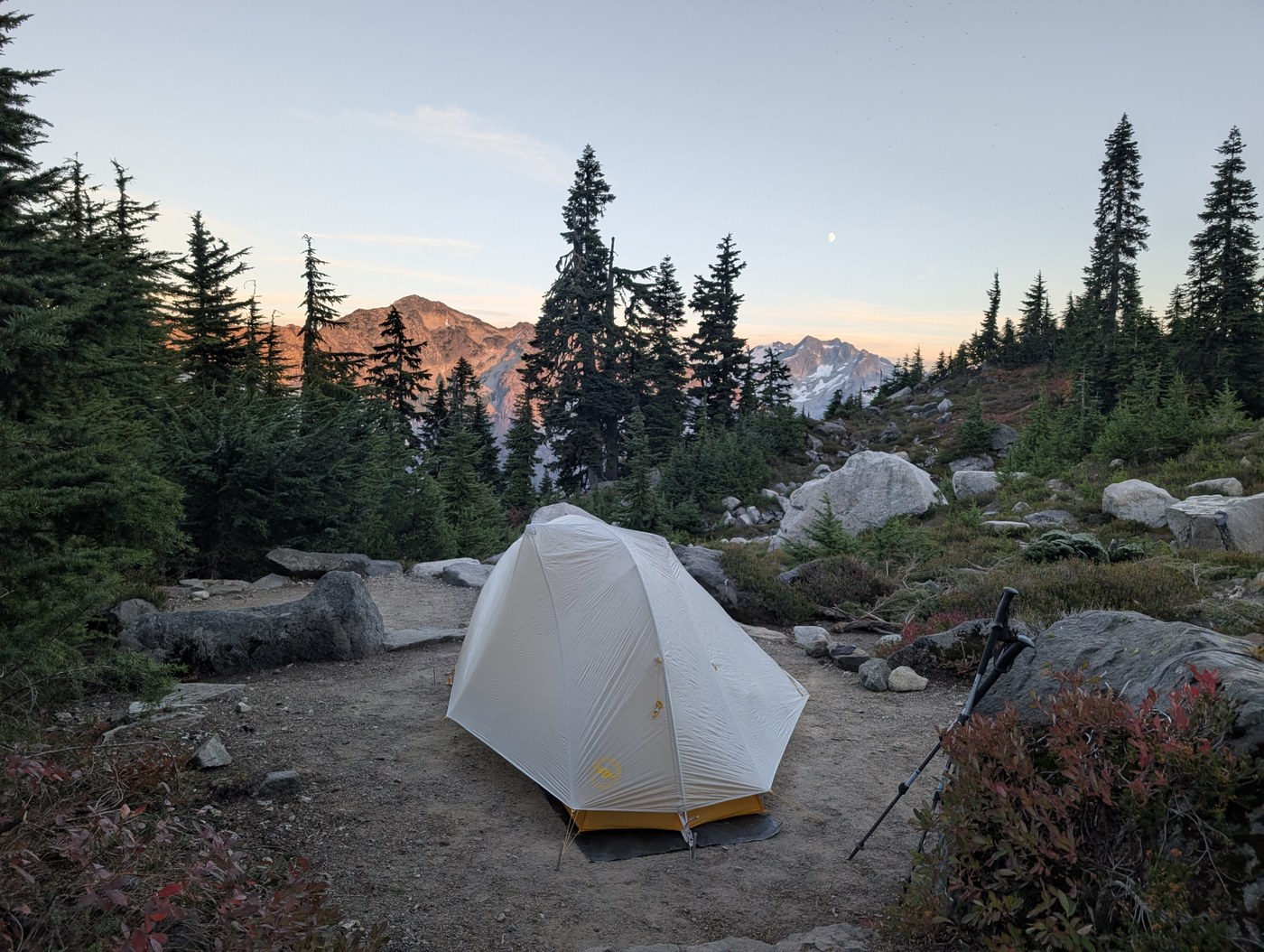
Copper Lake Camp: Did I find this camp so incredible because I was so so so so so happy to finally take that damn backpack off and stop walking? That may have contributed, but just LOOK at the pictures. It really is a beautiful campsite. And that toilet view. And a bear box! Would I camp at Copper Lake again? 100% yes.
Photos: Copper Lake Camp
Overall Day 2 thoughts: WHYYYYYY
DAY 3: COPPER LAKE CAMP TO TRAILHEAD
Wow. Just wow.
I was fatigued as &#$@ from Day 2 so this was a very slow day compared to what I expected it to be given the stats, but with its views and terrain, I wasn’t mad to be taking longer than usual.
Day 3 told me why I heard people call the Copper Ridge Loop one of the gems of the North Cascades. At some point, I thought to myself, "Ohhhhhhhhh, so THIS is why people like this loop."
This part of the trail was some of the most beautiful I've probably ever hiked in my life. It actually felt a little unfair to live in a place like this. How lucky are we?? To be honest, I don’t really have much else to say about this section of the trail other than that. Have more pictures of it instead.
Photos: The magnificence of the trail on Day 3
I saw a couple of USFS guys at the pass working on installing new signage on Day 1, and when I returned on Day 3, there were some shiny new signs there! Very cool.
When I returned to the trailhead on Tuesday afternoon, the parking lot felt super empty. My car was the only one parked on the side of the road from the weekend.
Copper Mountain Lookout: I couldn't actually see the Copper Mountain Lookout on my Gaia track, so wasn't sure if it would be easy to miss. No, it's on the trail. If you're looking for it and you use Gaia, it's right at the little restroom icon between Copper Lake and Silesia. Also, that little toilet is AWESOME. It has such a cool view. Literally 0 privacy though. I didn't use it but went to go see it. Talk about a poo with a view.
Photo: Copper Mountain Lookout
Water: There's very little water on this stretch, so unless you're dropping down to Egg Lake, I'd just carry whatever you're hoping to drink at Copper Lake until you can reach Boundary Camp or Hannegan Camp (which I'm assuming have their water sources; I didn't verify myself and just carried all of my water from Copper Lake to the trailhead).
Trail: Otherwise, the trail is in awesome shape here. No issues other than some of those marble-pebbles I'd been dealing with the whole loop. As with the rest of the loop, I absolutely needed poles, but the trail was really immaculate maintenance-wise.
Overall Day 3 thoughts: An incredible finish. Truly made the rest of it worth it. Maybe? Is this one of those things where you get all the happy brain chemicals after all the pain so you forget it afterward?
FINAL THOUGHTS
This trip report may have sounded largely negative, but that's because this was one of the most Type 2 Fun hikes I've had in a while. The Type-2-est of Type 2 Fun. I came home on SUCH a high and some of the loop was the prettiest I've seen in Washington. Not just Washington — anywhere.
I got so much of it to myself, including the ridge, and for such a gem in the North Cascades, I admit that that was really special, even in the parts that felt a little less visually spectacular. I felt true solitude in the North Cascades, which I find so rare these days. I came home with pain and soreness in just about every part of my body, which is a positive sentiment. (If anyone has made it this far, you may understand this.)
RECOMMENDATIONS, IF YOU CARE FOR THEM
Would I do the Copper Ridge Loop again? No, almost certainly not. This was a one and done for me. But I absolutely would do the western part of the loop again. It's wildly beautiful and camping at Silesia looks awesome (though water kind of seems like a pain).
I unfortunately am a completionist, which is something I've tried to train out of myself, but have failed. (Something I have not completed, I suppose.) In that way, I am very glad I've completed the loop. But if you are not a completionist just for the sake of completing things, I highly recommend taking just the western part of the loop; perhaps camping at Copper Lake, and day hiking a little further out past that before you would start descending into the valley, then turning back. This part shows off the majesty of the North Cascades. The one thing you'll miss out on is the cable car.
That said, if you're into masochism, I really recommend the opposite. Definitely consider doing just the east side of the loop up to the point I mention above. You'll love it. Specifically as an out and back for double the fun.
If you ARE doing the whole loop, I think I would recommend doing it counterclockwise, even with the worst climb of all time in there. You get arguably the "best" part at the end, although that is certainly personal preference. I know many folks love their North Cascades views though, and this direction gives you a magnificent finish.
The short report
ROAD / TRAILHEAD
Great shape, minor potholes. Any car will be fine to the trailhead. Trailhead toilet looked open.
TRAILHEAD TO U.S. CABIN CAMP
Trail: Pristine condition. Climb to the pass is tough with a pack on when hot (exposed) and your knees may cry on the long descent beyond the pass. Bring poles!
Water: A very cool waterfall over the trail 1 mile past Boundary Camp. Copper Creek goes right over the trail near the associated camp.
U.S. Cabin Camp: Awesome, roomy. Campsites very spaced out. Tree canopy for shade. Easy water access with river white noise. Privy easy to find across the trail from camp.
U.S. CABIN CAMP TO COPPER LAKE
Trail: Great condition. I remember 1 easy blowdown. Longest climb with this steepness I can remember on a hike in a while. Took me much longer than expected. Pain. Cursing.
Water: Very little. Last reliable source before the big climb is probably the Indian Creek washout about 1 mile past Indian Creek Camp. One other source in the flagged washout area 0.5 mile past this point was flowing well for me, but uncertain if this is reliable. I saw one stream about 2.5 miles up from the Chilliwack/Copper Ridge junction, but also uncertain if this source is reliable.
Copper Lake Camp: Epic. Views from here are so good. Poo (composting toilet) with a view. Bear boxes. A lake. Beautifully spaced out tent sites. What more could a girl want?
COPPER LAKE TO TRAILHEAD
Trail: Perfect condition. Lots of up and down here until Hannegan Pass, and boy is it pretty. Marmots and mountain goats. I lack good adjectives to explain the beauty of this section; please refer to pictures.
Water: Egg Lake might be the only option besides other camps. (I didn't verify, but I assume Boundary and Hannegan camps have reliable water sources. I carried everything I needed from Copper Lake the whole day.)
OTHER
Bugs: None.
Wildflowers: Not many, but fireweed and other blooms popped in the burn scar.
Fall foliage: YES! Fall is here in the North Cascades!🍂
 Length
 Elevation Gain
Comments