


Four days and three nights spent circumambulating this sacred site of the Cowlitz and Yakama, clockwise from Climber’s Bivouac. This trail is incredibly diverse: a new landscape seemed to open around us every few miles, each as strange and beautiful as the last. The challenges of the route—water scarcity, prolonged exposure, tedious clambering across lava flows, steep gully after gully, sketchy sandy footing at nerve-wracking heights—made for highly memorable trip.
DAY 1: CLIMBER’S BIVOUAC > BUTTE CAMP
- Garmin watch mileage: 5.72
- Water on route: No
- Water at destination camp: Yes
The road to the parking lot is well maintained; plenty of open spots early afternoon on a Thursday. After warming up on the gentle forested ascent on the Ptarmigan Trail to the Loowit Trail, we turned left and quickly found ourselves maneuvering over a hillside of igneous scree and jagged boulders; route-finding was tricky, but posts and kerns kept us heading in the right direction. The lava flow eventually gave way to easier trail across scrubby slopes. We took the Butte Camp Trail down into an amphitheater that felt holy after all that sunlight, ancient hemlocks holding the hillside together as if decreed since time immemorial. A brook rushes gently along the trail at the base of the hollow—several spacious campsites in the shadow of the hills.
DAY 2: BUTTE CAMP > SOUTH FORK TOUTLE RIVER CAMP
- Garmin watch mileage: 7.82
- Water on route: No
- Water at destination camp: Yes
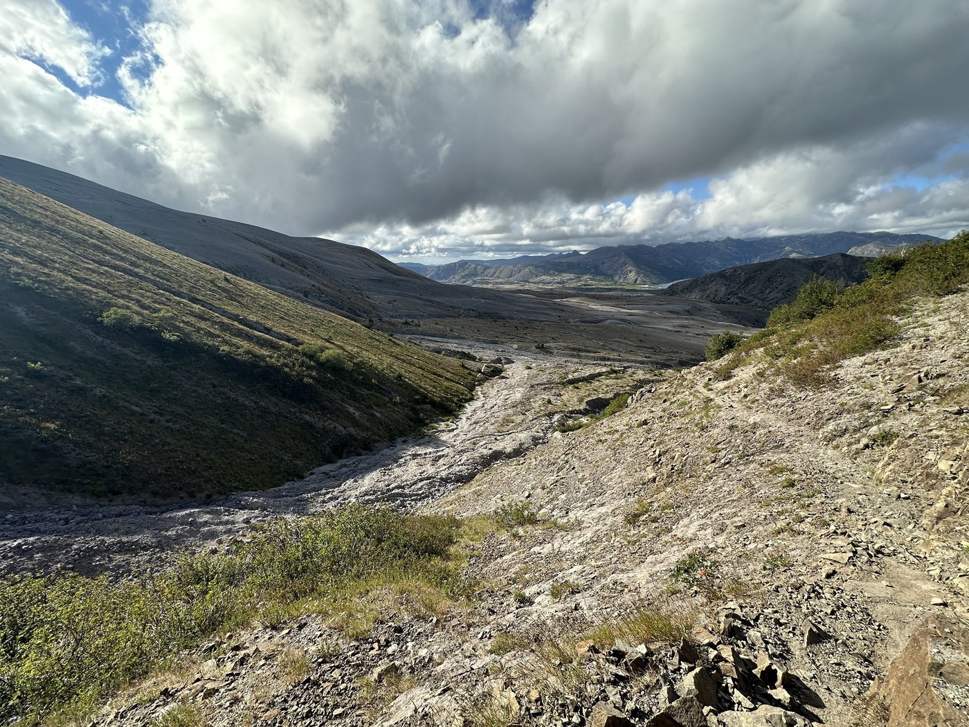
We climbed back out of the amphitheater and continued along the Loowit through open rocky meadows and groves of pine. In this stretch, the loop presents its first of many gullies, with their steep walls of ashy soil and stones. Thank you to the volunteers who maintain the anchored ropes used to lower and haul oneself in and out of the more treacherous ravine in this section. As the trail begins to descend Crescent Ridge, the sandy canyon walls of the South Fork Toutle River are a site to behold; the trail winds down through old growth forest to the river. There are several good campsites perched on the cliff before the gully; most were full, so we camped on the far cliff, where there are one or two okay options. More ropes in and out of the gully here, by the way. We filtered water from the river before bed, sunset painting the lunar slopes of the volcano amber.
DAY 3: SOUTH FORK TOUTLE RIVER CAMP > PUMICE BUTTE CAMP
- Garmin watch mileage: 11.69
- Water on route: Yes
- Water at destination camp: No
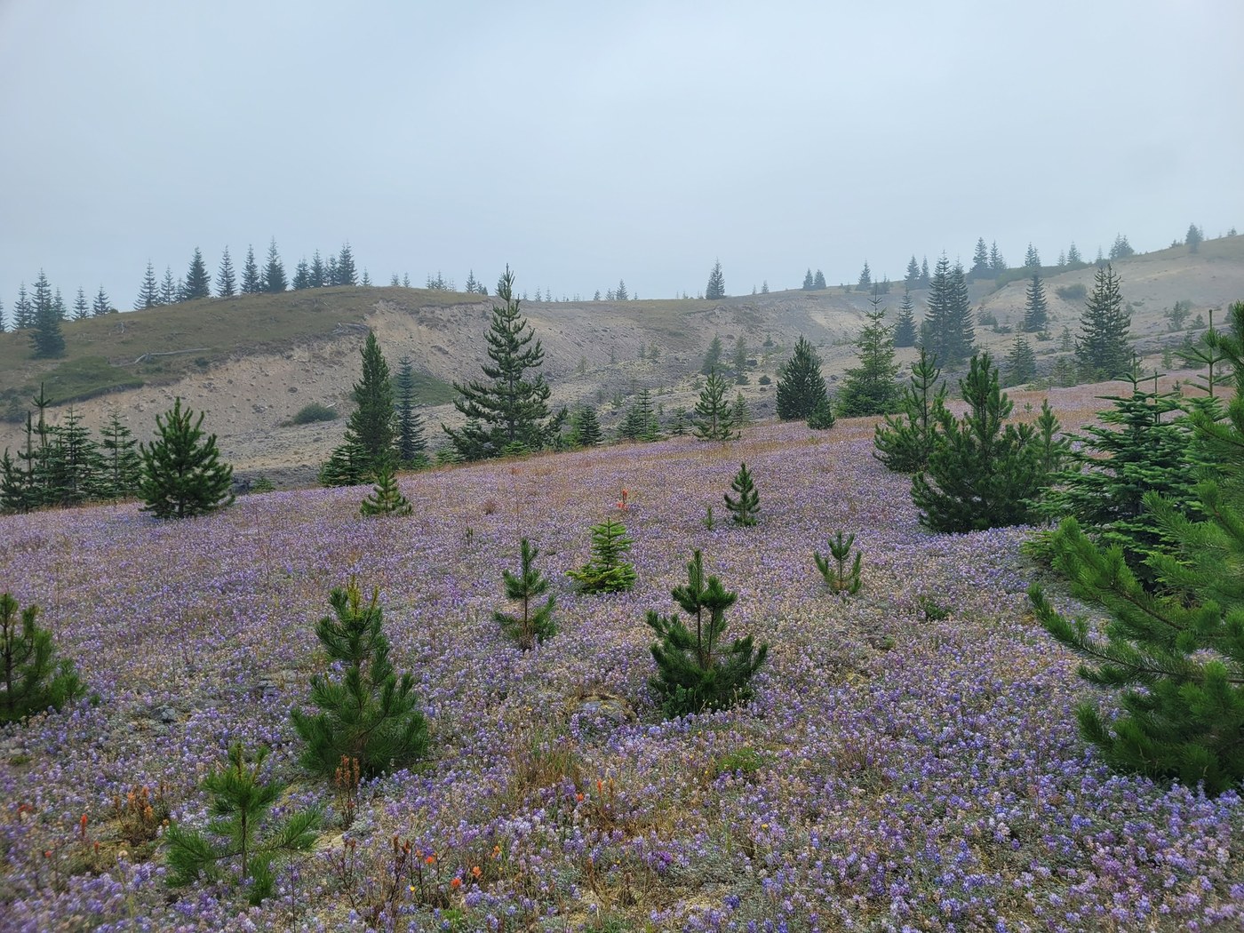
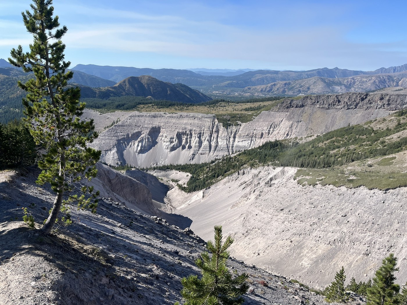
We started day three in fog; from the river the trail switchbacks over exposed slopes to reach a tundra-like expanse, technicolor with wildflowers. We spotted a coyote from the undulating track. Delightful hiking here, despite the intermittent wind and misty rain. Around midday, we stopped for lunch at the lip at the edge of the blast zone before pressing on. Crossing the blast zone is awesome in the true sense: even through passing clouds we were able to peer into where the rock was ripped asunder, where waterfalls bleed from the earth’s dark innards. One could drink said runoff, but its cloudiness would tax your filter; best to hold off for the “oasis:” about 0.4 miles before the junction with Windy Trail, the Loowit will lead you into a thicket that enshrines the head of a spring; top off with enough of the ice-cold water to carry you almost all the way to June Lake Trail (the next reliable water, at least when we did this). We finally found clear skies as we approached Windy Pass, the afternoon sun touching tan rock walls and herds of mountain goats dotting the grassy heights. If you think the saw-tooth switchbacks up to Windy Pass are harrowing, just wait for the descent: boot-width track on loose gravel at an uncomfortable angle—not for the faint of heart. We were grateful when we set foot on the level Plains of Abraham—regal, rugged, and barren at dusk. We rushed down the flat track to Pumice Butte Camp, feet sore. Apparently water runs through here earlier in the season. The view to Mt. Adams/Pahto from the cliff will take your breath away. The area has several nice sites outlined by protective rock walls. Our stay included an hourly parade of mountain goats past the camp.
DAY 4: PUMICE BUTTE CAMP > CLIMBER’S BIVOUAC
- Garmin watch mileage: 10.81
- Water on route: Yes
- Water at destination camp: N/A
We bade the goats goodbye and wandered through groves and rock gardens. We came across a black-tailed deer enjoying a berry patch. A few gullies in this stretch—a couple were tricky with loose footing. Eventually the trail begins to wrap around a boulder-laden hillside and descend below the tree line. Just before the junction with June Lake Trail you’ll reach reliable water, nestled down in depression to the right of the trail. After the Junction with June Lake Trail, you’ve got about 0.6 miles of lava flow clambering, this time easier to navigate than day 1. After traipsing over the porous talus, brace yourself for the final boss, an 880 ft ascent up to the junction with Ptarmigan Trail. From there, easy shady downhill back to the car.
Type of Hike
Multi-night backpackTrail Conditions
Minor obstacles posing few problemsRoad
Road suitable for all vehiclesBugs
No bugsSnow
Snow free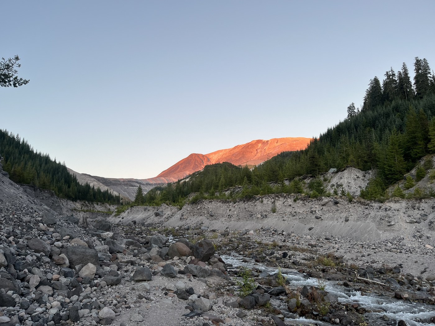
Trails Hiked
Loowit Trail

The Loowit Trail cannot be accessed via the Willow Springs (#207A) Windy (#216E) or Abraham (#216E) trails through all M-F between May 15 and Oct 31 through the end of 2027. The access trails will remain open on all weekends and federal holidays. The Loowit Trail remains open.
-
 Length
- 32.0 miles, roundtrip
-
 Elevation Gain
- 6,000 feet
Comments
Looks like an incredible trip! Thanks for the detailed report.
Posted by:
Loren Drummond on Aug 18, 2026 01:04 PM