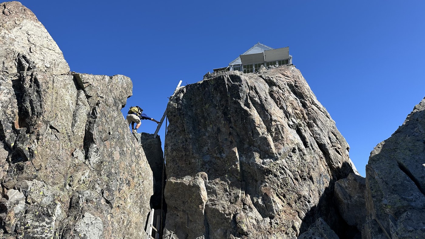
Fantastic trip with Kidz Won't Hike to climb to Three Fingers Lookout in a day. The terrain is stunning and the views are turning to fall colors, ripe berries above 5000'. In an effort to optimize for a C2C ascent, we decided to forgo bicycles and the normal route, and go through the direct backdoor. The crux of this route is 2 miles and 3400' of super steep terrain before joining up with the main trail on goat flats. It is not for the faint of heart. There are at least 10 ropes installed to help with steep and slippery sections and blowdowns are everywhere. You will slip and stumble, it's just a matter of how far you fall.
We arrived at the TH before the washout at 6:15am and there were at least 10 vehicles. 13 people slept at lookout the previous night, 5 of them had to sleep outside. Others had camped in goat flats. We set off by 6:30am heading up the main trail. 1/4 mile in, we turned right on an old overgrown road. Vegetation was higher than us in places and fairly wet, so we put on our waterproof layers. This trail is pretty flat and goes about 1.5 miles. From here, the fun begins. Things open up in the forest, so we didn't need gore-tex anymore. The trail goes straight up for what seems like forever. There are many very steep sections with soft slippery dirt. We wore microspikes the entire way up and down this 2 mile section. I honestly don't know how you'd do it without them. The ropes helped in places, though I mostly didn't use them. About 2/3 of the way up, the steepness eased off and we were on a narrow ridge going up and down. Lots of overgrowth on this part too. Eventually the terrain opens up into some small meadows. This whole 2 mile section is heavily flagged with pink and orange ribbon, very helpful. We still lost our way now and again, but the flagging and the ropes made it easy to get back on track. Once we got into the upper meadows we high-fived that we had made it through. We took a break and then set off on the main trail. There's still a long way to go from here, but the trail is nicely defined almost the whole way. We made our way through beautiful meadows, rocky slopes, mountain passes, side hills, a little bit of class 3 down climbing, and more. Views of the lookout are elusive, since it's tucked behind a large peak. Eventually we arrived at the one remaining snow patch. We headed up, then some more class 3 scrambling, and then we were at the base of the ladders. The exposure is high once you get up the ladders and step onto the final rock slope. The wind was howling and gusting today, so it was nice to get inside the lookout for lunch and a rest. There were 3 Aussies on a USA tour and 1 other person who had stayed 5 nights and was doing lookout repairs and painting. We spent an hour chatting with them while we refueled. The hike out was of course long and tedious, mostly uneventful. About 30 mins after we had left, a plane arrived and barrel rolled and dive bombed around the lookout 4-5 times, so that was cool. The steep forest section with the ropes was even more difficult on the way down, since we were more tired. It took a lot of concentration not to take a fall on the many steep sections. I used the ropes more often to help on the way down. We ended up matching or beating down some groups whom we had passed as they were descending and we were ascending, due to the many more miles required on the standard route.
Stats: 12.4 miles, 5800' gain, 10:35 total time, 2:40 stopped time
Gear: Poles, GTX hiking boots, gaiters, waterproof shell and pants, water filter, gardening gloves for veggie and rock scrambles and using the rope. Snow section was easy, no axe needed, didn't even put our spikes.
Water sources: A few really good ones not too far below the lookout. The lower one is 48.1672, -121.68947. I brought 3.4L and filled up another 1L.
GPX: https://www.peakbagger.com/climber/ascent.aspx?aid=2986940


Comments