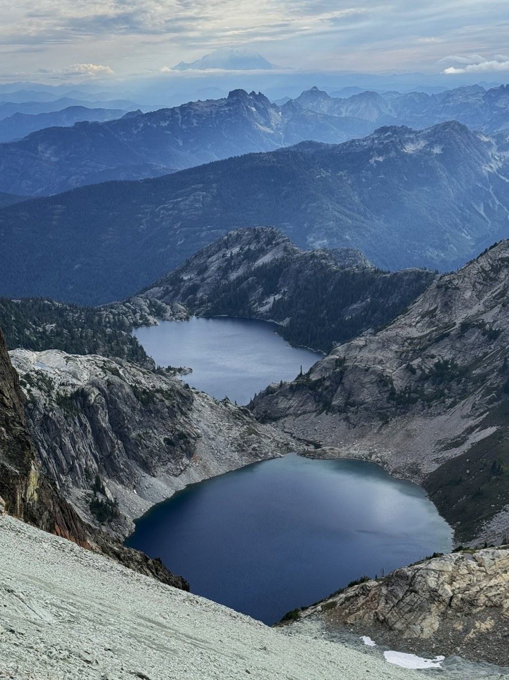
If you’re confident in your balance and ability to handle vertiginous drop-offs, this may be the best hike in the Alpine Lakes. There’s really nothing much harder than that scramble up the Haystack on Mt Si, but the view continually makes you visualize yourself tumbling down thousands of feet of scree and wondering how well that SOS feature on your phone works.
Scatter Creek still has a fair bit of water but my Corolla had no trouble. 8 cars at the Cathedral Pass trailhead at 7:15 on a Tuesday. The toilet was out of paper, but as it was stocked two days beforehand, it looks like hikers are stealing it for emergency use in the mountains.
The trail is 2 miles of standard uphill through some nice forest with the occasional massive, old-growth Douglas Fir. The beautifully named Nosh Nosh Wahtum (apparently ‘Salamander Lake’ to the Yakama) is worth a trip in itself and is followed by several lovely tarns as you meander along meadows toward Cathedral Rock.
When the PCT zags off to the left, it leaves you with a mile of horizontal scramble (you’ll see what I mean) between the many arms of Cathedral Rock and the talus plunging down to Deep Lake. This seems intimidating on the way up, but after you’ve been to Mt Daniel, you’ll wonder what the fuss was about.
Peggy’s Pond is a deep lake nestled in the north-west shoulder of Cathedral Rock. There are a lot of campsites but you might need AllTrails or a similar app to find that last one on a high-demand evening. I got to Peggy’s at about 9:45am and, after setting up camp and having a nap, was ready to go at 2pm. That’s probably the last time you should think of heading up to Daniel. I got back at 8pm, still light but the days are getting shorter.
There are other ways up, but I took what Beckey calls the standard route along the southeast ridge. There is no snow on the trail at this time of the year, but it’s scree, scree, scree. Starting from Peggy’s Pond, there is a rat’s nest of trails, and I needed AllTrails to get me up the ridge that towers over the campsites. Nothing special up this part but your aerobic fitness is tested. From there, follow the obvious ridge west as Circle Lake comes fully into view on your left and the remnants of Hyas Creek Glacier lurk in a scoured rocky scar to your right. When the ridge turns right (north), you meet the succession of false summits. The trail generally stays to the left of these, and you navigate an eternity of steep scree that is easier than it looks. The gorgeous Spade and Venus Lakes slowly come into view to the west.
Just before the East Summit is probably the hardest part. Over the ridgetop looks impossible but there is a nasty-looking path to the right where, apart from one heart-stopping moment, it’s not too bad. Still, I went over the top on the way back. After that, it’s another scree trail to the left of the ridge and an easy scramble to the summit. Some route-finding is probably necessary as it’s easy to see the East Summit as the highest.
According to the register, four people reached the top on Tuesday and that seemed about standard for weekdays (more on weekends). The views are stupendous. To the north, the enormous Lynch Glacier falls to Pea Soup Lake. Clouds began to roll in as I summited at 5pm so I didn’t get to see Glacier Peak. To the east is Granite Mountain (the one above Robin Lakes) and south of that, Cashmere Mountain and Mount Stuart. South is the view to the I90 peaks and hovering above it all the giant mass of Tahoma. East is Hinman and the familiar skyline of the Alpine Lakes High Route. It was like looking at an overview of my entire hiking history.
On the way back, marmots whistled me down and a trio of Air Force C130 Hercules circled Cathedral Rock. An awesome day.


Comments