
What an amazing hike - such accessible gloriousness for so little work! I did an overnight hiking in Sunday afternoon, day hiking and hanging out Monday, and hiking out Monday late afternoon.
Berries!!!!! The berries are bonkers. How is one expected to hike with all these berries begging to be picked?! It seems criminal to just leave perfect, beautiful fruit just sitting there on the bush. But the berries are endless - and it's not even peak time for most of them. Blueberries galore on the high divide,huckleberries too - though the biggest, fattest, purplest huckleberries I've ever seen were all around Damfino Lake. Berries to bring out everyone's inner preschooler - like Blueberries for Sal but without the bear!
Animals: none, except birds which I don't count. Guess the bears are waiting until later to go berry picking.
Bugs: Oh yes indeed. Several layers of spray and still got some bites. Different times of day, breezes, altitudes varying the degree to which I noticed them and the different types that made their presence knows (strong silent types vs big icky types, etc). Always present sunup to sundown. Occasionally could sit for a bit without being annoyed. Super loud crickets. Weird big black things with 4 inch antenna that landed on me once and got in my pack once, leading to a comical encouraging-the scary-black-bug-out moment.
Water: Please, if you're doing a day hike here, drop a line about water availability and help out a backpacker! I am grateful to the trip reports that came before me. There is a stream below the pass on the Damfino side - very flat, a little tricky to fill a bottle but plenty of water. There is a stagnant pond by the campsite below the pass - you'd need a strong filter. There is water on the other side of the pass, heading down Excelsior trail - BUT it does not cross the trail. It is not obvious whatsoever (and in fact I walked all the way into the forest before giving up on it, heading back, and then somehow catching a glint of it off trail). About 1/4 mile down the pass, you'll cross a dry rocky runoff - follow it down the hill a few steps and there's running water. Again, hard to easily fill a bottle, but can be done. No idea how much longer it'll last, but it was half the effort of going to the Damfino side stream!
Road: Excellent forest road. I always heard it was terrible, but some recent reports indicated otherwise. I'm here to confirm. But PSA - just because you can drive a one-lane forest road at speed....should you? I drove up at peak coming-down time on Sunday afternoon; 90% of drivers I encountered were really courteous and careful, but there were a solid 10% who didn't understand physics, like what two two cars need to do to be able to pass each other safely, or that not everyone can stop on a dime on steep gravel!
Parking: Arrvied Tuesday 1.30 pm. Having passed several cars on the way up figured parking would be fine and indeed there were several spit in the main lot. At 5pm Monday evening there were only 3 remaining (including me).
Trail: moderate grade, lovely tread. Totally exposed once you break out of treeline, be prepared.
People: Passed a bunch of folks hiking out Sunday afternoon, but no one behind me with a pack. I clocked one other backpacker Sunday night who stayed by the pond below the pass and who I passed heading back on the high divide trail after sunrise the next day - assumed he was off to camp near welcome pass or beyond. Monday no one came up until later in the day after I'd peaked and high divided, and I saw no one on my walk out to the west of the pass.
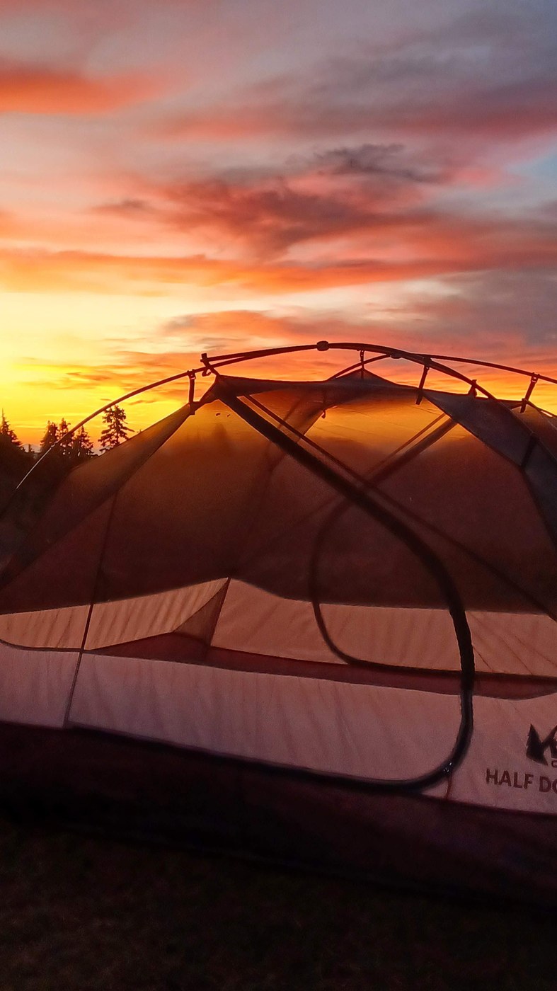
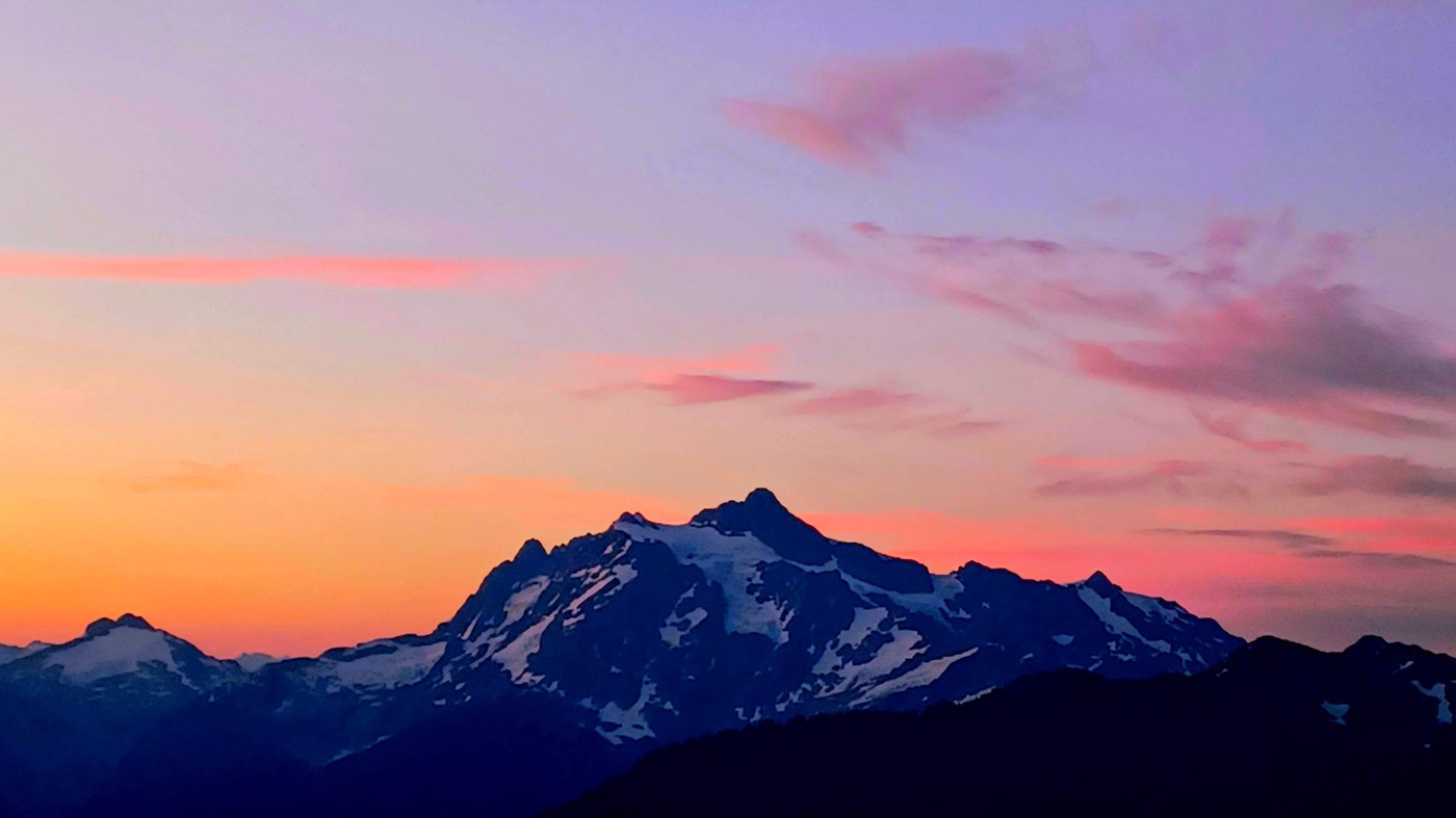
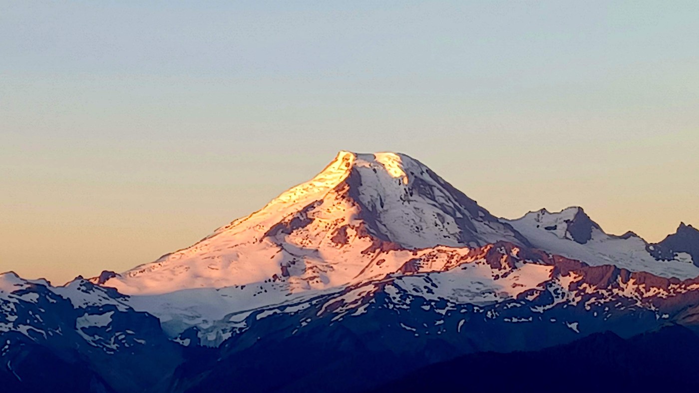
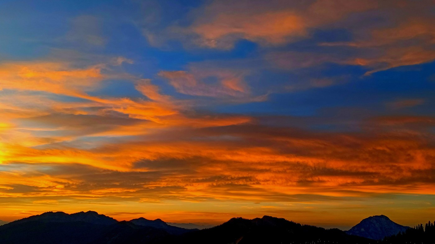
Sunset and Sunrise: simply glorious. Both took over a full 180 of horizon, plus light on Shuksan and Baker. I had clear (and hot) conditions, but the clouds came out just for golden hour, which was really thoughtful.
My morning plan was head back to my tent for coffee and chill and rehydration before a walk, but the High Divide was calling. Very glad to walk in the cool of the morning with slopes still shady - made coming out into the sun and change of view even more special. Walked about 2 miles, had breakfast, came back, loaded up on water, then read at the tent until I wanted blueberries. Then I went out the other direction from the pass - tons and tons of berries, some actual sittable lovely shade - and even better views (if that's possible). Same mountains, new perspectives. Half a mile and it's splendid - but the trail keeps going! Dropping then ascending another peak until it dead ends at a cliff. Sometimes overgrown and steep but never sketchy. Canyon Lake, whatever river is between Shuksan and Baker and whatever peak is behind that - Rainier? The glacier to the west of Shukdan. Also all the peaks to the north - Canada?. Just all the peaks. Yes, I will go pull out a map to figure out what I saw after I write this report. Geology is amazing.
All in all - I had wonderful time in a spectacular region, timed well for people and weather, and I look forward to returning! There are more berries to be eaten!
Comments