A quick report for a loop that I have referred to as the Chinook Pass Loop: This loop utilizes the Eastside Trail, part of the Naches Peak loop, the PCT from Chinook Pass to Laughingwater Creek Trail and back to the Eastside Trail.
I began at the small trailhead that leads down to the Eastside Trail off Hwy 123. I wanted to get the big climb of the day done early so the rest of the day would be relatively easy cruiser trail. Of note, a big storm passed through the night before so I knew there would be a chance of some wet feet in the morning but hoped for the clear skies in the forecast of the afternoon would dry things out.
Sure enough, the Eastside Trail up to Cayuse was brushy and wet. Spent the climb with a wet lower torso but otherwise the trail is in fairly good condition for a trail that I don't believe is used much. A few blowdowns and muddy spots but easy to follow. A handful of water sources as you near Cayuse Pass.
Hopped on a section of the Naches Peak Loop to get to the PCT. Lots of photographers out in the early morning. Unfortunately, many of them set their tripods up right on the trail then gave me blank stares when I asked to get by. I'll put them in the category of, "minor obstacles posing few problems" category. Wildflowers are still out and boy are there a lot but definitely fading.
From there, onto the PCT which felt like a six lane freeway after the Eastside. The sun briefly appeared here and it was a glorious morning. The colors were vivid, the lupine smelled glorious and my feet were already starting to dry out. But after taking a left with the PCT and leaving the loop behind, the clouds rolled back in. For good.
However, this section of the PCT following a rolling profile through open forest and many little pockets meadows is a delight. Plentiful water sources the first couple of miles, but they grow scarce the last four or so miles to the junction with Laughingwater. Lots of NOBO PCTers encountered in this section. Bunched together, bundled up and looking wet and tired. Sounds like it was a rough night for them. I tried to encourage them with news of a very clear forecast for some time after this day.
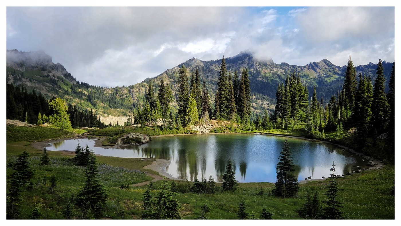
Jumped on Laughingwater and the feet were immediately soaked again. This trail is again, not often used and the tread was minimal in some sections. Also some terrific blowdowns that required more than the usual casual effort to get past. Once you get to the Three Lakes area, and back into the Park, the trail improves. Of note, the lakes are the only reliable water source on this trail.
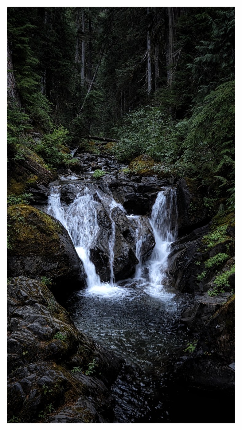
As the trail ends, you cross Hwy 123 and are greeted with Silver Falls. I then worked over to the parking lot for the Grove of Patriarchs (still closed by the way.. will they ever fix it?). I had planned a longer break here but they were cleaning out the portapotties and the scent was the opposite of the lupines. So, onward it was on the Eastside. This section is much less brushy than the climb to Cayuse. I had the trail to myself and as usual with a long day, these last few hours were the most serene and fulfilling for me. The hours floated by as I closed out the loop. A few water sources to be had here along the way. Only major note, one collapsed footbridge which when dry is easily navigated, was a little tricker when wet. Fortunately, I managed to not faceplant.
A lovely loop and perfect for cloudy skies as it doesn't have the huge, dramatic soaring views but nevertheless plenty of beauty to take in. It works well for backpackers, long day hikers like myself or trail runners. It also has a number of trailheads to start from. I usually go clockwise as I love the long, winding descent of Laughingwater.
My stats are usually around 32 miles and 5500' of gain.
Trip Report
Eastside Trail, Three Lakes via Laughingwater Creek, Naches Peak Loop & White Pass to Chinook Pass — Wednesday, Aug. 6, 2025
 Mount Rainier Area > SE - Cayuse Pass/Stevens Canyon

Comments