
Cougar divide has been discovered, it is time for WTA to add an official description and driving directions. For this trail AllTrails had decent info and current trip reports.
The road once you cross Nooksack Falls is 12 + miles, very rocky and rough, requiring good tires and a slower speed, though the potholes weren’t bad. There were many swales put in for road drainage, I had my hitch bike rack on and it hit bottom, if not for the rack I would have been fine in my RAV4. The road is narrow in many places so passing is a challenge.
There were about 10 cars in the parking area and we passed several more on our way down, though few people on the trail. There is no outhouse or kiosk/map.
The mosquitoes were ferocious in the parking lot and we were glad for DEET and nets for our heads.
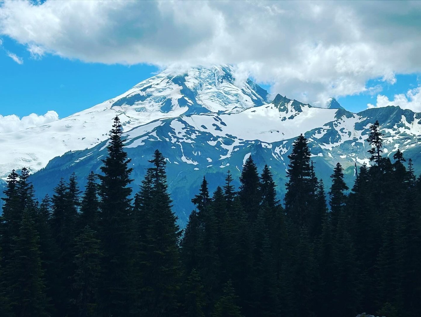
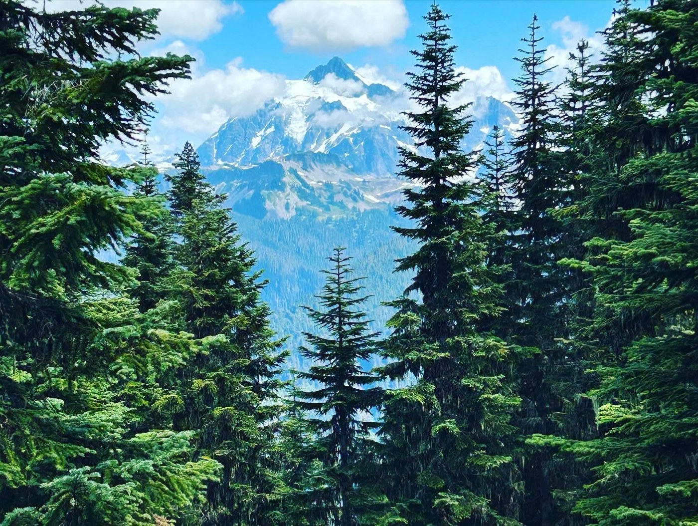
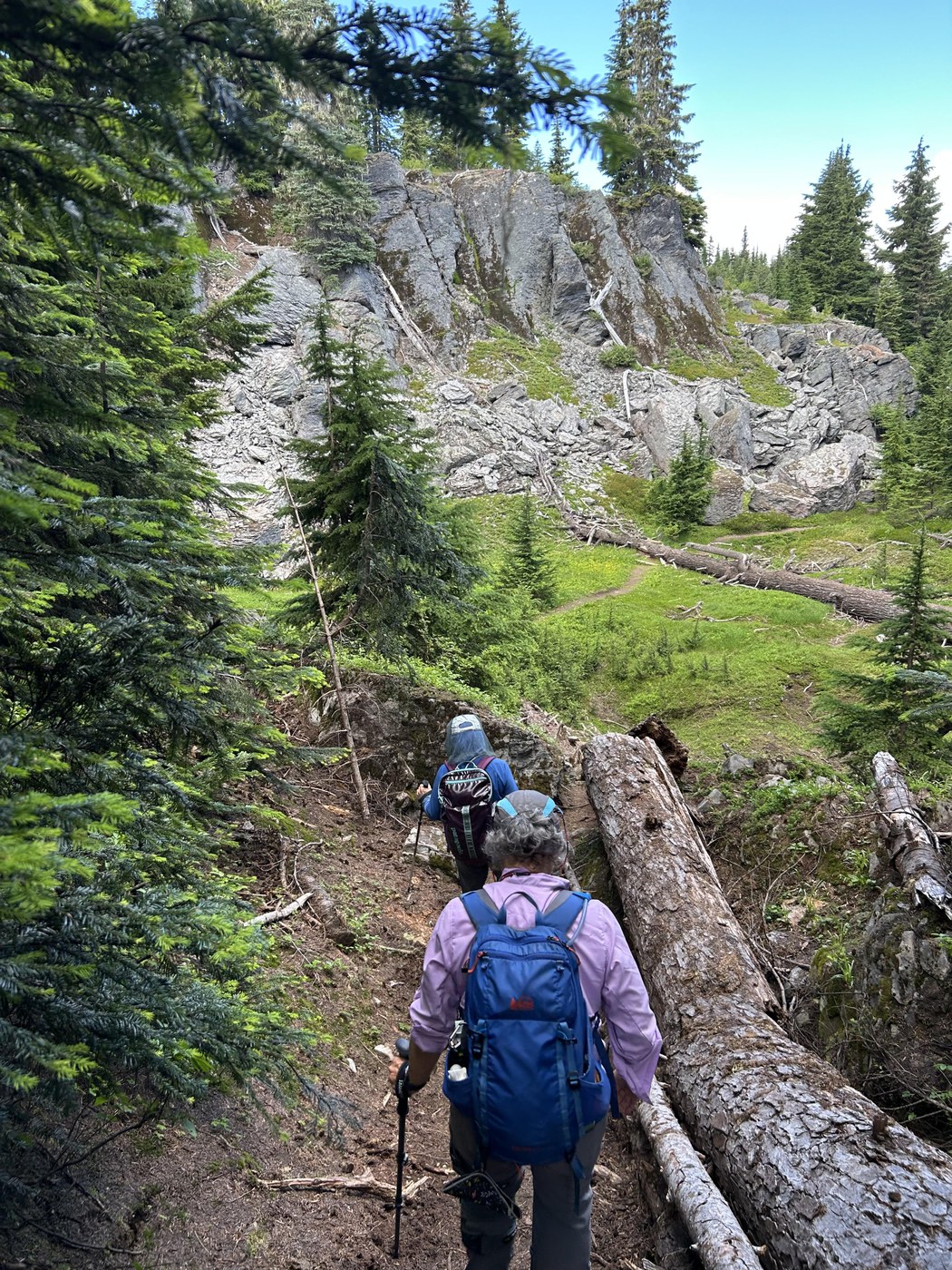
The trail starts out through lovely subalpine forest at an easy elevation gain. There were one or two downed trees that were easy to get over in the first stretch. At 0.8 miles we came out on amazing views of the mother Komo Kulshan(Baker) and Mt Shuksan, up close. Also very interesting geology. If you aren’t in good shape or have young kids this might be a turn around point. From that overlook the trail drops very steeply over the edge of the rocky point, 40 feet or more so down a rough and very loose trail. Happy for poles that I don’t normally need.At the bottom be sure to observe the geology again. From there for the next mile to about 1.8 miles, the trail is in old growth forest with no mountain view, and goes steeply down then back up several of what I am calling gullies, with multiple large down trees to go over and around. It was a challenge for a couple in our group that weren’t as nimble as they would have liked. At 1.8 miles we came out on a gorgeous wildflower meadow and the views of our mountain friends opened back up and made the hike worthwhile. It appeared the trail would go back into the trees. Since we had already been delayed giving aid to a backpacker suffering from dehydration, overheating and panic, due to what sounded like a GI bug the day before(2 in our group were medical professionals) we turned back at this point.
Other hikers returning as we went out told us the most spectacular scenery comes at Chowder Ridge, which I believe is at about 3 miles. We were also told there were large patches of snow at that point. Also no water at all on the trail, except a backpacker told us the snow was melting in the afternoon and they used that as drinking water.
Comments