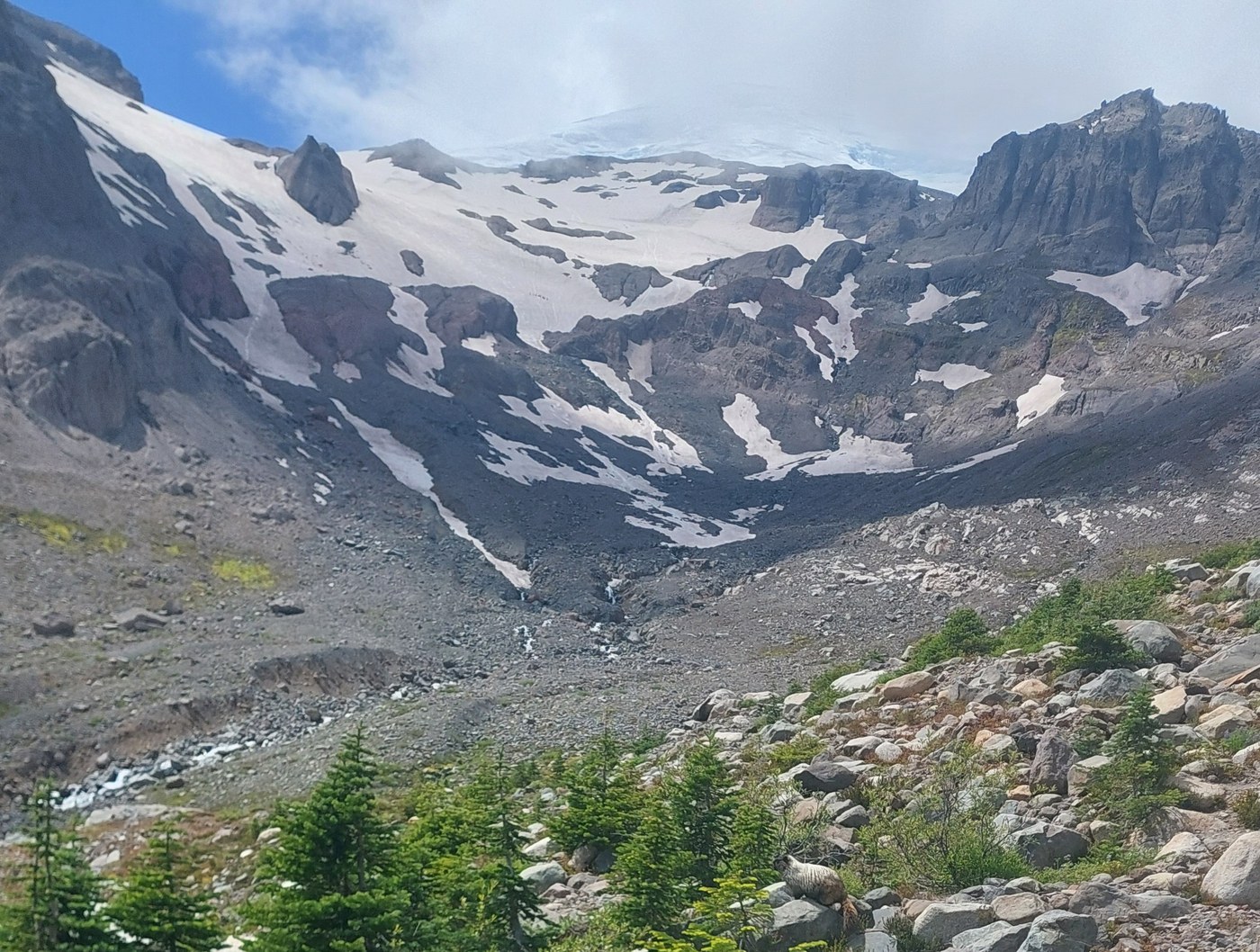
Sunday's hike took us from White River Campground all the way up to the snow patches below InterGlacier, Mt. Ruth, and Steamboat Prow. We follow the Glacier Basin trail all the way to Glacier Basin Camp, where the trail pops out from the trees and continues straight along unmaintained trail up to the snow fields.
The first four miles were mostly wooded, with peeks at White River and Inter Fork Creek to the left. The trail is very well maintained and easily traveled. The nature views here are great - little creeks with cascading waterfalls, huge trees growing out or around boulders, wildflower filled meadows, and some forests that sustained some damage, unsure if from blowdowns or a small fire. We saw chipmunks, hummingbirds, and many different butterflies. Multiple hikers out and back mentioned they had seen a bear around the meadows before Glacier Basin Camp and near the bridge to Emmons Glacier Trail, but we were not so lucky.
Beyond the End of Trail sign, the travel is obviously not maintained, or did we expect it to be. Follow a mostly dry stream bed full of rocks and sand, sometimes loose and easy to stumble over. It appears there are many routes that people take along the way. In the wet areas of the trail we happened upon several largish frogs. We watched them hop of towards the larger Inter Fork Creek. There were plenty of ants around for them to eat.
Eventually you will reach al large, exposed hill of densely packed sand and rock. It was easier to get up, and later back down than we expected, it was not as loose as we had feared, but we did lose footing a couple of times. Poles were useful. At the top of this sandy hill you will again walk through some short trees and ascend a wet, rocky staircase that leads up to the rocky flat area below the glacier. We took a break here for lunch to watch the climbers ascending the ice to Camp Schurman. A marmot greeted us too, and was not at all bothered by our presence.
The trail was harder to follow the last 3/4 mile or so to the snowfields and required regular attention to stay on course. Stop and look up often to see the top of Mt. Rainier gradually disappear behind Steamboat Prow. The trail can be quite loose the closer you get, so make every step count. Again, our poles were useful.
At the end we were rewarded with amazing views in all directions, including the Glacier Basin Valley and all three of the Burroughs.
There are many creeks that peek-a-boo through breaks in the snow, some of these snow bridges dropped 3-4 feet to rocks below, so think twice before wandering out. We also found a bag for a sleeping bag where water was rushing out from under the snow. It was under a 3 foot boulder, so there was no way we could get it out. I wonder how long it has been there and from where it came.


Comments