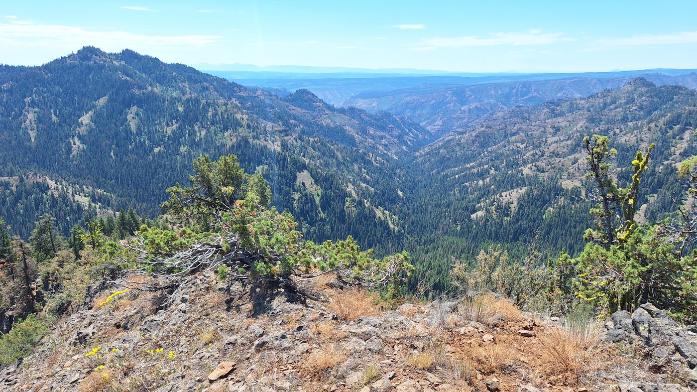
5 night, 52 mile loop starting from Panjab TH, taking Turkey Creek to Oregon Butte, Smooth Ridge trail to Wenaha River, Crooked Creek and Melton Creek up to Diamond Peak, then the Mt Misery trail back to the Oregon Butte and back out via Turkey again. NF47 is in good condition the whole way.
PANJAB & TURKEY CREEK: Can only speak for first mile of Panjab before it splits. Bridge from parking lot is out but the creek is easily crossed on logs. Starting to get overgrown, mostly with thimbleberry or other such easily-waded-through shrubs. All creek crossings easy. No serious blowdowns to deal with. Northern end is exposed due to the trees being burnt, the southern mile nearest Teepee TH is well forested and almost like some of the Cascades forests.
OREGON BUTTE VIA TEEPEE TH/MT MISERY TRAIL: good condition, no issues. SPRINGS: Oregon Butte- running.
SMOOTH RIDGE TO TWIN SPRINGS: Mostly good condition, a bit faint/disperse through some of the meadows, so sometimes difficult to pick back up. No serious blowdowns. SPRINGS: McBain- running. Taylor/Huckleberry/Rettkowski- could only find one tiny stream across trail. Lodgepole- running, though trough destroyed. Twin- running.
SMOOTH RIDGE BETWEEN TWIN SPRINGS AND WENAHA: take it off the map boys, this one's gone! It's been eaten by the snowbrush and I'm not exaggerating. You can follow this one until the saddle immediately before the split for the Packer Trail, and from there it is literally nothing but snowbrush, with numerous blowdowns under it. I could only make headway by walking atop the blowdowns or finding the occasional elk trail (which never lasted more than a 100' before disappearing). While I used GPS to stick as close to the old trail path as possible, there was literally no sign of it. It took me seven hours to get from Twin Spring to Mud Spring. South of Mud, the snowbrush is replaced by willow and other shrubs, or is open entirely, and so Moore Flat proper is much easier to deal with. The connector that switchbacks down to the Wenaha is fine. SPRINGS: Pistol- only a mere trickle, maybe in extreme need. Mud- running. Soap- skipped.
WENAHA RIVER TRAIL: some woody brush encroaching in spots, one gnarly washout, and several nuisance blowdowns. Only time I encountered mosquitoes on this trip was at my campsite on Fairview Bar.
CROOKED & MELTON CREEKS: while there are fewer blowdowns, the first three miles of Crooked are quite brushy. While I could always determine where the trail was, I was frequently screened out. Annoying and a bit slow, but still a trail. From the mile before Three Forks junction it's received recent trailwork from the Pomeroy Ranger District and is in great condition, including Melton Creek. Last water access going north on Melton is on that long second switchback. Between the Three Forks area and Diamond, the only campsites with water access for Melton are near where it crosses the creek at 3500'. SPRINGS: Diamond- could not find in brush.
MT MISERY: excellent condition, no serious blowdowns or brush. SPRINGS: Sheephead- could not find. Sq--- running. Bear Wallow- skipped. Clover- running. Bullfrog- could not find. Dunlap- running. Table Camp- skipped/could not find (did not notice campsite remains in burned area). Emergency- running under pipe, may be fixed by lookout.
OVERALL: what would otherwise have been a fairly easy trip was made very strenuous by the bushwhacking on Smooth Ridge and the heat. It was over 95 most days, including the long climb up to Diamond. I normally carry two liter water bottles, I regret not bringing a third due to unknown or poor water access. The Blues are definitely a beautiful, but sometimes very difficult area. After Saturday, the only people I saw were Forest Service staff and one group along Mt Misery trail. However, I did frequently find (sometimes historic) garbage from destroyed basecamps, or hitches and other infrastructure in campsites.


Comments
RichP on Panjab Trail, Turkey Creek, Mount Misery, Oregon Butte, Smooth Ridge, Crooked Creek, Melton Creek Trail, Wenaha River Trail
Great intel. Thanks!
Posted by:
RichP on Jul 29, 2025 05:10 PM