

Da Klagwats! It was a perfect day for a climb. The road up to the trailhead was overgrown but not heavily rutted. My vehicle has less than 5 inches of clearance and it was okay as long as I took it slow. There were a few larger potholes to navigate. It is a narrow single lane road with only one turnout early on before you reach the trailhead. Parking consists of two nearby turnouts that can collectively hold about four cars. We arrived at the trailhead at about 7:40 and found only one other car.
The lower part of the trail was in decent shape, with relatively few impediments. The trail started to get messier after the second or third switchback. The vast majority of the obstacles were in the switchbacks above Lake Metam. Most of the downed trees were reasonably navigable and the rest could be bypassed with some effort.
The path up to Stujack Pass is steep but easy to follow. This is the most strenuous part of the route and it gains elevation quickly. The wildflowers were in bloom from this point on and there were plenty of noisy marmots and pikas to greet us. We reached the top and transitioned onto the ridge line at about 10:40.
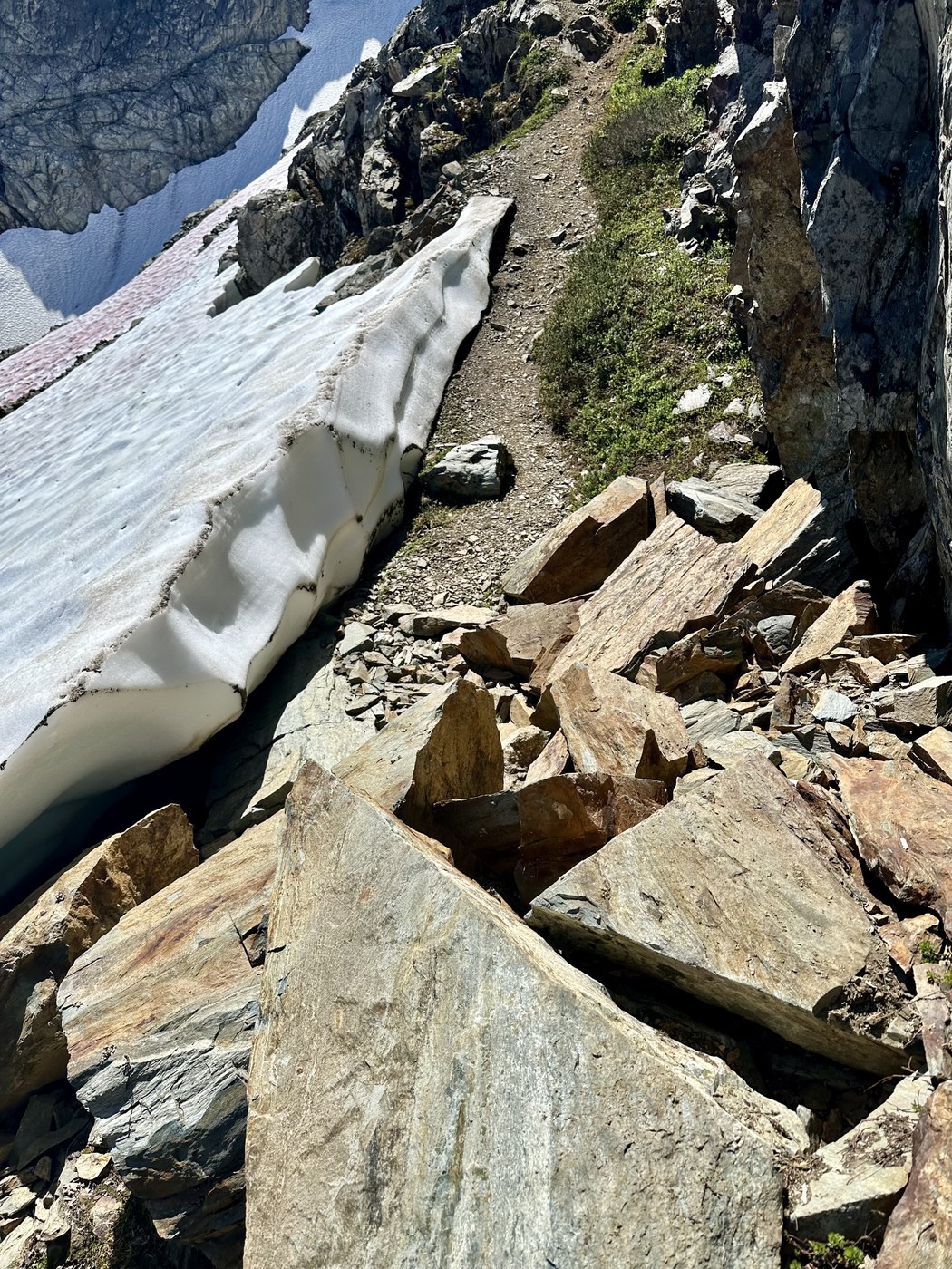
At this point, above 6,000 feet, there was still some snow along the route. We each probably took twenty steps total in the snow on the whole mountain. There were no areas that required traversing steep snow. Many if not all areas could have been avoided entirely if it had been easier to do so and I expect will be completely melted within days. The remaining snow was extremely soft and slippery in the afternoon sun on the way down. If you choose to cross it then, proceed accordingly.
The only particularly consequential area starts at the transition from the ridge path to the scrambling portion. The path down has loose rock underfoot and you immediately begin an easy scramble. The slope is moderate and there are solid handholds. Still, be deliberate as rotten rock is not uncommon. There is one area at the end of the first switchback of the scrambling route that presents a bit of exposure. It was not troubling in good conditions but the section could be problematic if it was wet.
The last 400 or so vertical feet up to the summit was straightforward. We topped out at 11:50. It was a near bluebird day and every direction held something awe inspiring. One of the finest vantage points in the North Cascades. The relief over the valley presented an almost surreal perspective of the mountain loop area.
The path was easier to see and follow from above and the descent went smoothly. Starting earlier would likely have been a good plan, as the afternoon sun in the exposed sections was intense. Come prepared, as we each went through 4+ liters of water in total. We made it back to the car at about 15:40.
Total distance was 10.54 miles and the elevation gain was 5105 feet. There was conflicting data between my watch and my Gaia recording, so I went with the lower totals. Distance and elevation gain could be somewhat more. Total time was precisely 8 hours. Other hikers on trail: 1. AT&T service on most of the trail once you gain a bit of elevation.


Comments