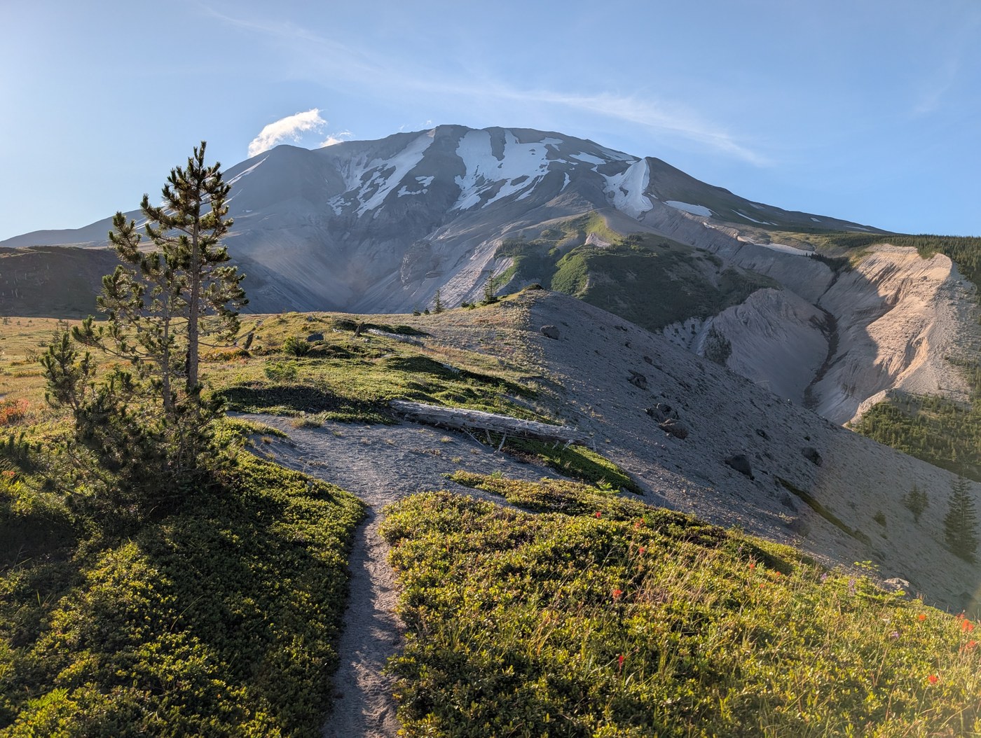
A group of three, we started from Climbers Bivouac on July 4 at 7 am, going clockwise. There were only minor snow patches, some bear grass super blooms, one ravine with ropes to descend and ascend, and no water sources until we reached the Toutle River around 1.30 pm. We got a camp site up on top of the ravine but lots of people camped right down by the river too. There are a couple ropes to make it easy to get down to the river from the south side, which we used to go get water. The next morning around 6.30 am we went up the rope on the north side. My friends took off their boots to cross the Toutle, but I was feeling lazy and just ran through fast and only got damp ankles. The rope is looking kind of frayed on its exterior but it worked. The rest of the ascent out of the Toutle area involves a narrow trail along a bare slope where it's a looong way down, so I did not look down and just kept walking! The blast zone was beautiful, with flowers and birdsong and views of Mt. Margaret backcountry and Spirit Lake. There were lots of streams but only the Loowit was deep enough that my friends again took off their boots and I, again, was lazy and just waded through in my boots (soaked them completely). The blast zone ends with Windy Pass. I did the Windy Pass in the opposite direction in 2021 and didn't like it then. I still don't like it now (not a fan of heights combined with walking on loose rock or sand) but it is doable for me. We camped for night two at Pumice Butte, arriving there around 2 pm. Lots of sun to dry my wet socks and boots! I've camped at Pumice Butte twice before, both times in July. Advice: when you arrive, if the stream is clear but running low, filter your water then! By 3 pm the stream can quickly double in volume but then be full of silt (says I who had to filter silty water in 2021 because I didn't do it immediately upon arrival). We left Pumice Butte on day 3 at 6 am. There are sure a lot of ravines after Pumice Butte... We were aware of the washed out section of the trail on the north side of the Muddy River from earlier trip reports. I and one of my friends elected to just slide down it on our butts, "sand-glissading," but my other friend went closer to the mountain where there is an area of boulders one can also use to cross. After that, it's some nice shady forest alternating with a lot of walking on rocks and boulders, and some more bear grass super blooms, and then (unfortunately) an uphill finish to get back to the junction of the trail down to Climbers Bivouac, where we arrived a little after 1 pm All in all, I loved this trip and was glad to get pushed a little out of my comfort zone with its ruggedness and distance.
 Washington Trails
Association
Trails for everyone, forever


Comments
SavvyExploring on Loowit Trail
Love the map! Entertaining and useful, the best kind!
Posted by:
SavvyExploring on Aug 26, 2025 07:59 PM