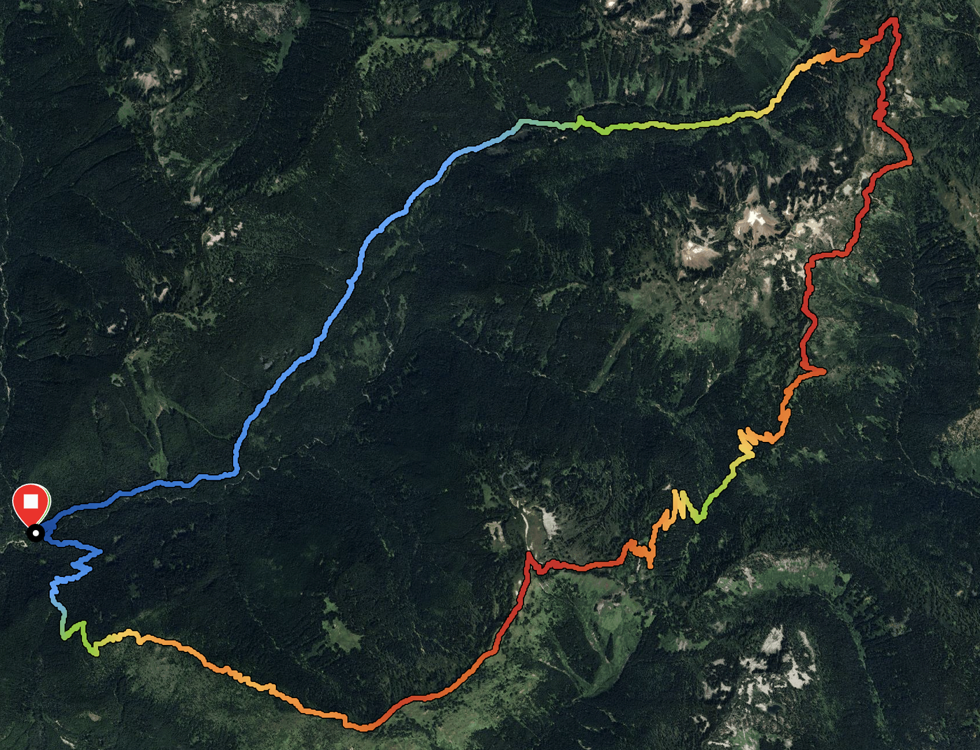
A lovely 25 mile loop up North Fork Skykomish to Dishpan Gap, south on the PCT to Lake Sally Ann, up Benchmark Mountain and down West Cady Ridge. I did a resupply/trail angeling for friends doing the Washington section of the PCT. Road in is typical condition, potholes make you want to drive carefully but doable in most cars (high clearance helps). Trailhead bathroom is one of the cleanest I've seen in a while. Two other cars in the parking lot at 7:30 am.
North Fork Skykomish River: Starts pretty gentle for six miles or so before kicking up to Dishpan gap at the end. Brushy and muddy in places, definitely glad to be wearing long pants and waterproofed boots. Pretty easy water crossings most of the way, one tricky one at 7 miles or so that I crossed a little downstream of the trail on a bigger log. Plenty of opportunities to refill water if needed. Blowdowns here and there, mostly easy except for a couple that required carefully vaulting. In general, it is a lovely forest walk with lots of frogs. Near mile 8, around 5000 feet, snow appears, but doesn't become troublesome until the last quarter mile where the trail is steepest. I wouldn't have put on spikes if I had had them, it just slowed me a little. Met friends at Dishpan Gap and had the burritos I had brought for lunch.
PCT from Dishpan Gap to West Cady Ridge Trail: Similar to the top sections of North Fork Trail. Mostly clear, not a whole lot of brush or mud, just sections of snow left and deadfalls. Snow was not too hard as it was never very steep. Some blowdowns are challenging to cross, but most are relatively easy. Dishpan Gap has some nice views both East and West, could see a little smoke from the Pomas fire. Lake Sally Ann is very pretty, still too cold to comfortably swim with snow and ice still covering spots. Was very nice to be able to walk with friends for 7 miles or so and break up the solitude of the other 18 miles. Great views to the East and South for the first four miles, so nice to be outside in the wilderness. Turned off at the West Cady Ridge Trail and transferred the rest of the contents I had brought them.
West Cady Ridge to Benchmark Mountain: Little bit more brushy (in the form of small trees) and snowy than the PCT. Steep in sections too, it's slightly more of a battle to get up to the top. Routefinding is a little challenging across the snow, but trails can be seen in most places. GPS is helpful, especially going up from West Cady Ridge to Benchmark Mountain, but not fully required. Regardless, the views are for sure worth it. Can see a lot of the cascade range, both Glacier and Rainier, and the entire basin behind Blanca Lake to the West. Coming down from the summit was beautiful, as the trail winds through alpine meadows and along the ridge. Many wildflowers could be found here, as evidenced below. Super nice day to be out, clouds came in at around this point and provided some great lighting to enjoy the views. Glad I came down this way, and it was much steeper than the North Fork Trail.
Garmin logged 25.5 miles and 6200 feet of elevation gain. Saw one other person apart from my friends all day, definitely a great place for some solitude and peace.


Comments
Phaunts on West Cady Ridge to Benchmark Mountain, Lake Sally Ann, Dishpan Gap, North Fork Skykomish River
Thanks for the thorough trip report! Curious about camping at Lake Sally Ann, was enough snow gone from the campsites?
Posted by:
Phaunts on Jul 03, 2025 08:18 PM
Peter Lie on West Cady Ridge to Benchmark Mountain, Lake Sally Ann, Dishpan Gap, North Fork Skykomish River
Not sure, did not check out where the campsites were. There was definitely still about a foot of snow on the PCT coming into and out of the lake, would not be surprised if the campsites were under a couple inches as well
Posted by:
Peter Lie on Jul 03, 2025 08:53 PM