
All those beautiful reports of Little Giant Pass popped up on WTA, luring me into a long drive to this remote area yet not explored by me.
Summary
Little: water in the river, potholes in the road, crowds.
Giant: views, number of blueberries, fall colors, elevation gain.
Pass: you shall not (next day after this hike).
Getting There & Trailhead
Drive from US-2 feels like forever. The further you go, the worse the road - but it’s never bad enough to trigger an inner dialogue about poor life choices (which I often have when I take my sedan on forest roads). Majority of the road is pretty neat, with a couple atrociously rocky spots that can still be safely crossed in any vehicle.
Trailhead is a small turnaround that fits five-six cars; the rest have to park along a narrow road. There were about 10-12 cars in/around TH today at noon. No amenities; the nearest outhouse is at campground half a mile away.
Hike
I didn’t have anything qualifying as water shoes, so I just forded the river barefoot. Current is not strong, and river bed is just an ideal balance between slick and sharp, so it was doable. Bring a towel - water is cold, and even dry rocks are not much warmer in the morning.
The trail starts innocent. Here and there, evidences of the recent blowdown cleanup are still fresh, making me wonder how anyone would cross all these obstacles before they were cleared. Then a tough climb comes, followed by equally steep descent to the creek. Unfortunately, due to how the space works, this descent will be your steep climb on the way back when it’s the least welcome.
After the creek crossing, which was easy, climb just gets atrocious. I routinely hike 1000 ft/mi, but this climb, apparently exceeding this number, continuing for two miles, complicated by overall difficult terrain, hit me real hard.
On the boulder, cairns are mostly sufficient to see where to go; if unsure - you will want to approach the top left corner of the outcrop to find the trail.
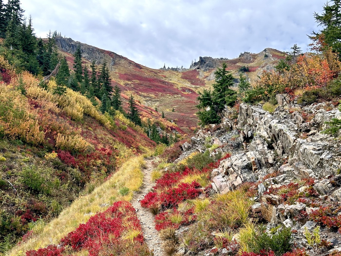
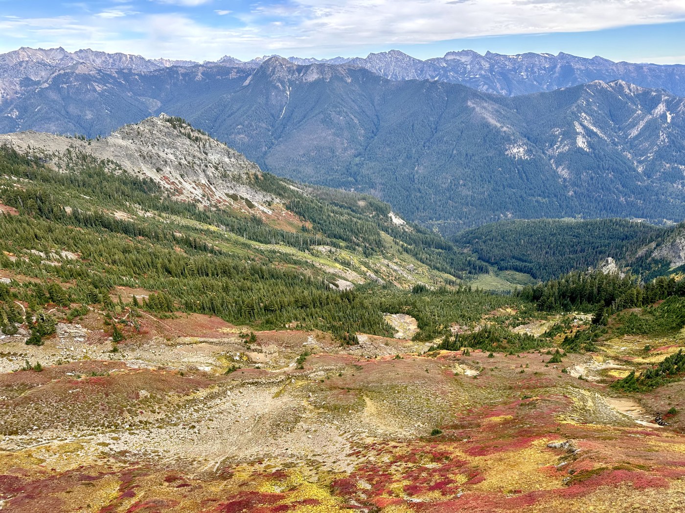
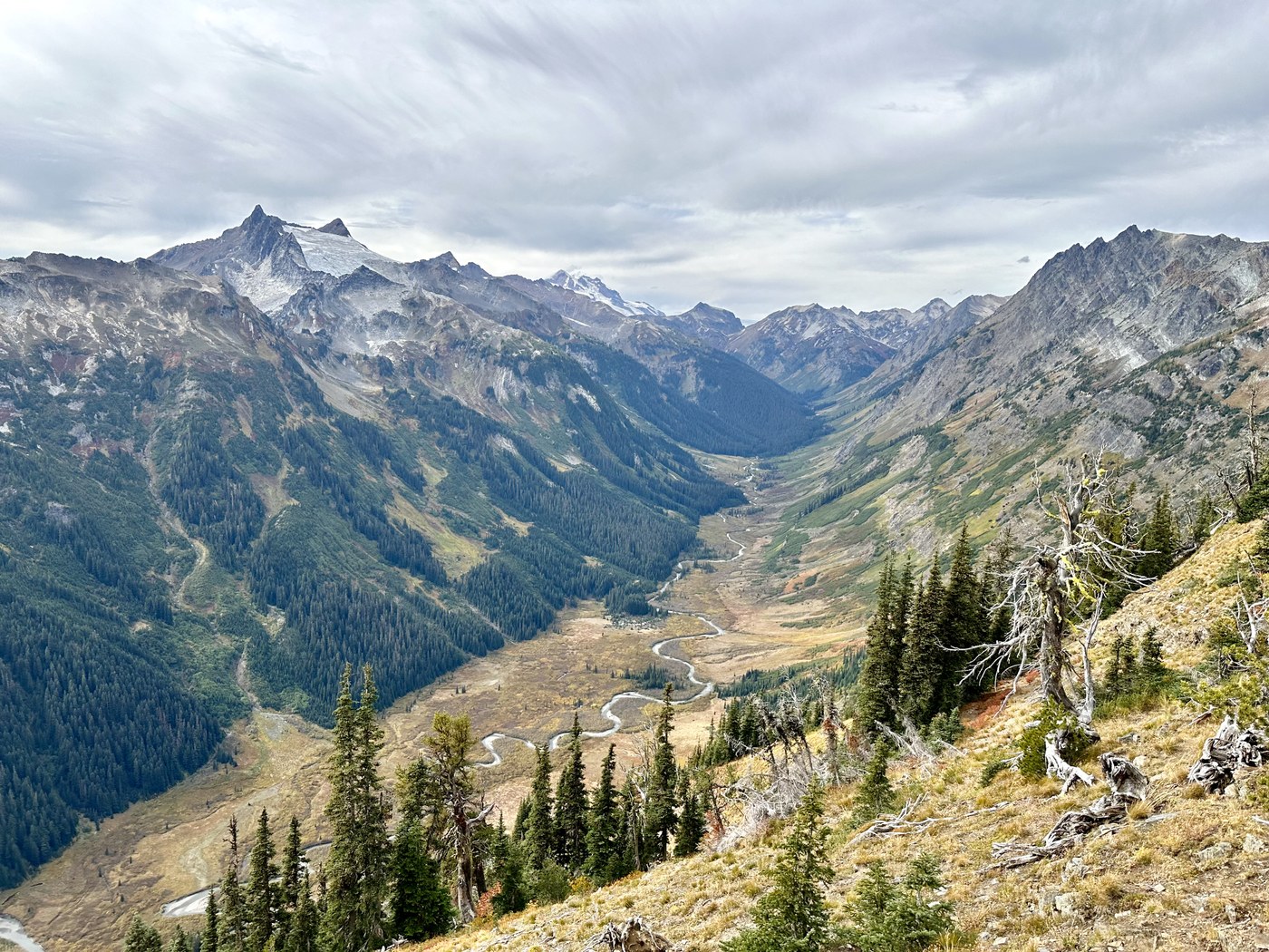
About 1.5 mi from the pass, views, fall colors, and blueberries kick in. Fall colors are just insane right now - super vibrant, covering entire slopes. Blueberries also went bonkers - never seen so many on my fall hikes. All these beautiful things somewhat lighten the burden, and sooner or later, with purple fingers, full stomach, and elevated mood, you arrive at the pass, where suddenly valley views open.
From the pass, I explored both social trails. The one to the left just disappears in thick trees - it’s good for the views of your climb but not so helpful with valley views. The one to the right is well-treaded and opens amazing views of the valley. Quite a few people ventured as far as the nearby peak, but I didn’t feel like it.
Coming back is uneventful, but the trail is so steep that sliding is a real risk in many places.
Timing & Crowds
3 hr to get to the top, including lots of huffing, puffing, and blueberry picking
1 hr at the pass
1.5 hr to get back
Met about 20 people, including a couple groups - very lightly trafficked trail

Comments