Planned for a 3-day backpacking trip to Necklace Valley with below plan:
First day: La Bohn Lakes + La Bohn Peak and camp near one of the lakes
Second day: Mount Hinman, Break camp, go up to Tanks Lakes and set-up camp near Tanks Lakes.
Third day: Otter Point and Hike out.
First day: Arrived at the parking lot around 9 AM and the lot was full as expected. The trail was a little busy but not too crowded for a labor day weekend.
First 5 miles was really nice with a rolling terrain and minimal elevation gain in the woods. After the log bridge, there's a short boulder section which marks the significant elevation gain all the way to Jade Lake
The meadow area between Jade Lake to Emerald Lake was full with sweet and juicy huckleberries. We probably ate a handful of them.
At the end of the valley, I encouraged our group to go up the gully route to the gap (instead of the waterfall route) which was a bad idea with overnight packs. There were only a couple patches of snow, so boulder hopping was pretty tricky and time consuming.
It took us 10 hours from the TH to La Bohn Lakes and we quickly abandoned the plan to go up to La Bohn Peak as it's approaching sunset.
Second day: Went up to Hinman at around 8 AM. Saw few climbers already on the route. Several cairns marked the route and there was an obvious climbers trail through the meadow.
I went up the west ridge through the rocks to avoid the snow while the rest of the group stayed below the ridgeline, which was easier.
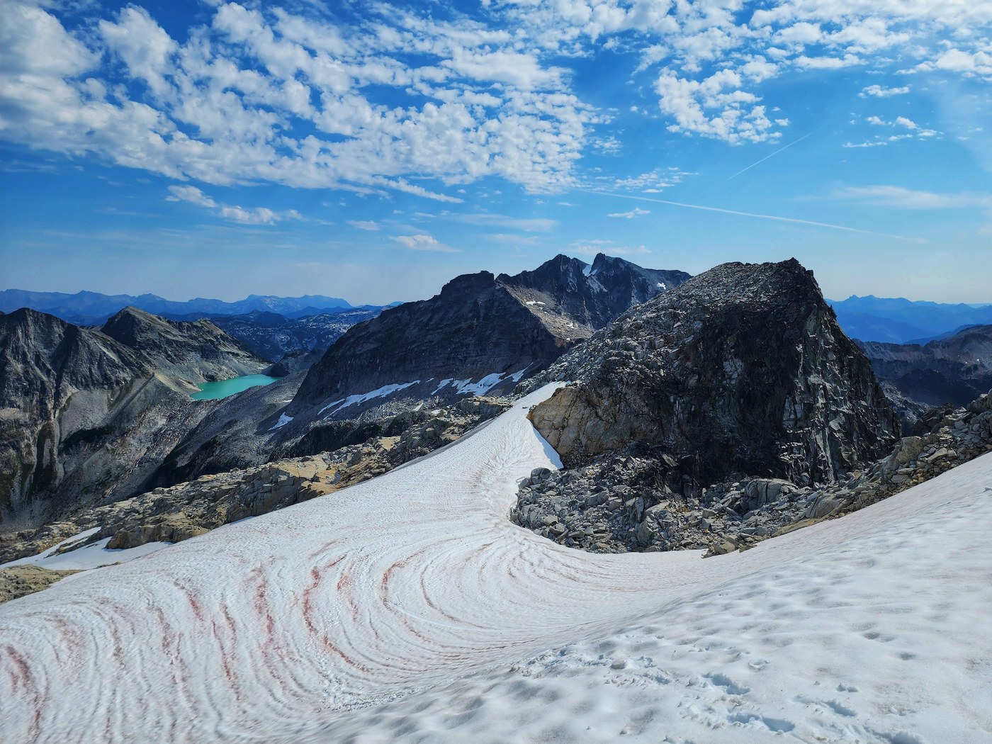
Used poles, helmet and spikes for the last traverse above the glacier to the summit. The glacier looked recessed and looked more like black ice (that we avoided). The snow was soft enough that spikes were fine for that day. Brought an ice axe but ended up not using it.
As described on many trip reports, it's unknown where the true summit is. We did go to the far end and the middle summit. The far end summit gave us the best view of Lake Rowena, Rebecca and (I think) Shovel Lake, as well a closer view of Daniel and Pea Soup Lake.
Third day: My left knee was done. The group didn't feel like going up to Tanks Lakes and even Otter Point. Left La Bohn Lakes at around 8 AM. We decided to hike out via the waterfall route back to the valley which was better than the gully route
Got rained on for a bit which made the trail more slippery and I descended super slow as the knee pain became more unbearable. Back to the TH at around 5 PM.
Stats: just less than 25 mi with a very relaxed and slow pace. I think 3 days 2 nights are still doable to bag all 3 peaks that we originally planned but we were just too slow and tired 🙂.


Comments