3 days, clockwise from Timberline, went through Paradise Park and down the Ramona Creek trail (not the old, high route across the upper branches of the Muddy Fork), camped near the lower Muddy Fork crossing and at Cloud Cap.
The Timberline Trail has been on my to-do list for years, but I've always put it off because I could 'do it anytime.' I had planned a circuit of the Loowit Trail with my daughter, but she hurt her knee a few weeks ago. Finding myself with a few days already set aside for hiking, I decided this was a good time to check this one off the list.
There are plenty of great guides to the Timberline, starting with this site, so I'll try to limit this mostly to current conditions.
Departed my car at the Timberline parking lot around 11:30 on Wednesday. We had a big thunderstorm in Eugene the night before, so I was worried about arriving and finding fires all over the mountains. Fortunately, no fires, no smoke. There is a layer of smoke developing in the distance to the east.
Trail conditions were good throughout. Minimal blowdown--probably not more than 15 trees across the trail over the entire 40 miles, and none were a challenge to get around. The north side has many diminishing snow patches, and the east side has significant snow fields especially around the high point. These got tiresome but none were difficult. Poles help a lot. Plenty of flies (but not swarms) from Zigzag to Cloud Cap. Repellent kept them at bay. Did not need any on the third day. Noticed very few mosquitoes. The trail never felt crowded. Some day-hikers from Timberline to Zigzag, but they mostly disappeared after that. Then saw very few people until mid-day on Friday, when the counter-clockwise backpackers starting their weekend trips started to pass through.
Here is what I remember of the water crossings. (Those not mentioned were easy and obvious.)
Zigzag: early afternoon, narrow log downstream or rock-hop options upstream, crossed with dry feet.
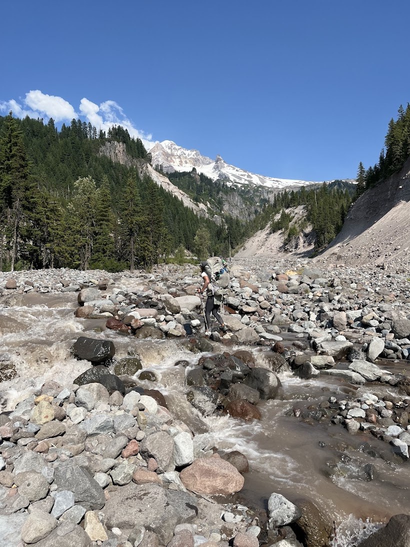
Sandy: mid-afternoon, no dry option, had to ford after scouting for awhile both up and down. Found a spot well upstream with moderate current and good footing, came up just past my knees. A couple with a dog used a different spot nearby (had to carry the dog across). Trail exits the canyon on the north side well downstream of where it drops in on the south.
Glisan, Ladd and Coe: early to mid-afternoon. These have run together in my head. All looked daunting at first, but I crossed each with mostly dry feet after a little scouting. On one, this involved throwing my pack ahead and making a pretty big jump. Of course, as soon as I was across, I looked back and up and could see a line of cairns well upstream that probably marked an easier crossing.
Eliot: about 4:30. Was able to cross by scrambling to a large boulder mid-stream, then jumping down and across to a reasonably flat gravel bar, then rock-hopping the rest of the way. There was no point that looked safe to ford. A group of four coming the other direction scouted for an hour before concluding it was impassable from that side and retreating to Cloud Cap for the night (jumping across and up to the rock I used wasn't possible). There are no spots to camp on the east side. There is one spot just big enough for a small tent on the west side just before the final drop into the canyon bottom.
Newton: mid-morning, no dry option, had to ford. Found a spot pretty much in line with the trail, water was pushy but didn't reach my knees. I crossed immediately upstream of the largest rock in the picture.
Coe: still covered by a large, solid snow bridge/ice sheet.
White: around 4:00 pm, still able to cross with dry feet after minimal scouting. Easy to step across using the three large rocks in the lower right of the picture.
A couple of other notes. Cloud Cap now has at least six official sites and a working water spigot. Three sites were occupied by hikers on Thursday night--myself, another solo, and the group waiting to try the Eliot in the morning. No car campers. The forest service website says 'no potable water' at Cloud Cap but there are no caution signs at the campground, so I guess the water at the spigot is drinking water safe? Maybe the website statement is just leftover from when they turn off the water for winter.
I saw several dogs. Unless you and your dog are very experienced with difficult water crossings, I would leave the dog at home. The couple who I saw carry their dog across the Sandy planned to complete the whole loop. I find it hard to imagine how they (and others I saw) were going to safely cross the north side streams, especially the Eliot.
Happy hiking!


Comments