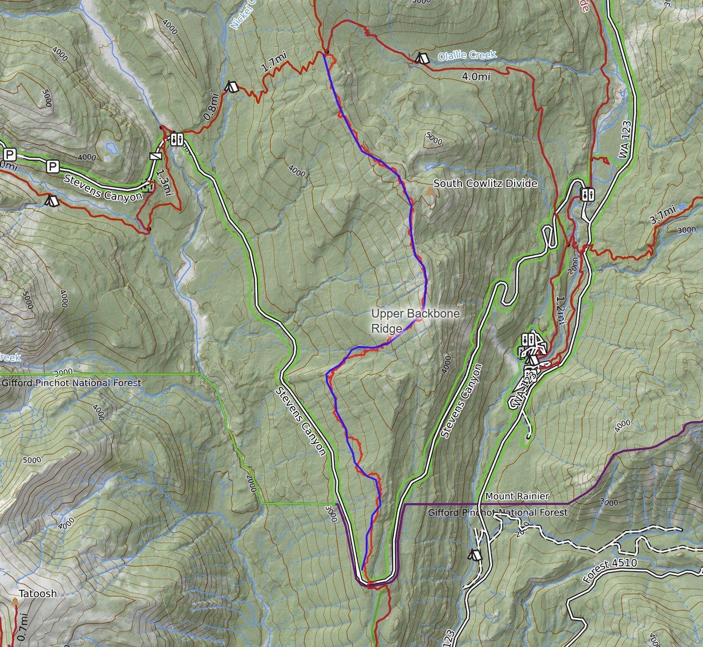
This is a report on the upper part of the Backbone Ridge trail, from where it crosses Stevens Canyon Road up to the Wonderland Trail.
The trail is... sorta still there in places. Old. Overgrown. MUCH fainter than the lower section from Stevens Canyon Road down to the Cowlitz River. I made heavy use of multiple navigational techniques, which frequently contradicted each other:
- GPS.
- Historical research to find an old map that showed the trail.
- Experience recognizing faint remnants of ancient trails.
- Repeated use of the "aiming off" technique to rediscover the trail after I lost it.
- Common sense.
I stashed my bike at Box Canyon, so I only had to hike the abandoned trail in one direction. After reaching the Wonderland intersection, I was able to complete my hike more easily by hiking out down the Wonderland and then cycling back to my car.
Navigational notes: start north up the top of the ridge. Trust your navigation when the map says to drop down to your left, then follow a contour NNW. Turn NE and traverse across a slope - you'll want to make sure you're on the actual trail here as this slope is STEEP, and although the trail is narrow and somewhat sketchy, it's much better than trying to offroad this area. Cross a stream, head due E a bit, then NE and climb steeply as forest gives way to open patches with views. Upon reaching the top of the ridge, follow it N and then NW until you intersect the Wonderland. Navigation remains challenging even on top of the ridge as it's mostly treed in and littered with knolls, dips and divots that attempt to confuse.
Downsides to coming here: the terrain is exhausting. So much sidehilling! Sap all over everything from fighting my way through dense pine thickets. Scratched up legs from all the shrubbery battles. I carried 4 liters of water, filtered one more near the end, and that was barely enough. The area is hot and mostly dry, so be sure to carry plenty.
Reasons to hike here: deep solitude, of the kind that makes regular solitude feel crowded. Knowing you visited a place that has been walked by more Taidnapam than European settlers, and more frequently hundreds of years ago than within the last 50.
This trail won't be for everyone, but exploring it felt good for me today.


Comments