Obstruction Point Deer Park Trail
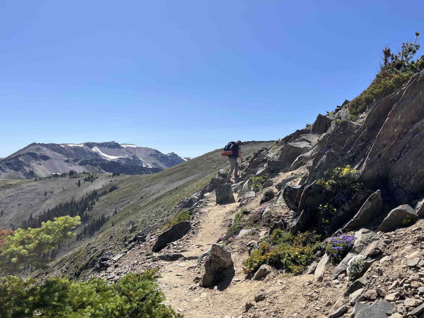
Overview: Starting from Deer Park, this descends through a forest with peekaboo views. The trees look like they suffered disease or insects or something terrible. After the descent, the ascent begins, and you climb to open ridge line with fantastic views - optionally go up to Maiden Peak here. I strongly recommend trekking poles.
Snow/Mud: nothing notable
Wayfinding: none
Water/Ford: none
Blowdowns: none
Bugs: not bad except for right around Roaring Winds (which does not appear to have accessible water for campers)
Elk Mountain cutoff to Badger Valley
Overview: this trail is down (left) where the Obstruction Point trail splits before you get to the Badger Valley trail intersection. It is signed towards Badger Valley and Grand Valley. A well marked trail down to the valley with one stream crossing, many marmot holes in the trail before you join up to Badger Valley trail. We saw several marmots out of their burrows (early evening) near the Badger Valley trail.
Snow/Mud: none
Wayfinding: none
Water/Ford: nothing notable
Blowdowns: nothing notable
Bugs: not bad
Badger Valley intersection to Grand Lake
Overview: This is a beautiful valley with open meadows and forested sections. Little elevation gain or loss. The mosquitos made it challenging to stay still and appreciate the views of the mountains above and the large valley. Badger Creek is most enjoyable at the crossing where there is a nice log bridge and a couple of dispersed tent sites. We saw a few American Dippers in the creek. Wildflowers galore in the meadows.
Snow/Mud: some muddy sections
Wayfinding: a little overgrown in Badger Valley before Badger Creek but human trail is followable.
Water/Ford: nothing notable
Blowdowns: nothing notable
Bugs: terrible. The mosquitos were out in force.
Grand Pass trail from Grand Lake to Cameron Creek
Overview: This is a lovely stretch of trail with beautiful views and alpine lakes. Moose Lake and Gladys Lake are both gems - with stunning color. Gladys Lake tricks the hiker a bit because the part that you can see from the trail is shallow, but the back side is deep. Hiking by, you would never guess. We saw a few snowshoe hares and cascades frogs. Dauntless deer around Gladys Lake; they are nice to watch running through the shallow lake, but disturbing to follow you. From the trail split just past, Grand Lake, you climb up a well made stone trail until the stones deliver you to snow crossings and some scree to the top. Excellent views from Grand Pass and a beautiful shallow tarn reflecting snow. The section from Gladys Lake to Grand Pass is full of nice views and places to rest. The descent from Grand Pass is scree to forest with some loose footing, steep in places.
Snow/Mud: Short snow crossings within 1/4 mile of Grand Pass. Not slushy in mid-July.
Wayfinding: none
Water/Ford: You cross Grand Creek and it is a bit of a choose your own adventure with footprints going all over the snow on both sides. Easily crossed in boots.
Blowdowns: nothing notable
Bugs: not bad once past Gladys Lake
Cameron Creek trail (Lower)
Overview: The first 3 or so miles of this trail from the Grand Pass trail intersection are meadow bushwhacking interspersed with short forest sections. The forest parts are generally shaded and well marked; the meadows are heavily overgrown and require constant attention to not step in holes. Recommend pants and not shorts. Beautiful wildflowers and so many future berries. Around 6 miles, there were a few ripe salmonberries and golden raspberries - some blueberries already filling out in mid-July, but most berries we saw along the trail were still flowering.
Snow/Mud: some short muddy bits, nothing that will eat your boots.
Wayfinding: Meadow bushwhacking, but you can generally stay on the ‘trail’. One creek crossing appears to have moved, but there is tape/flags to mark your crossing.
Water/Ford: two creek crossings about 4 and 5 miles in; the first has a very nice large downed tree as a bridge. The second looks like it washed down the creek, unmoored from its original location, and it is at an angle - still easily crossable and flagged - even if it looks rough.
Blowdowns: in places, there are many washout or blown down tress requiring climbing over or navigating rockfall. However, all are passable with minimal effort. The sketchiest part is right around where the Lower Cameron campsite is identified on the map. No tent sites or water access to be seen, but a mess of trees to scramble through.
Bugs: not bad
Three Forks trail to Deer Park
Overview: This is a relentless uphill slog through a silent forest (no birds to speak of), so your breath and steps are the only accompaniment. At just over 4 miles, it will feel much longer because it is monotonous. However, there are peekaboo views at the top, and plenty of places to choose to take a break. For most of the climb, you are walking in a sea of salal - which may mean bears to observe in the fall or a few berries if you like bitter things. Make sure you fill up on water at Three Forks because there is only one stream - running mighty low in mid-July about 2 miles up.
Snow/Mud: none
Wayfinding: none
Water/Ford: none.
Blowdowns: nothing notable
Bugs: not bad


Comments
blendergasket on Three Forks, Badger Valley, Cameron Creek, Grand Pass, Deer Park to Maiden Peak
Thanks for the excellent writeup!
Posted by:
blendergasket on Jul 14, 2024 01:38 PM