


Short version: trail bad, creek lovely, some flowers, berries are blooming, bugs kinda bad.
My plan was to hike to the McAllister Trail, then over to the Sand Ridge Trail, and then back to the old TH via the Little Buck Trail. Spoiler alert: the hike ended up being an out-and-back.
As others have noted, one can drive past the berm but there's really no reason to as doing so only saves you a short bit of walking. The road walk to the old trailhead is pleasant enough. The wildflowers are still blooming, and in places the creek gurgles alongside your path. The trail is in good shape in some places and dreadful condition in others. The blowdowns are numerous, and someone took the time to clear the limbs on several of them. For the most part, the blowdowns can be climbed over or under; there are a few that are likely a barrier to stock animals.
Just over a mile past the old trailhead, the trail takes a sharp turn to the east. This is the site of a large washout. Right now, there's orange flagging tape attached to trees signaling where the trail is. It's very helpful -- thank you to whoever did that!
The trail down to & up away from the crossing of Indian Creek is sketchy in spots. There're sections that started to wash away, and in places the trail is covered with loose shale. The areas of the washouts were solid when I trod them, but test your footing carefully.
Indian Creek was flowing strong, but there are numerous options for fording the creek. (A nimbler hiker may have been able to rock-hop.) There's a lovely campsite on the other side of the creek with room for at least three tents and several hammocks. I didn't notice any dead trees in the immediate area, either.
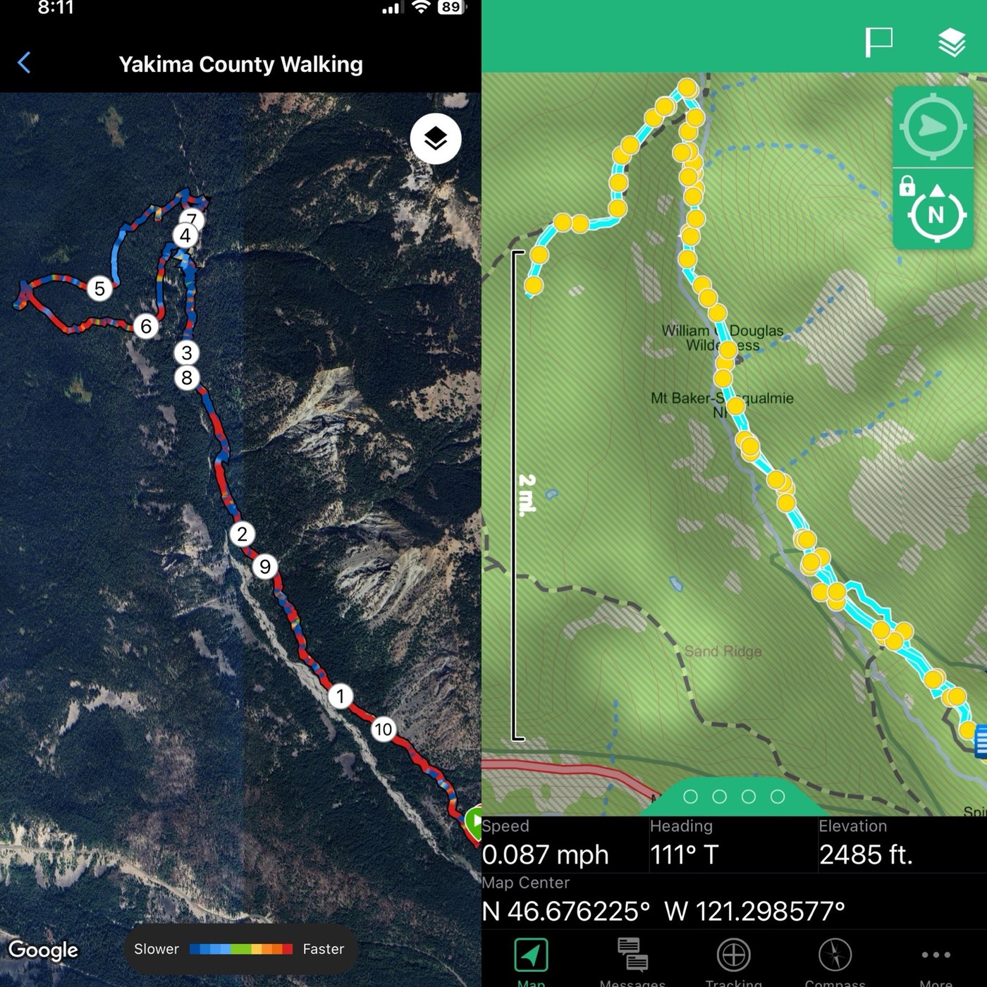
I was carrying a Garmin InReach, using a Garmin Forerunner, and using the AllTrails app & the USGS 7.5 map (through Avenza) on my phone. As I approached the junction with the McAllister Trail, AllTrails insisted I'd taken a wrong turn. But I was trodding the only trail, so I kept walking. I was relieved to find the junction, but the GPS track in this area was strange. That's what led me to turn around at some point instead of doing the loop.
The McAllister Trail is in roughly the same shape as the Indian Creek Trail. There's plenty of water available in the mile & a half of it I walked. Once again, AllTrails insisted I was off the trail. The 7.5 map also showed I was well off the trail but again, I was walking on the only trail I could see. I came to a spot at which the trail became a marsh and it was enveloped with shrubbery. I was at about the half-way point of the loop, so I decided to turn around. I didn't want to bushwack my way through a bog in hopes of finding my way to the Sand Ridge Trail.
The bugs were not bad in some places and very annoying in others. Strawberries, salmonberries, and thimbleberries are blooming, and there are wee blueberries forming on the shrubs. Soon enough, happy bears and the occasional intrepid hiker will dine. Perhaps later in the season when the bogs are not so fierce I will come back and try to find that trail.
The track on my Garmin Forerunner showed that I'd taken a circuitous route back to the junction with the Indian Creek Trail, but I retraced my route. The track on the Garmin InReach was correct. I know that the InReach uses the iridium satellite network, that GPS devices we wear on our wrists are not always accurate, and that phone-based GPS data is often weak. That was really evident on this hike. It was a good reminder to trust my gut if the navigation data on my phone doesn't seem right.
Comments
Just hiked that today, the old trail with the "not maintained" sign at the start; only had some printed topo maps; not sure how far I made it; went past the one small washout then to the large washout. My topo maps show a footbridge and my goal was the waterfall. Did you see those on your route?
thx
se
Posted by:
jca2521 on Aug 25, 2024 08:23 PM
sorry about the triple post; sticky keyboard and lagging internet. :/
Posted by:
jca2521 on Aug 25, 2024 08:27 PM
@jca2521 - I did see the waterfall; I don’t recall a footbridge. It’s difficult to get a really good view of the falls from the trail — the best view I got was near the junction with the McAllister Trail. I suppose one could hike up stream where the trail crosses the creek below the falls, but that would depend on the conditions in the creek.
Posted by:
HillSlug on Aug 27, 2024 10:26 AM