
My brother and I hiked the trail on the way to Glacier Peak. The approach has some blowdowns to get over or around and has some fast running streams. The drive in from Darrington and on FS-49 is very muddy and potholed. When we arrived at the trailhead a couple guys were about to head in to spend the night at the Mackinaw shelter for an overnight and we saw one casual day hiker near the trailhead on the way out. A couple FS employees were at the trailhead when we started and asked about why there seemed to be fewer people coming to climb GP this year than in previous years.
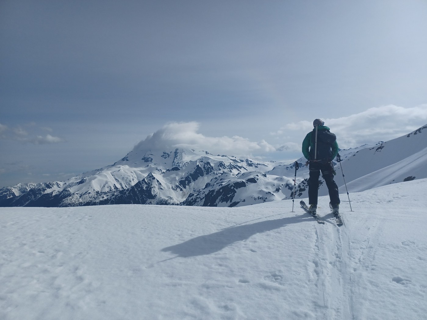
The rest of this trip report pertains to the switchbacks above the Mackinaw shelter and the alpine higher up. Consistent snow started around 4300' near the end of the switchbacks. We turned around just south of the White Mountain summit @~6900' when it became clear we were too far behind to summit. Our 1 PM start was too late on Tuesday and we were only able to camp at 5000' after a navigation delay after we hit consistent snow. We turned back around 11 AM Wednesday. The sun was hitting the slopes south of the ridge west of White Mountain hard then and there were many wet loose avalanches, natural and that we triggered.
The rest of this trip report pertains to the switchbacks above the Mackinaw shelter and the alpine higher up. Consistent snow started around 4300' near the end of the switchbacks. We turned around just south of the White Mountain summit @~6900' when it became clear we were too far behind to summit. Our 1 PM start was too late on Tuesday and we were only able to camp at 5000' after a navigation delay after we hit consistent snow. We turned back around 11 AM Wednesday. The sun was hitting the slopes south of the ridge west of White Mountain hard then and there were many wet loose avalanches, natural and that we triggered.
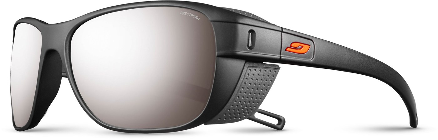
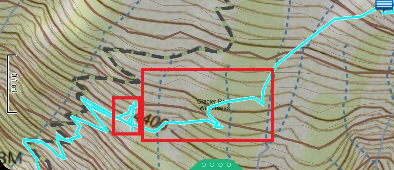
I lost my Julbo glacier glasses, probably between 4350 and 4600 in case anyone finds them. The glasses are black with an orange logo and probably with a neck strap only connected to one side (the hook mechanism on the neck strap falls out of the glasses way too easily). The map photo shows the area of my track where they probably fell off. I think they fell off shortly after consistent snow started and past the first major stream/small waterfall either in the small rectangle bushwacking above and just east of the stream looking for the trail (the route actually continues contouring east there) or between where we transitioned to skis 100-200 feet east of the small rectangle and where we exited the trees where I noticed they were missing. The trail is incorrectly drawn in this USGS Quad Sheet from my InReach EarthMate app. It should be lower, which the last map from CalTopo shows.
Comments