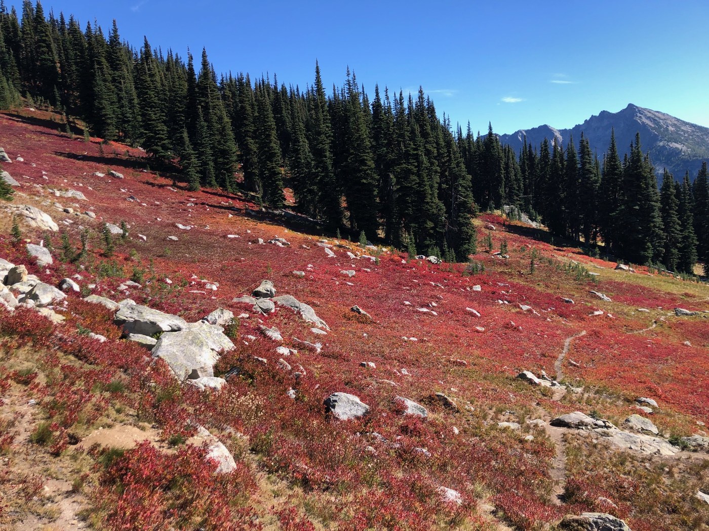
I started at the Bridge Creek parking area, which is right off of Route 20. You have to cross the roadway and continue on the PCT South for a brief stretch. The previous trip report from 6 days ago is very accurate. I hiked this trail on a gorgeous fall day in the Cascades. There is good signage at the intersections. The last sign, which points you to the left-turning Stiletto Peak trail, is low and not immediately visible since it is attached to the away-facing side of the pole, if you are coming from the Bridge Creek parking area. Up to this junction you actually lose about 500 feet in elevation. Once you turn onto the Stiletto Peak trail, it is indeed a challenging climb, via countless switchbacks, about 3300 feet in elevation change up to the remains of an abandoned fire lookout at over 7200 feet. It is also well worth it. Once you get to the meadow and to views, it will leave you amazed. I did not see a single other person on the entire hike, which took me about 8 hours altogether. To pass the time on the way back down, I counted the downed trees impeding progress along this trail. I had to step over, climb over, hike around, or crawl under 82 trees on the way down, for a total of 164 trees for the day! The short PCT section was the only part of the hike without trees stopping you in your tracks. I never found the trail at the very top to be hard to find, as some guidebooks state. Once you reach the meadows, there are cairns to help you along. I am very happy I attempted this hike, in spite of the hard work required.
Trip Report
Stiletto Peak — Thursday, Sep. 16, 2021
 North Cascades > North Cascades Highway - Hwy 20
Type of Hike
Day hikeTrail Conditions
Obstacles on trail:Trees down across trail,
Overgrown in places.
Road
Road suitable for all vehiclesBugs
No bugsSnow
Snow free
Comments
amazana on Stiletto Peak
Dolomighty i like your report and your name! 164 trees down i am out! Thx!!
Posted by:
amazana on Oct 15, 2021 08:41 PM