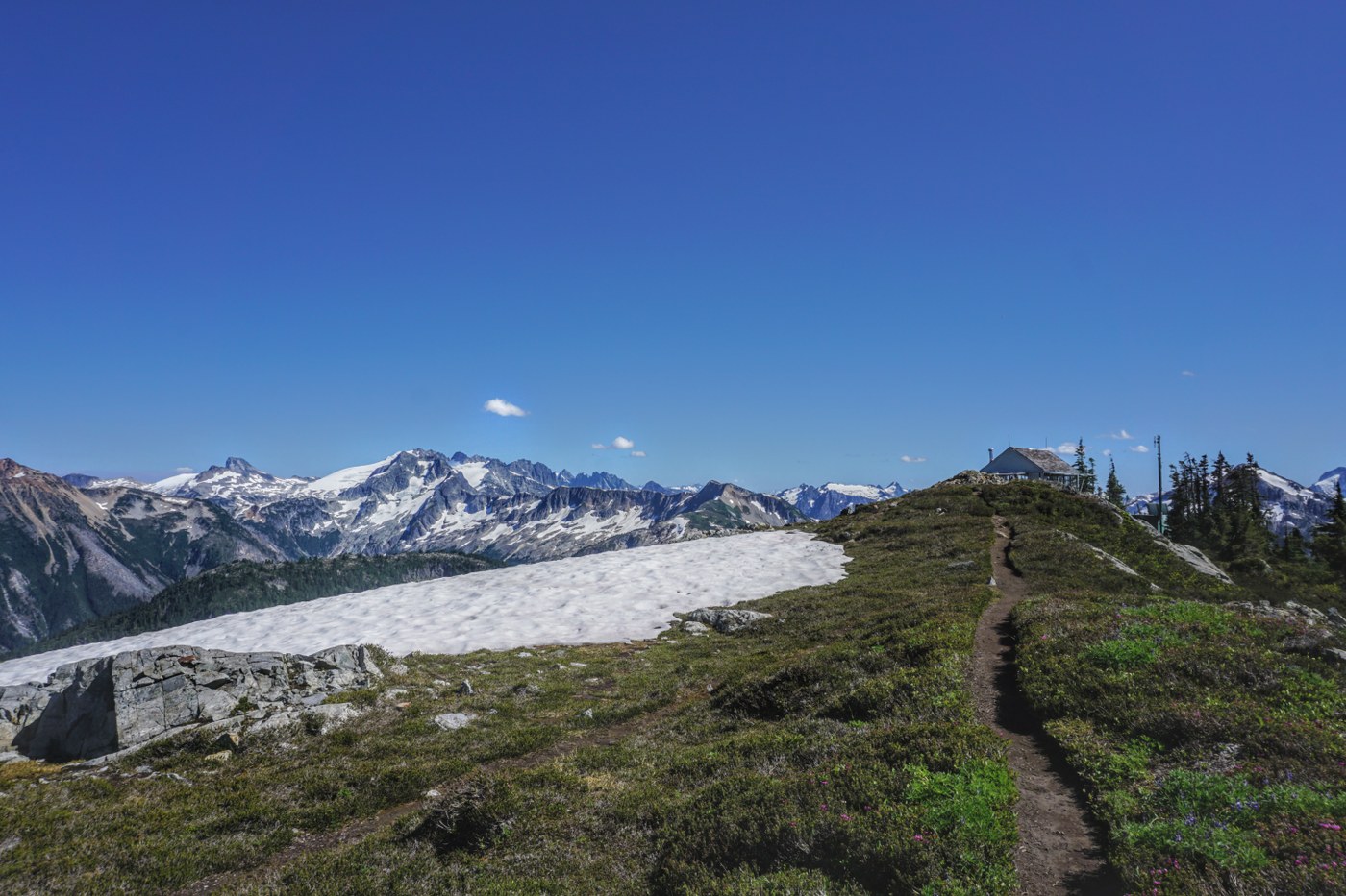
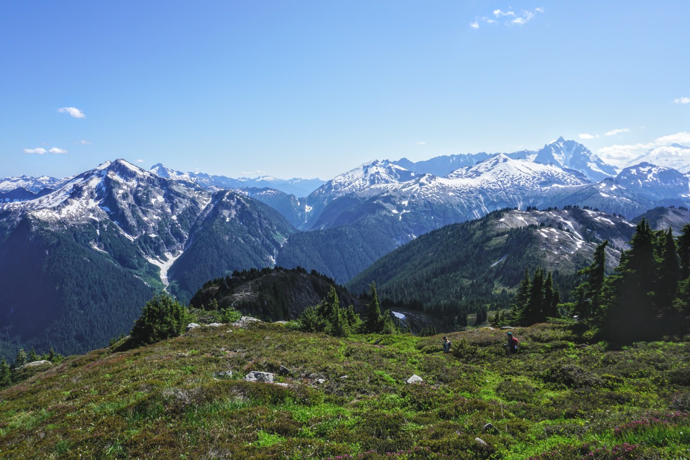
Did this as a loop from Hannegan Peak to Copper ridge lookout and then down to boundary camp and then back to hannegan trailhead. This TR has info if someone wants to who wants to do this as a loop from hannegan peak rather than dropping down to Chilliwack river. For the ridge walk above the copper ridge trail bushwhacking, climbing down water stream, vegetable belaying, route finding through thick forest are must have skills else I will recommend just drop down from pass and stay on regular trail. Ice axe not needed as you can go around that steep snow slope with slightly longer travel. Bear spray would also be nice to have as you will not see anyone on that ridge above copper ridge trail. See caltopo link for blue section for ridge walk.
Bugs were terrible the whole day and did not let you rest even for a moment. I have way too many bites through the clothes today.
TH to Hannegan Peak:
Trail in good shape. Water source at hannegan camp not hannegan pass. Wildflowers galore and awesome views in all direction specially south and east. Just when you leave parking lot you are welcomed by huge valley with waterfalls and this is a long walk to pass with almost very low gain. From Pass to peak it is a steep gain but views kept on getting better.
Hannegan Peak to Copper ridge trail
There is a sheer drop off on east face of Hannegan peak and the Chilliwack river trail is 2000 feet below the peak so for this ridge walk I would highly recommend staying on the west side of the ridge while doing the ridge walk.
Getting down from peak to the north flank is a challenge in itself. There is a one section which is steep class 3 scramble with fall of 100ft or even more if you cannot catch on any rocks as next to the rock face is just loose sand. This downclimb can be easily avoided by going north-west flank towards granite peak and dropping down to scree field below that then traverse west from there. This adds mileage to your plans. Once you hit the ridge you can clearly see the booth path there going north which I followed as much I could. When it disappeared you had to look around to find it again but then it starts entering thick forest (where the east cliff of hannegan ends). The actual trail is still 500 ft or more below you.
Merging back to copper ridge trail is going to be a challenge. The satellitle images show forest which is old so there are much more trees and vegetation there than I had planned for so route finding took a long time there. You can see in satellite image there are two huge rock faces after copper ridge trail has climbed switchbacks you can see trail may be 100 feet below you there but I couldnt find a safe downclimbing spot there. I kept on going north but then started bushwhacking and trying to follow a stream bed from satellite image. The stream was dry with this was steep section. Had to do lot of vegetable belaying here to get down to real trail.
Once back on copper ridge trail I took a breath of relief. I am glad I didnt rely on the bigger stream north of it to get down. This stream which starts from same point as south fork Silesia creek must be avoided to climb down as it is very steep and slipper by just looking at it and it might be impossible to downclimb it without rope or partner. Also I would not recommend any of this with a heavy pack. I had a running vest which made getting through those bushes and trees easier.
Copper ridge trail to lookout:
Trail in good condition overall. There are section of snowfields but they are easy to cross as snow is slushy and they are mostly flat. Met few people who were going to camp at Egg lake and had finishing rods with them. Didn't know egg lake had fish. Views from Silesia campground are great and keeps on getting better.
The last section to lookout is steep and gains almost 1000 feet in a mile. There is some weak melting snow water at the bottom which will dry in few days. From the point I merged till the lowest point below lookout it is almost at same elevation but you gain/drop almost 800 feet or even more going up and down on the ridge. At lookout views are awesome in each direction Mt Baker becomes visible again. Challenger and other peaks nearby still has a lot of snow. The real showstopper is Ruth from this angle along with the Sukshan ridge looks like a huuuge crater.
The hannegan ridge to copper ridge also had too much up and down so you do not save much/gain elevation gain while doing the traverse. Lookout had ranger stationed for this weekend. After exploring the lookout area for 20 minutes and talking to other trail runners who were running the whole copper loop today I headed back. There was 10 miles to go and around 2000ft of gain and it was already 4pm.
Lookout to Boundary camp
The view coming down the copper mountain is great as the trail meanders through the ridge. At lookout you can see the pass and hannegan peak and it is a long way to go from here. Did not meet a single person from here till the intersection of Chilliwack river trail. The trail is in this section is fairly good except few narrow section with steep angle. since I was running low on time couldnt go down to the egg lake or enjoy views as much I would have liked to. Once the trail leaves ridge it goes drops more than 1000 feet and I thought I had missed the junction but the junction is hard to miss. There are water sources just beyond the camp. Marmots were singing in the valley and so I had my snack there around 6:30 and it was cooler there so bugs were not an issue. After resting for a while headed up to pass.
Boundary camp to TH:
There was still more than 5 miles to go. Bunch of switchbacks to go up to Hannegan pass. Also still lot of snowmelt coming down. You can see caves in the avalanche chutes. you can also see why the trail is so low and not bove the hannegan pass due to the east face of Hannegan peak. Trail is rocky for a while but then becomes softer. Saw a rockfall/rockslide on other side of the trail towards Ruth Arm. The wildflowers were maximum in this section that I has seen the whole day. Saw bunch of backpackers at hannegan pass didnt have time to chat with them from there on just ran the rest of the section in 80 minutes to car finishing around 9pm. Didnt need to use headlamp but it was getting dark in forest so I had it with me just in case.
A day full of type 2 fun. 12 hours car to car. 22 miles 7400ft gain/loss.
360 degree views from lookout in additional links. The 360 degree view from Hannegan peak will explain why it was hard to get to boothpath.
Caltopo link : https://caltopo.com/m/0VG4


Comments
gemhel19 on Copper Ridge Loop, Copper Ridge
https://i.redd.it/oault1mtcmf71.jpg
Please share any info you have that may help fire investigators. A person of interest accessed Hannegan Pass Trailhead on bike on or around July 26th. White male, 30-35yrs old, 5'7"-5'9", short dark hair and stubby beard. Email tips to nps_isb@nps.gov
Posted by:
msgemmer on Aug 05, 2021 07:37 PM