

Went out to climb Glacier Peak this past week and, since we live in Leavenworth, decided to go for an alternate approach to save us several hours of drive time. We ended up hiking in on Cady Ridge Trail, taking the PCT out to White Pass and Glacier Peak, and then descending via the Little Wenatchee River Trail. The last two miles of the road into the TH are rough, we made it with a low clearance vehicle but not without bottoming out a couple times. Not ideal.
Day 1: Little Wenatchee Trailhead to Dishpan Gap via Cady Ridge Trail
Got a late jump on the day, hitting the trail at 7pm to avoid the heat. We hiked in a few hours, including about an hour in the dark, to set up camp at Dishpan Gap where there was a small, stagnant tarn. This was the first water we had seen in the ~8 miles since we started. Some steep sections on the climb up to Cady Ridge, but trail is generally in good condition.
Day 1 totals: 9 miles, 3.5 hours, ~3500' elevation
Day 2: Dishpan Camp to Glacier Peak Base Camp via the PCT
The mosquitoes were awful when we woke up, forcing us to get moving quickly that morning. We cruised out on the high meadows of the PCT to White Pass. The trail here is in great shape and offers fantastic views. Bugs made sure our breaks were short along this section.
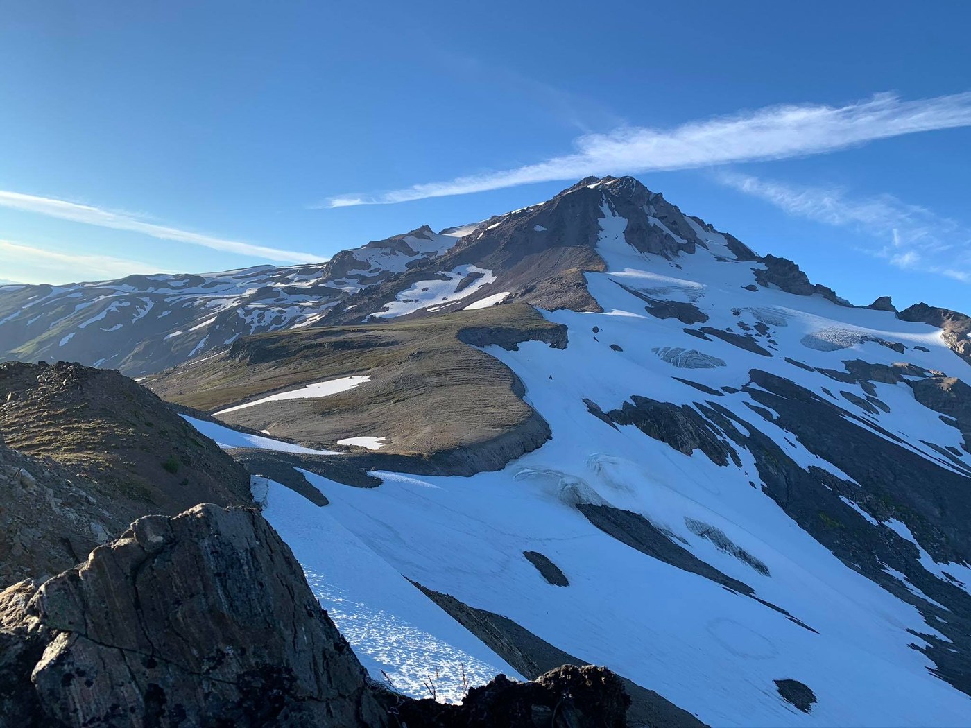
After arriving at White Pass, we turned onto Foam Creek Trail towards base camp. The trail is initially well-maintained as it traverses the hillside northeast of White Pass. A climb down, up and over a second ridge takes you into a rocky glacial basin. The trail here gets considerably rougher and more difficult to follow. A slow slog through this basin clambering over rocks, hopping streams and skirting across snowfields gets you to base camp at ~7300 between the White Chuck and Suiattle Glaciers. There isn't any glacier travel before base camp. No views of glacier peak from camp but many flat sites complete with rock bivys to block the wind, which was prevalent. No bugs at all up here. We crawled into the sleeping bags early to get ready for an early morning summit bid.
Day 2 totals: 11 miles, 6 hours, ~4000' elevation
Day 3: Base Camp to Summit, back to car via PCT/Little Wenatchee River
We set out for the summit at 4am. The trail is well defined and easy to follow out of base camp, going up and over a ridge and then switchbacking down a snowfield on the backside. The route then goes up the moraine near the edge of the Suiattle glacier. Eventually it becomes easier to move onto the glacier rather than clambering around on the moraine, so we threw the crampons on and followed the bootpack on the edge of the glacier. We decided to rope up to traverse over to the Cool Glacier, but didn't encounter any crevasses or funkiness on the well-defined bootpack.
Getting onto the Cool Glacier is the crux of the route. There is a snow-bridge immediately followed by a hop-over crevasse. Other groups we encountered on the way up didn't rope up for this section, but we were happy that we did. The snow-bridge was wide but there is an overhanging lip on the crevasse immediately after it. I do not recommend going all the way to the edge of this crevasse to start your hop/step, since it is maybe 6 inches thick at the furthest point of the lip. This felt easy and secure for us but could get trickier in the next couple weeks as the crevasse widens. The glaciers on the route were in great shape other than this short (~30 foot) section.
Once we were on the Cool Glacier, it was smooth sailing the rest of the way. There were a few more small crevasses on the bootpack on the glacier, but they were very easy to step over. A few bigger crevasses in other parts of the glacier off the path, it'll be interesting to see what it looks like in a couple weeks. We hit the moraine ridge at the end of the glacier and stashed our rope and harnesses for the final push to the summit. Ascend loose scree on a well defined path until you hit the steepest part of the route ~300 feet below the summit. This section was a mix of rock, scree and small snowfields but is never more than easy class 2/3. We made it to the summit at 8am, 4 hours from when we started. Incredible views from up here!
It took us just under three hours to descend back to base camp, where we packed up and headed out for the car. While we were gone, rodents got into our food and even chewed a hole in a sleeping pad. Bring a bear can or find some other creative way to secure your stuff, no places to hang up here. The Little Wenatchee River Trail is very overgrown, but still easy to follow. A serious slog, but we elected to take it back down rather than do the extra elevation on Cady Ridge. We got back to the car at 7pm after a long, long descent from base camp. This approach is no joke!
Day 3 totals: 26 miles, 15 hours, ~6000' elevation
Overall this was a fantastic trip and our whole crew's first time up Glacier Peak. Our group is relatively new to glacier travel and this felt like a great intro for us.


Comments