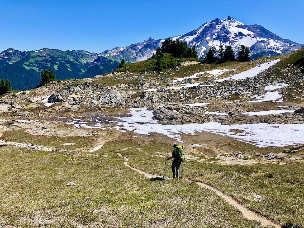
Ever since my October 2018 hike up to Sunup Lake, I’ve wanted to hike Lost Creek Ridge to Lake Byrne, the gem that lies at the eastern end of the ridge above the White Chuck River valley with front row seats to Glacier Peak’s western expanse. This year, wta member Wild Side and I got our chance. After examining the route on topo maps and google earth, we decided to plan the backpack as a 3 day/2 nighter. With a big elevation gain the first day, we had contingencies to camp at one of the lakes to the west of Byrne (Hardtack or Camp) or even in a meadow along the ridge where water was running and we could find a flat spot.
We started on a Friday morning at 10 am. By then the small parking area (space for about 5 cars) was already full, so we parked on the side 50 feet down the road. Fortunately, the NFS had recently mowed down the Devil’s club and other growth a good 6 feet on either side of the road to allow additional unofficial parking. The trail is in good shape most of the way up to Bingley gap (2.7 miles). The switchbacks start very gradually, but become increasingly steep as you gain elevation. As the trail breaks out of the forest into the meadows, the trails begins to show signs of deterioration. This is bound to be unavoidable in meadows where the dirt erodes much more easily than exposed rock, but clearly the Lost Creek Ridge trail is due for some maintenance. Additionally, as you leave the southern basin under Zi lob peak, the trail becomes what one trip reporter has called “a rollercoaster” until Hardtack Lake. In some sections where there are ascents and descents, the slope increases to +/-40-60%. Few of these places are treacherous, but they are energy-sapping!
As for water, except for a couple small trickles in the first mile, including at the duck-under of the massive old-growth tree downed on the trail, there is no water from about 2400 ft until Round Lake (assuming you want to make the nearly 600 ft descent to Round on your journey). Otherwise, the next water is from the drainage from Sunup Lake, about ½ mile from the overlook onto Round Lake and about 5400 ft elevation. Fortunately, much of the beginning of the hike is in gorgeous shaded forest. Water can also be found in several places in the basin beneath Zi lob peak, about 6 miles from the trailhead. Don’t plan on reliable water until Hardtack Lake, about 9.5 miles from the trailhead.
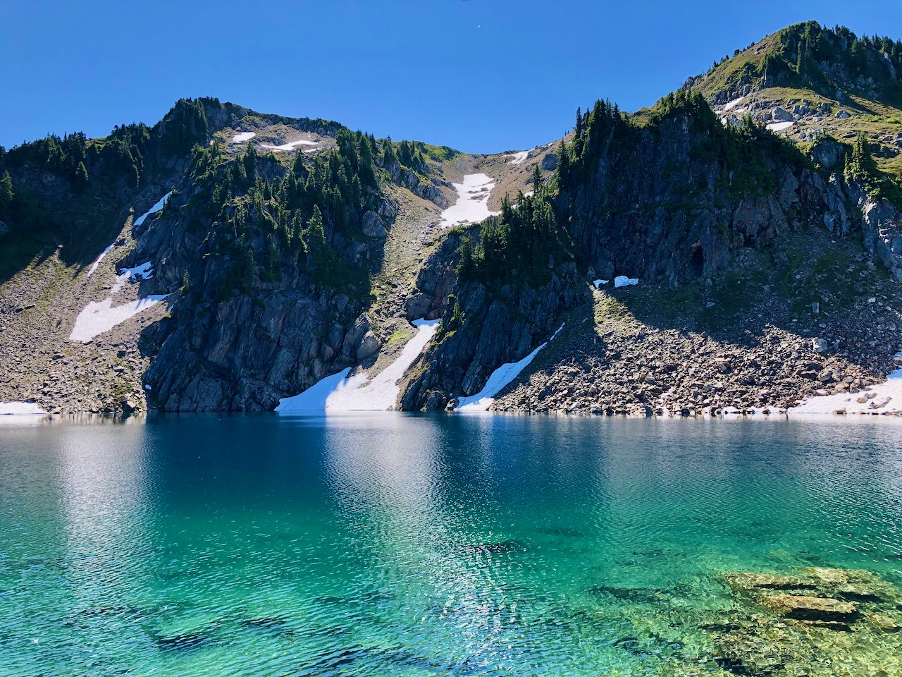
For Day 1, we were beat and decided to stop at Hardtack Lake. Hardtack Lake has several decent campsites around the lake, but the lake isn’t particularly scenic nor does it have great views. Fortunately, it’s just a short 2.5 miles to Lake Byrne and made for a leisurely 2nd day hike and long day exploring the beauty around Lake Byrne. Before getting to Byrne, we passed Camp Lake, which is spectacularly blue, with lots of fish visible. There are great camp sites there on the south side, and you’re likely to have fewer others camping with you if you camp here. But Camp Lake wasn’t our destination! Another 400 ft climb from Camp Lake takes you to what I’ve seen called “Little Siberia,” a rocky snowy meadow that forms a small plateau before the trail descends 400 ft back down to Lake Byrne.
Lake Byrne is spectacular to be sure! So blue I couldn’t believe it! Unfortunately, campsites are sparse, given that the eastern shore is dominated by small but steep meadowed bluffs. If the few campsites immediately near where the trail reaches the lake are full, you can continue over the lake’s drainage and follow the steep trail up the next bluff where there are many possibilities. The most flat and grassy campsites are actually at the far southern end of that bluff, although neither has both perfect lake view/access and Glacier Peak views. But you’re also likely to be alone at that end of the lake, and the lake access is superior there.
The steep slopes surrounding Lake Byrne limit exploring options, but it is possible to hike the boot trail counterclockwise around the northern end of the lake over the rocky boulder field to the western meadowed slopes under the snowfields that feed into the lake. And you can easily climb up here for better pictures of Glacier over the lake. That day we were there, a bird of prey of some sort (couldn't tell which), rocketed into the lake and came circling out of the basin with a trout in its talons. So amazing to see! Sunset is the show here, with the light changing from orange to pink on Glacier Peak. Sunrise is less dramatic since you're looking at its shadowed face.
Unfortunately, our departure on Sunday coincided with the unprecedented heat that built in that day. We departed Lake Byrne at 6:45 am and it took 8 hours, including a few stops, to get back to the car where it was >95 degrees. I drank 3 liters of water and only had to make a bathroom break one time until I was back home in Seattle! yikes! Overall, we agreed it was a glorious backpack, albeit one of the hardest of our lives, and well worth it, but probably one we would never do again given the condition of the trail on the ridge.


Comments
rubingrad on Lost Creek Ridge, Round Lake
AWESOME PHOTOS! this is on my bucket list... someday...
Posted by:
rubingrad on Aug 30, 2022 01:52 AM
adriennek on Lost Creek Ridge, Round Lake
I just hiked this last weekend - turned it into a grueling one-nighter/24-hour trip, staying at Camp Lake and making it as far as "Little Siberia" for a sunset walk. Beautiful area, no one else within 5 miles on a Friday night. Your notes were extremely helpful, thank you.
For others considering it - there were several small streams along the trail around Zi-Lob basin in late July.
Posted by:
adriennek on Aug 01, 2023 01:46 PM