Trails for everyone, forever

Home Go Hiking Hiking Guide Wynn-Jones Preserve

Wynn-Jones Preserve

Olympic Peninsula > Kitsap Peninsula
47.5874, -122.5566 Map & Directions
Length
1.5 miles, roundtrip
Elevation Gain
25 feet
Highest Point
96 feet
Calculated Difficulty About Calculated Difficulty
Easy
A newly improved trail through lush mature forest on the edge of Puget Sound. Photo by akflyer130. Full-size image
  • Coast
  • Dogs allowed on leash
  • Good for kids

Parking Pass/Entry Fee

None
Saved to My Backpack

Enjoy a quiet mile-long ramble among towering trees just outside of Port Orchard. Continue reading

Rating
0.00 out of 5

(0 votes) Log in to rate

Hiking Wynn-Jones Preserve

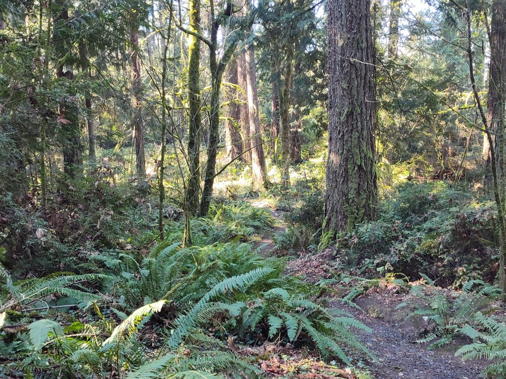
Wynn-Jones Preserve is a quiet 55-acre preserve donated to Kitsap County that has benefited from extensive trail work by 40 WTA work crews in 2024 and 2025. The WTA work parties installed 30 cedar wooden steps (hand-hewn from fallen trees) that make this trail now accessible year-round. This hidden gem makes for a wonderful short loop hike and offers a serene escape as you wander a mile around beautiful old-growth forest. The preserve also allows for some shoreline access (see below). The terrain is varied, with some elevation gain, making it a fun yet manageable hike for all levels.

To reach the trailhead from the parking area, head back up the driveway and turn left on Wynn-Jones Road for about 100 feet, until you will reach the signed Owl Ridge trailhead. Walking counterclockwise from this trailhead is preferable. The graveled start of the trail leads you up a short rise, but the remainder of the trail is mostly level and passes through some large cedar stands and over several wetland areas where boardwalks have been constructed.

Continue along the main trail (Owl Ridge - Connector - Eagle’s Nest trails), past two access trails (Northeast Trail and Sheldon’s Trail) and you will arrive back at the north trail head (signed Eagle’s Nest Trail). On the last portion of the loop, keep an eye out for the namesake eagle's nest high in a dead fir tree. At the Eagle’s Nest trailhead, turn left and head back downhill to the parking area.

WTA Pro-Tip: Once you return to your car, take a moment to visit the small strip of park just to the left (when facing the water) of the private residence marked 5968, extending to the high bank shoreline of Rich Passage. From here, you can enjoy stunning views of aquatic wildlife, Bainbridge Island, East Bremerton and ferry traffic.

Toilet Information

  • No toilet at trailhead

More information about toilets

WTA worked here in 2025 and 2024!

Hike Description Written by
Multiple authors contributed to this report, WTA Community

Wynn-Jones Preserve

Map & Directions

Trailhead
Co-ordinates: 47.5874, -122.5566 Open in Google Maps

Before You Go

See weather forecast

Parking Pass/Entry Fee

None

WTA Pro Tip: Save a copy of our directions before you leave! App-based driving directions aren't always accurate and data connections may be unreliable as you drive to the trailhead.

Getting There

From Highway 16, take exit 22 for Mullenix Rd. Head east on SE Mullenix Road. Go 1.1 miles and turn left onto Phillips Rd SE. Go 2.6 miles and turn right onto SE Sedgwick Rd. Go 0.5 mile and turn left onto Long Lake Rd SE. Go 1.8 miles and turn right onto Woods Rd SE. Go 4.1 miles and turn right onto Beach Drive E. Go 0.9 mile and turn left onto Wynn-Jones Rd E.   

Almost immediately after turning onto Wynn-Jones Rd, take the first driveway on the left (unpaved and heading downhill). Continue down the driveway and take the first left again. Park in the small unmarked parking area around the large tree on the left, across from private residence 5968 Wynn Jones Rd. 

More Hike Details

Trailhead

Olympic Peninsula > Kitsap Peninsula

Kitsap County Parks

Guidebooks & Maps

https://www.kitsap.gov/parks/Documents/WynnJonesPreserveMap2019.pdf

You can improve or add to this guidebook entry!

Wynn-Jones Preserve

8 Trip Reports

Hiked here recently?

Submit a trip report!
 
Loading trip reports...
Trip Reports