

This park includes an archery range, a series of equestrian trails, and various trails suitable for hiking or mountain biking. The Tapteal Trail is a 30-mile trail along the Yakima River that runs through W.E. Johnson Park. Using part of the Tapteal Trail in conjunction with other local trails provides several nice loop hikes.
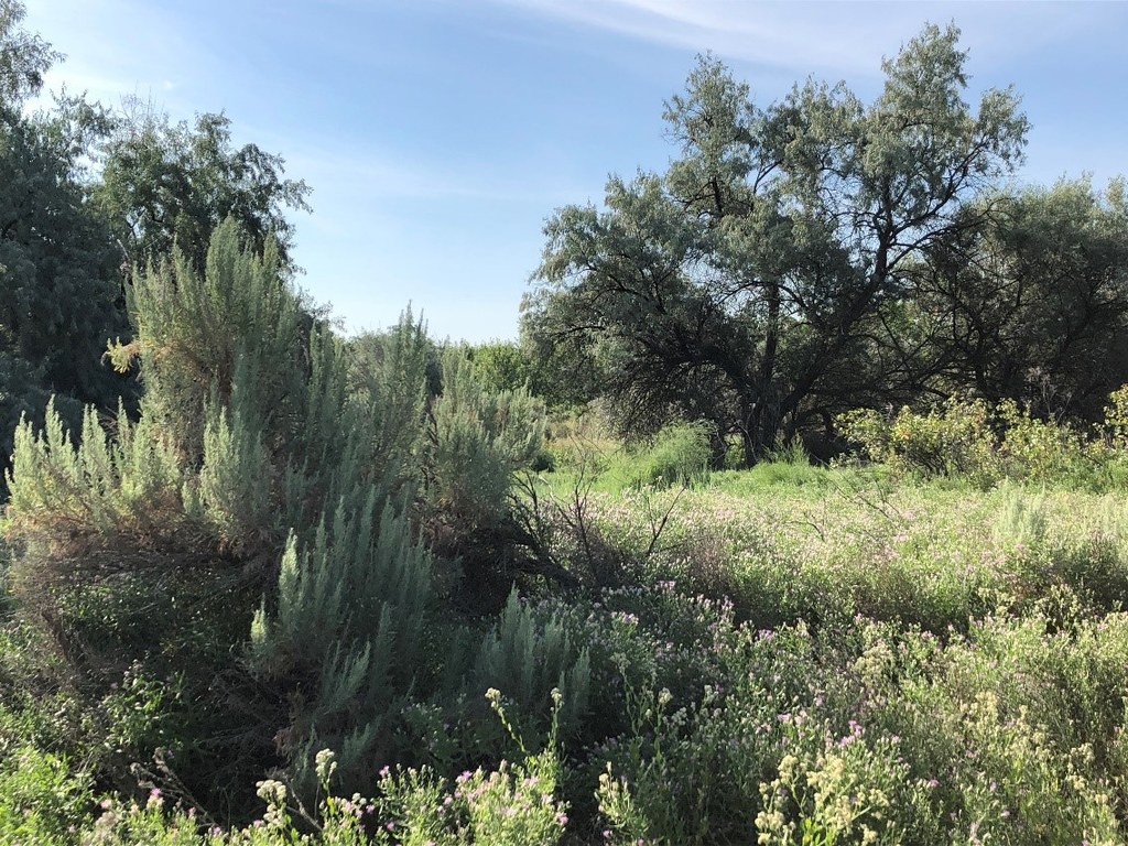
You’ll walk in the shade of Russian olive trees and cottonwoods, then emerge into the sun, surrounded by enormous sagebrush. You’ll likely hear lots of birdsong, and you may see deer or muskrats if you’re lucky. Be aware that ticks and mosquitoes are also part of the wildlife. Also note that portions of the park are subject to flooding or muddy conditions, especially in the spring.
From the north trailhead, walk south on the gravel road till you get to two metal gates. The main road goes off to the right and exits the park; the left fork is part of the Tapteal Loop trail, but that trail is usually blocked by water about 0.7 miles from the fork.
Instead of those, take the dirt road in the center (Tapteal Trail). Walk about a quarter mile to a trail junction marked with a posted map (which faces the opposite direction). You can either follow the center track (Tapteal Spur Trail) or the left track (part of the Loop Trail).
The Loop Trail (left track) heads southeast and passes a couple of trail junctions on the left. The Loop Trail then curves west and merges with the Tapteal Spur Trail, which proceeds south and intersects the Tapteal Trail. Turn right on the Tapteal Trail for the return leg of your loop (a left turn would take you to the South Trailhead). A short distance after the junction with the Tapteal Trail, you’ll see a minor trail bearing left. It’s worth taking a few minutes to walk that short trail to the Yakima River. Return to the Tapteal Trail and head north. When you get back to the gates, you can either return via the gravel road or take the footpath on the right (labeled Tapteal Trail) that runs parallel to the gravel road.
 Trailhead


