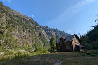
Although best known for its namesake mine and the nearby aircraft wreckage, the Tubal Cain trail also offers a pleasant and scenic route to Marmot Pass, a gateway to further wanderings.
After registering your visit at the trailhead kiosk, enter shaded forest and soon pass by a shelter and camp. Cross Silver Creek on a footlog, then begin a gentle ascent on a well-sloped trail lined with rhododendrons. The trail remains in the shade, and the rhodies remain the best view until they yield to mature forest at about 2.5 miles. At 3.0 miles, a mine shaft is visible on the hillside left of the trail. A few yards past is a junction with the Tull Canyon trail, which doubles back sharply to the mine shaft.
If the 1952 B-17 crash site is your destination, take the Tull Canyon trail to the mine and past. This trail is steep, gaining 450 feet in 0.6 mile, passing countless enormous boulders poised on the steep slopes all around you. Note that this short side trip is not counted in the round trip mileage. At the wreckage area is a plateau featuring several camp sites. A water source flows through the debris-strewn valley, but drinking water can be filtered upstream of most of the debris.
From the Tull Canyon junction, continue gently uphill, coming up beside a stream in 0.4 mile, then crossing it. If you’re particular about your water, know that most of this water is pouring directly out of the main shaft of the Tubal Cain mine. It may contain high concentrations of certain unsavory substances.
Just ahead is an unmarked junction. To the left are numerous camps (many littered with mining debris), and a hillside covered in tailings, marking the location of the main mine shaft. To the right is the main trail, more camps, and Copper Creek. Rock-hop the creek then turn right (north) and start climbing, passing in and out of tree cover. Ultimately, the trail breaks into the open, carved into a steep hillside populated with trilliums, lupine, alpine aster, scotch bells, and countless grasshoppers.
At 5.7 miles, a signed and obvious side trail leads down to Buckhorn Lake. Go left and negotiate the narrow trail via steep ups and downs past a few camp sites and plenty of water, to tiny Buckhorn Lake at 6.1 miles, elevation 5100 feet. Huckleberries can be found in some of the camps.
For wandering beyond Buckhorn Lake, the trail from the signed junction climbs more steeply to 6,200 feet and ridgetop views, before traversing around Buckhorn Mountain then dropping through more wildflowers to Marmot Pass, elevation 5,900 feet, 2.9 miles from the Buckhorn Lake junction. The Marmot Pass junction is with the Upper Big Quilcene trail, which in turn connects with the Constance Pass trail 1.5 miles to the southwest.
WTA Pro Tip (courtesy WTA correspondent Meagan Mackenzie): On your way out or back from your hike, check out the best local grocery store this side of anywhere. Sunny Farms, in Sequim at 261461 Hwy 101 W. Locally owned, it is crammed with lots of yummy, organic, fresh fare, and features a beautiful nursery.
Tubal Cain Mine to Buckhorn Lake

-
 Length
- 12.0 miles, roundtrip
-
 Elevation Gain
- 2,000 feet
-
 Highest Point
- 5,200 feet

Parking Pass/Entry Fee
NonePermits Required
Wilderness permit. Self-issue at trailhead (no fee)
Although best known for its namesake mine and the nearby aircraft wreckage, the Tubal Cain trail also offers a pleasant and scenic route to Marmot Pass, a gateway to further wanderings.
Continue reading
Hiking Tubal Cain Mine to Buckhorn Lake

WTA worked here in 2023, 2022, 2021, 2020 and 2019!
Map & Directions
 Trailhead
Before You Go
Parking Pass/Entry Fee
NonePermits Required
Wilderness permit. Self-issue at trailhead (no fee)WTA Pro Tip: Save a copy of our directions before you leave! App-based driving directions aren't always accurate and data connections may be unreliable as you drive to the trailhead.
Getting There
From Highway 101, turn west on Louella Road just south of Sequim Bay State Park. In 0.9 miles, turn left on Palo Alto Road. Travel 5.5 miles, then turn right on FS Road 2880. In another quarter mile, turn right again to remain on FS-2880, heading downhill. A sign warns, “Narrow Road. Not recommended for trailers or motor homes”. Cross a bridge, pass Dungeness Forks Campground, and then a scant mile later go straight, following the sign to “Dungeness Area Trails”. Travel 2.4 miles, then turn right on FS-2870. Go another 4.8 miles then turn left to remain on FS-2870. In a mile and a half, cross a bridge, pass the Dungeness Trails trailhead, and drive the remaining 3.5 miles to the parking lot, for a total of 21 miles from US 101. There is room for a dozen vehicles, plus additional shoulder parking. There are no trailhead amenities.