
The trail to Trout Lake is excellent for a beginning backpacking trip or a longish day hike for those wanting a robust outing that is easy on the knees.
From the trailhead, depart to the left of the kiosk and set out through gorgeous forest signature of the east side of the Cascades. Jack Creek itself is audible from the trail. Shortly after departing the trailhead, arrive at a fork. Take the left trail and continue on; less than quarter mile past the fork along, you'll arrive at a bridge crossing Trout Creek.
Pause on the bridge and enjoy the rushing water before continuing on. The trail meanders along a bluff above Jack Creek. Follow the creek for a mile until it turns away and heads into the forest. Shortly after this turn, you'll arrive at a fork in the trail. This is 1.3 miles from the trailhead. Either way takes you to the lake, but you'll want to take the left fork for the more nicely-graded Jack Creek Trail.
Follow moderate switchbacks through a forest of second-growth western redcedar and Douglas-fir trees. The grade is lovely, making for a delightful forest wander while gradually gaining elevation in shaded woods. This part of the trail is mostly open forest, though one swampy section boasts quite a bit of devils club and a short, mucky section of trail.
1.92 miles from the last junction, the trail rounds the shoulder of Jack Ridge and becomes more steep and exposed. On sunny days the views up valley here are lovely, with the meadows on the lower levels of Eightmile Mountain visible. Trout Creek is audible down below (though not visible or accessible), and the flowers along this section are gorgeous. Look for paintbrush, bistort, and lupine among others.
Continue along this ridge, climbing slightly and then descending to a more forested area. 2 miles from the talus field on the shoulder of Jack Ridge you arrive at a fork (and what seems like the lakeshore. It's not).
The trail to the left crosses a creek and heads up towards Windy Pass on a very infrequently maintained trail. You'll stick to the right, and, unfortunately, continue uphill about 0.6 more miles. It's not too bad a climb, but the false promise of your destination can be a morale suppressor if you're not expecting it.
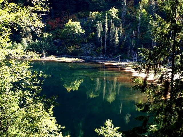
The lake as a destination is unusual. The view is beautiful, but between the trees in the camping area and the long, dried out marshy area before the water, it's difficult to access the water or relax by the lake. However there are some bare spots near the outlet stream that are good to sit and enjoy lunch before heading back the way you came.
WTA Pro-Tip : If you want to make a loop of it, continue along the Jack Creek Trail instead of coming back the way you came in. The trail climbs up to the spine of Jack Ridge before descending steeply into the Jack Creek river valley, then turns right at a junction and leads you straight back to the Jack Trout trailhead, where you started.
 Trailhead