Trails for everyone, forever

Home Go Hiking Hiking Guide Temperance Creek - Warnock Corrals Trailhead

Temperance Creek - Warnock Corrals Trailhead

Southwest Washington > Columbia River Gorge - OR
45.4822, -116.6497 Map & Directions
Length
1.0 miles, roundtrip
Elevation Gain
160 feet
Highest Point
6,853 feet
Calculated Difficulty About Calculated Difficulty
Easy
A trail sign on the Temperance Creek trail. Photo by Austin Smith. Full-size image
Saved to My Backpack

As we present this trail here, it is a short before-dinner leg-stretcher to witness some of the most remote country in the lower 48. Continue reading

Rating
0.00 out of 5

(0 votes) Log in to rate

Hiking Temperance Creek - Warnock Corrals Trailhead

So remote and desolate, the Forest Service doesn’t even have a description online for this amazing 5000’ descent trail into Hells Canyon. 

If you’ve come to this trailhead, you are at Warnock Corrals — you’ve come a long, long way to get here so please plan on spending a night or two. Warnock Corrals sits just west and below the top of Summit Ridge which overlooks Hells Canyon.

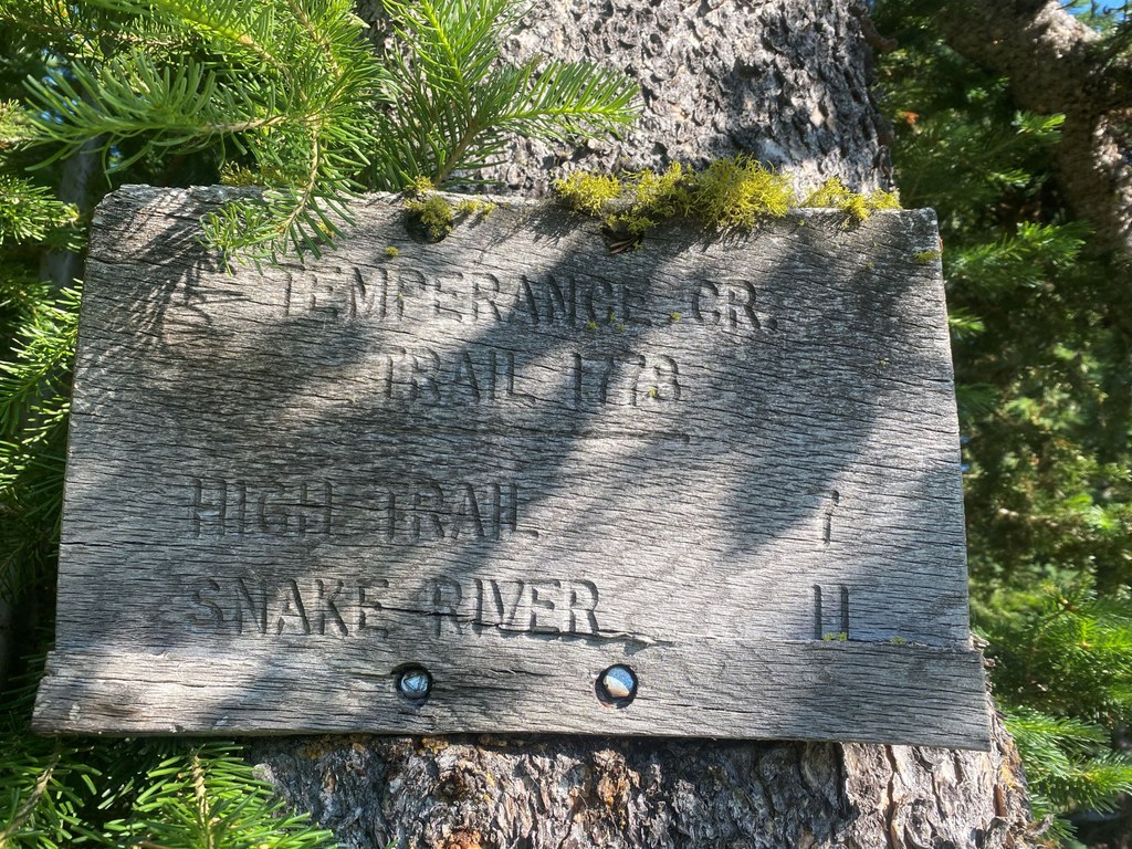
Hiking the first half mile of the Temperance Creek Trail will get you to the top of the ridge looking down into more than 5000 feet of descent. The view, to say the least, is stunning. Ridge upon ridge, drainage upon drainage, wildfire scarred — just stunning. To tackle the true trail to the Snake River is beyond the scope of this guidebook entry. Suffice to say, this short little leg-stretcher will wet your whistle for how dramatic, how big the backcountry can be. 

Pro Tip: Prescribed reading before hiking here or before venturing into Hells Canyon is Temperance Creek by Pamela Royes. 

Hike Description Written by
Austin Smith, WTA Correspondent

Temperance Creek - Warnock Corrals Trailhead

Map & Directions

Trailhead
Co-ordinates: 45.4822, -116.6497 Open in Google Maps

Before You Go

See weather forecast

WTA Pro Tip: Save a copy of our directions before you leave! App-based driving directions aren't always accurate and data connections may be unreliable as you drive to the trailhead.

Getting There

From Enterprise, Oregon, travel south 6 miles on Highway 82 towards Joseph. In Joseph, turn left on Highway 350 and go 30 miles to Imnaha, Oregon. In Imnaha, travel about 26 miles on Forest Road 2640 (Hat Point Road) to the Warnock Corrals trailhead.

Please note that FR 2640 is a very steep, winding narrow gravel/dirt road. Low-clearance vehicles, RVs and vehicles pulling trailers are advised to use caution on the lower sections of this road. The road can also be slippery when wet or frozen, and is not recommended for trailers in the late fall and winter.

More Hike Details

Trailhead

Southwest Washington > Columbia River Gorge - OR

Temperance Creek (#1778)

Wallowa-Whitman National Forest

You can improve or add to this guidebook entry!

Temperance Creek - Warnock Corrals Trailhead

1 Trip Report

Hiked here recently?

Submit a trip report!
 
Loading trip reports...
Trip Reports