Trails for everyone, forever

Home Go Hiking Hiking Guide Narrows Park

Narrows Park

Puget Sound and Islands > Seattle-Tacoma Area
47.2675, -122.5644 Map & Directions
Length
2.0 miles, roundtrip
Elevation Gain
10 feet
Highest Point
34 feet
Calculated Difficulty About Calculated Difficulty
Easy
The Tacoma Narrows Bridge from the beach walk along Narrows Park. Photo by Jaime Weber. Full-size image
  • Coast
  • Dogs allowed on leash
  • Good for kids
  • Wildlife

Parking Pass/Entry Fee

None
Saved to My Backpack

At low tide, walk along the rocky beach for an up-close view underneath the Tacoma Narrows Bridge and enjoy wildlife viewing from the shore along the way. Continue reading

Rating
0.00 out of 5

(0 votes) Log in to rate

Hiking Narrows Park

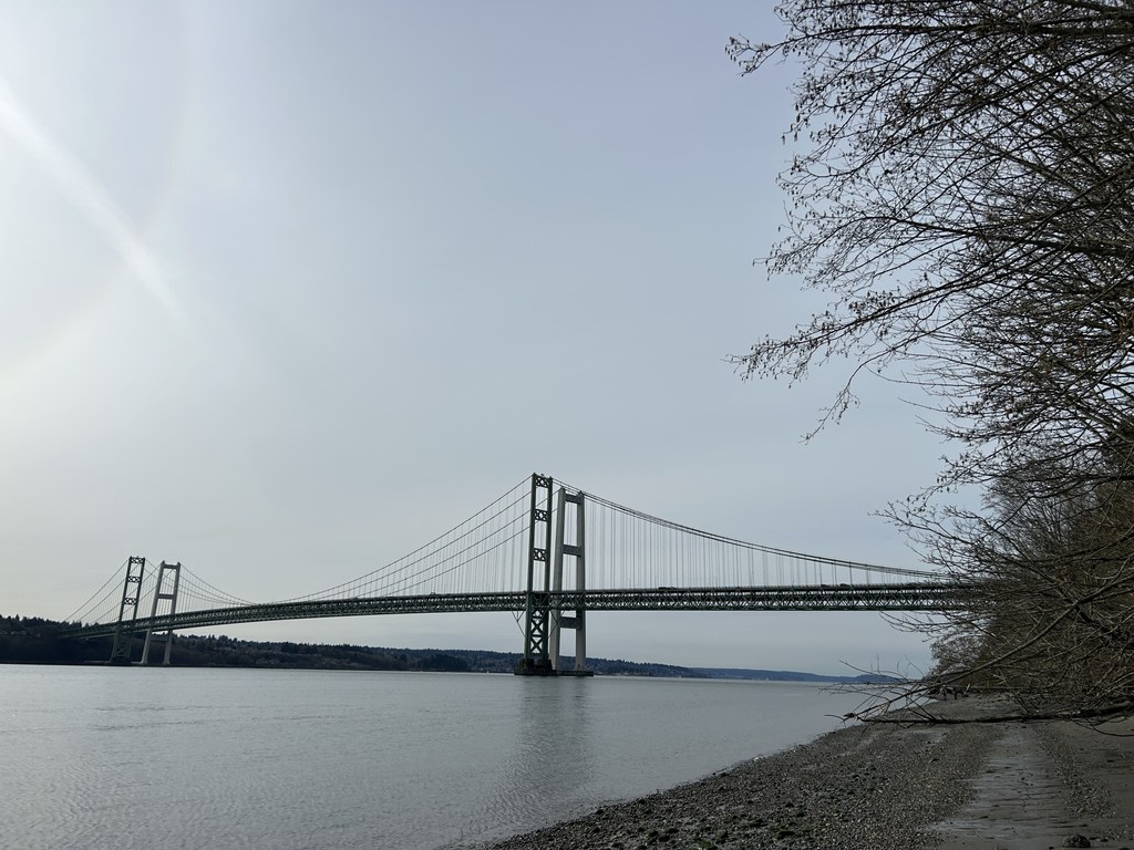
Before setting out along this beach walk, pay close attention to the tide tables. A couple of hours past high tide will be needed if you intend to reach the Tacoma Narrows Bridge.

From the parking lot, head down the short paved walkway. Take a moment to try out the telescope to spot whales or harbor porpoise, or pause for the view from the gazebo. Otherwise, take a few more steps down to the beach and turn left to head north towards the bridge. Along the 0.6-mile walk to the bridge, admire the large downed trees that have come to rest along the shore, the way is easy if the tide is out enough.

Past the bridge, at about the 1-mile mark, the beach becomes rockier and tide pools are more abundant. Shortly thereafter, eroded cliffs above and snags of trees start to make the way difficult. Turn back here to start the trek back and enjoy the southward views.

Toilet Information

  • Toilet at trailhead
  • Accessible toilet

More information about toilets

Wheelchair Accessibility

The viewing area is ADA-accessible.

Hike Description Written by
Jaime Weber, WTA Correspondent

Narrows Park

Map & Directions

Trailhead
Co-ordinates: 47.2675, -122.5644 Open in Google Maps

Before You Go

See weather forecast

Parking Pass/Entry Fee

None

WTA Pro Tip: Save a copy of our directions before you leave! App-based driving directions aren't always accurate and data connections may be unreliable as you drive to the trailhead.

Getting There

The park is located at 1502 Lucille Parkway NW in Gig Harbor.

From I-5 in Tacoma, take the exit for WA-16 W. In 6.6 miles, take exit 8 for 24th St NW toward Tacoma Narrows Airport. After 0.3 mile, turn left onto 24th St NW. In 0.2 mile, turn left onto Jahn Ave NW and again in 0.2 mile, turn left onto Stone Dr NW. Stone Dr NW turns slightly right and becomes Lucille Pkwy NW. Proceed 0.2 mile and turn right onto Doc's Drive. Follow the drive 0.4 mile and turn left into the park’s parking lot.

If this parking lot is full, there is room for a few more cars at the top of Doc’s Drive.

More Hike Details

Trailhead

Puget Sound and Islands > Seattle-Tacoma Area

Peninsula Metropolitan Park District

Guidebooks & Maps

https://penmetparks.org/parks/narrows-park/

You can improve or add to this guidebook entry!

Narrows Park

2 Trip Reports

Hiked here recently?

Submit a trip report!
 
Loading trip reports...
Trip Reports