Trails for everyone, forever

Home Go Hiking Hiking Guide Storybrook Park (Maplewood-McLeod Open Space)

Storybrook Park (Maplewood-McLeod Open Space)

Puget Sound and Islands > Bellingham Area
48.7811, -122.5100 Map & Directions
Length
0.6 miles, roundtrip
Elevation Gain
72 feet
Highest Point
144 feet
Calculated Difficulty About Calculated Difficulty
Easy
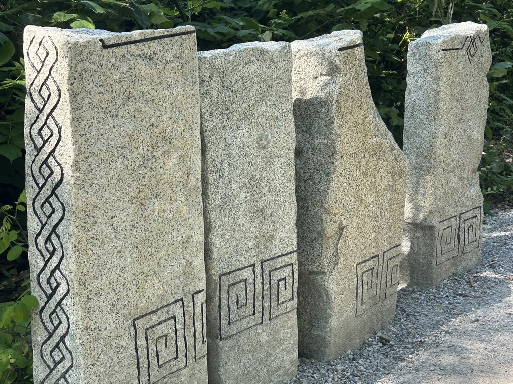
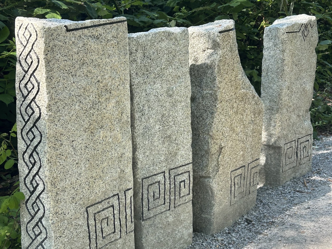
An engraved stone art exhibit at the start of the Forest Trail in Storybrook Park. Photo by Jen Boyd. Full-size image
  • Dogs allowed on leash
  • Fall foliage
  • Good for kids
  • Wildflowers/Meadows

Parking Pass/Entry Fee

None

Wander through a true neighborhood park in Bellingham with a creek, playground and art to enjoy. Continue reading

Rating
0.00 out of 5

(0 votes) Log in to rate

Hiking Storybrook Park (Maplewood-McLeod Open Space)

Storybrook Park is an intentional public space, chosen and built by the City of Bellingham to serve the nearly 5,000 residents who live within a ½ mile of the park, making it a walkable option for many. 

From the park entrance on W Maplewood Road, follow the wide gravel path toward the center of the park until the playground appears. Bend left to stroll slightly uphill to the park entrance on Cherrywood Avenue, checking out the pond area to the left on the way up. Head back toward the playground and bear left to the trailhead for the signed Forest Trail. The trailhead is marked with engraved stone art on the sides of the path and in the path itself. This loop travels through a small forested area with snowberry, red alder, elderberry and the like. 

Follow the loop around until it returns to the playground and then bend left to enter another (unsigned) forested trail to the left of the community information board. The path here descends on stairs to a creek easily accessible from the trail, a nice spot to spend a hot afternoon in the shade.  Then, continue over a small bridge to pop back up to the sidewalk. Backtrack via the sidewalk to the entrance on W Maplewood Road to complete the route.

Park amenities include a dog poop station, drinking fountain, trash cans, picnic tables, community information board and playground. Parking is available in two marked slots on W Maplewood Road but there is plenty of neighborhood street parking available as well. 

WTA Pro Tip: The nearest public bathroom is the gas station at the intersection of Airport Road and Bennett Drive. Another option is a restroom at Squalicum Park, just a bit south.

Toilet Information

  • No toilet at trailhead

More information about toilets

Hike Description Written by
Jen Boyd, WTA Correspondent

Storybrook Park (Maplewood-McLeod Open Space)

Map & Directions

Trailhead
Co-ordinates: 48.7811, -122.5100 Open in Google Maps

Before You Go

See weather forecast

Parking Pass/Entry Fee

None

WTA Pro Tip: Save a copy of our directions before you leave! App-based driving directions aren't always accurate and data connections may be unreliable as you drive to the trailhead.

Getting There

From I-5, take exit 258 toward Bakerview Road/Bellingham International Airport. Turn left onto W Bakerview Road. Turn left onto W Maplewood Road. The park will be on the right.

Take transit

Consider taking transit to the park as there is limited parking here. 

Washington Transportation Authority Route 18 stops at Maplewood Ave at McLeod Rd, which is right at the corner of the park. Route 232 stops at Northwest Ave at Shuksan Middle School; walk north to the intersection with Alderwood Ave and head west for one block to reach the block that the park is on. 

More Hike Details

Trailhead

Puget Sound and Islands > Bellingham Area

City of Bellingham

Guidebooks & Maps

https://cob.org/services/recreation/parks-trails/parks-guide/storybrook-park

You can improve or add to this guidebook entry!

Storybrook Park (Maplewood-McLeod Open Space)

2 Trip Reports

Hiked here recently?

Submit a trip report!
 
Loading trip reports...
Trip Reports