Trails for everyone, forever

Home Go Hiking Hiking Guide St. George's Trail (Trail 503)

St. George's Trail (Trail 503)

Eastern Washington > Spokane Area/Coeur d'Alene
47.7826, -117.4965 Map & Directions
Length
7.2 miles, roundtrip
Elevation Gain
1,280 feet
Highest Point
2,170 feet
Calculated Difficulty About Calculated Difficulty
Moderate
An abundance of spring wildflowers greet hikers along St. George’s Trail. Photo by Mary Hartman. Full-size image
  • Dogs not allowed
  • Rivers
  • Wildflowers/Meadows
  • Wildlife

Parking Pass/Entry Fee

Discover Pass

This out-and-back hike takes you through rich wildlife habitat on the south side of the Little Spokane River valley. You’ll find a variety of birds — from tiny songbirds to wild turkeys — and an abundance of wildflowers. Continue reading

Rating
4.00 out of 5

Hiking St. George's Trail (Trail 503)

The Little Spokane Natural Area within Riverside State Park protects the riparian ecosystem along the Little Spokane River. It isn’t as well known as the popular Bowl and Pitcher Area, so it’s perfect for hikers seeking more solitude. St. George’s Trail (also known as Trail 503) wends along the south side of the river valley, then climbs the rocky hill, providing views of the serpentine river below.

From the Indian Painted Rocks parking area, walk south on the Rutter Parkway across the bridge. Stay on the west side of the road; this allows better visibility on the blind curve and there is a walkway on the west side of the bridge. After you cross the bridge, you’ll see bollards on the east side of the road marking the start of St. George’s Trail.

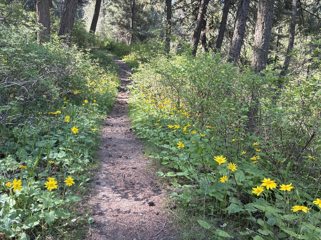
The first half mile of the trail is level, passing through a meadow, a pine forest with a lush understory and alongside a small wetland. The Little Spokane River is off to your left across the river plain. At a little more than 1 mile is a marked junction with Trail 504. Keep left to stay on Trail 503, which ascends gently and crosses briefly into property of St. George’s School. Respect the no trespassing signs on the school trails and stay on Trail 503, which turns south and climbs steeply. This part of the trail shows evidence of erosion from runoff, and is not recommended during spring runoff or wet weather.

After climbing about 500 feet in half a mile, the trail levels out and you’ll soon find a perfectly situated bench with a dramatic view of the river valley. Enjoy a well-deserved rest and a snack, then continue east for about 0.7 mile, when you’ll reach a junction with an unnamed trail. Trail 503 turns left (it’s not marked) and descends steeply to the trailhead on West St. George’s School Road.

Head back the way you came (pausing to admire wildflowers, birds and wildlife along the way so you can catch your breath on the steep uphill climb). For a little variety on the return journey, you can make a side detour on Trail 504, which winds through open pine forest and adds about half a mile. When you see a gate ahead, look to your right… Trail 504 turns that direction and reunites with Trail 503.

St. George’s trail is for hikers and trail runners only. No bikes, horses, or pets allowed.

WTA Pro tip: If you visit during spring or summer, be prepared for mosquitoes.

Toilet Information

  • Toilet at trailhead
  • Accessible toilet

More information about toilets

WTA worked here in 2022!

Hike Description Written by
Mary Hartman, WTA Correspondent

St. George's Trail (Trail 503)

Map & Directions

Trailhead
Co-ordinates: 47.7826, -117.4965 Open in Google Maps

Before You Go

See weather forecast

Parking Pass/Entry Fee

Discover Pass

WTA Pro Tip: Save a copy of our directions before you leave! App-based driving directions aren't always accurate and data connections may be unreliable as you drive to the trailhead.

Getting There

St. George's Trail (Trail 503) has two trailheads. The Indian Painted Rocks trailhead has parking for about 20 cars and a vault toilet. This trailhead is shared by various trails on the north side of the Little Spokane River. The Lower St. George’s trailhead (on West St. George's School Road/Rural Route 5) has room for about 6 cars and no toilet.

To reach the Indian Painted Rocks trailhead from I-90 in Spokane, take the Maple Street exit 280. Drive north on Maple/Walnut Street for 4.4 miles. Turn left on Francis Street and continue for 1.1 miles. Bear right onto Indian Trail Road and continue for 4.8 miles. Indian Trail will become West Rutter Parkway. Follow for another 0.7 mile; the parking area will be on the left.

More Hike Details

Trailhead

Eastern Washington > Spokane Area/Coeur d'Alene

Washington State Parks

Guidebooks & Maps

Day Hiking Eastern Washington (Landers & Romano – Mountaineers Books)

USGS Dartford

You can improve or add to this guidebook entry!

St. George's Trail (Trail 503)

2 Trip Reports

Hiked here recently?

Submit a trip report!
 
Loading trip reports...
Trip Reports