Trails for everyone, forever

Home Go Hiking Hiking Guide Springboard Trail

Springboard Trail

Eastern Washington > Okanogan Highlands/Kettle River Range
48.6138, -117.5344 Map & Directions
Length
2.6 miles, roundtrip
Elevation Gain
540 feet
Highest Point
3,637 feet
Calculated Difficulty About Calculated Difficulty
Easy/Moderate
The Springboard trail wends through beautiful, open forest. Photo by Mary Hartman. Full-size image
  • Dogs allowed on leash
  • Established campsites
  • Fall foliage
  • Lakes
  • Mountain views
  • Wildflowers/Meadows

Parking Pass/Entry Fee

None
Saved to My Backpack

This loop hike in a popular recreation area offers a good mix of forest and meadow, with just enough elevation gain to work your legs and lungs. Continue reading

Rating
3.00 out of 5

Hiking Springboard Trail

The Springboard Trail is named for a feature related to logging. As the trail’s interpretive guide explains, loggers put metal-tipped boards called springboards into notches in the lower part of the tree trunk so they could stand on them and cut the tree above the butt swell.

This interpretive trail has 8 posts corresponding to an informational sheet that you can download before your trip. However, with the passage of time, some of the features are no longer evident.

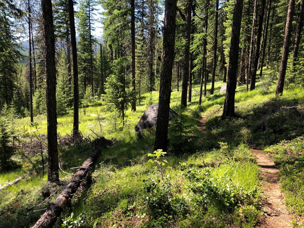
It’s a beautiful hike anyway, with wildflowers in the early summer and golden larches in the fall. A short walk from the trailhead brings you to a fork with a peeling sign. Turn left onto the Springboard Trail. After crossing a small stream on a footbridge you’ll reach another signed fork.

Go left to do the loop in a clockwise direction, which corresponds to the interpretive guide. The trail ascends, crosses an ORV track, and continues up through a mix of sun and shade. Post 5 is a viewing platform from which you can see Lake Thomas below. Near the top of the bluff you’ll pass through a sunny area filled with very young larch and pine trees.

As the trail descends, you’ll get back into deeper shade with larger trees. The trail continues to descend, crosses the ORV track again, and returns to the campground.

Toilet Information

  • Toilet at trailhead

More information about toilets

Hike Description Written by
Mary Hartman, WTA Correspondent

Springboard Trail

Map & Directions

Trailhead
Co-ordinates: 48.6138, -117.5344 Open in Google Maps

Before You Go

See weather forecast

Parking Pass/Entry Fee

None

WTA Pro Tip: Save a copy of our directions before you leave! App-based driving directions aren't always accurate and data connections may be unreliable as you drive to the trailhead.

Getting There

From Colville, Washington, drive east on Washington Highway 20 about 24 miles and turn east on Pend Oreille Lakes Road (watch for the “Recreation Area” sign). Drive 0.4 mile to Gillette Campground on the right (not to be confused with LAKE Gillette campground on the left).

The beginning of the trail is at the northern end of the Gillette Campground. There are two parking areas (two hour limit).

More Hike Details

Trailhead

Eastern Washington > Okanogan Highlands/Kettle River Range

Springboard (#149)

Colville National Forest, Three Rivers Ranger District

Guidebooks & Maps

100 Hikes in the Inland Northwest (Landers, The Mountaineers)

USGS Map: Lake Gillette 30

DNR: Colville

You can improve or add to this guidebook entry!

Springboard Trail

1 Trip Report

Hiked here recently?

Submit a trip report!
 
Loading trip reports...
Trip Reports