Trails for everyone, forever

Home Go Hiking Hiking Guide Snow Bowl Hut Snowshoe

Snow Bowl Hut Snowshoe

Mount Rainier Area > SW - Longmire/Paradise
46.7060, -121.9932 Map & Directions
Length
8.5 miles, roundtrip
Elevation Gain
2,000 feet
Highest Point
4,300 feet
Calculated Difficulty About Calculated Difficulty
Moderate/Hard
Snow Bowl Hut on a snowy evening. Photo by bhawn13. Full-size image
  • Dogs allowed on leash
  • Mountain views
  • Ridges/passes

Parking Pass/Entry Fee

Sno-Parks Permit
Saved to My Backpack

Bruni's Snow Bowl Hut is named for Brunhilde (Bruni) Wislicenus, a passionate mountaineer and wilderness skier who donated a substantial portion of the funds to rebuild the hut after a fire in 2007 burnt the original to the ground. Now, it provides skiers and snowshoers a place to warm up after a bracing 4.5 mile jaunt along forest roads in Tahoma State Forest. Continue reading

Rating
5.00 out of 5

(8 votes) Log in to rate

Hiking Snow Bowl Hut Snowshoe

Access to the south district of the huts, managed by the Mount Tahoma Trails Association, is via a series of steep forest roads. Climbing almost the entire way, the trek can be tiring, but don’t let this discourage you. The views are well worth it. If you're snowshoeing, make sure to practice good trail manners and stay to the right side of the road, out of the ski tracks.

From the lower Sno-Park trailhead, start up the road, continuing straight through the first junction in under a half mile. Pass the middle parking area at 1.2 miles and the upper park at 1.9 miles. After passing over Catt Creek, you’ll come to a string of switchbacks. Keep straight at the junction, then reach a low saddle at 2.6 miles. Here, the road veers right, where you can continue up to High Hut — closer, but a steeper hike.

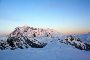
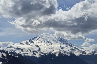
Turning left, you'll enjoy a somewhat flatter grade for a short while. Look for peek-a-boo views of Mount Rainier to your left, until the trail begins climbing again. You'll have another 0.8 mile of steep uphill before this section peaks beneath a banner of prayer flags strung up across the trail.

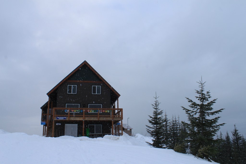
From this colorful indicator, continue on through more forest on a flat grade that begins descending downhill to a junction with the road leading to The Yurt — the furthest flung hut on the system. Stay to the right, and begin the final moderate uphill jaunt, just 0.25 miles to Bruni's.

WTA Pro Tip: Navigating snow travel can be difficult and dangerous! Be prepared by looking at trip reports (below), reading about the hike on the Mount Tahoma Trails Association website and brushing up on our winter safety tips.

Reservations

Each of the huts are open and free to enter during the day, but from 7 p.m. to 7 a.m., guests must have advance online overnight reservations. Reservations for the Snow Bowl Hut can be made on the Mount Tahoma Trails Association website.

Hike Description Written by
Anna Roth, WTA Correspondent

Snow Bowl Hut Snowshoe

Map & Directions

Trailhead
Co-ordinates: 46.7060, -121.9932 Open in Google Maps

Before You Go

Reservations must be made to stay overnight in the Snow Bowl Hut. See the hike description for more details.

See weather forecast

Parking Pass/Entry Fee

Sno-Parks Permit

WTA Pro Tip: Save a copy of our directions before you leave! App-based driving directions aren't always accurate and data connections may be unreliable as you drive to the trailhead.

Getting There

From Elbe, drive east on SR 706 to just a mile before Ashford (about 8 miles). Look for a Baptist Church on the right side of the road, and turn onto the road just before it. This is DNR Road 1.

Road 1 leads straight to the sno-parks for the south district of Mount Tahoma Trails Association. Proceed 5 miles from 706 along this likely snow-covered, but well-signed road to arrive at the lower sno-park.

If the gate past the kiosk is open, continue on for 1 mile to the upper sno-park. In the winter, have traction devices ready to put on, as this section is steep and can be icy. 

Note: Sno-park permits, not Discover Passes, are required between November and April. Discover Passes are required between May through October. 

More Hike Details

Trailhead

Mount Rainier Area > SW - Longmire/Paradise

Washington State Department of Natural Resources

Guidebooks & Maps

Mount Tahoma Trails Association map (Available at Whittaker's Mountaineering)

Green Trails Randle No. 301

You can improve or add to this guidebook entry!

Snow Bowl Hut Snowshoe

118 Trip Reports

Hiked here recently?

Submit a trip report!
 
Loading trip reports...
Trip Reports