Trails for everyone, forever

Home Go Hiking Hiking Guide Selah Valley Canal

Selah Valley Canal

Central Washington > Yakima
46.7486, -120.7980 Map & Directions
Length
2.0 miles, roundtrip
Elevation Gain
20 feet
Highest Point
1,645 feet
Calculated Difficulty About Calculated Difficulty
Easy
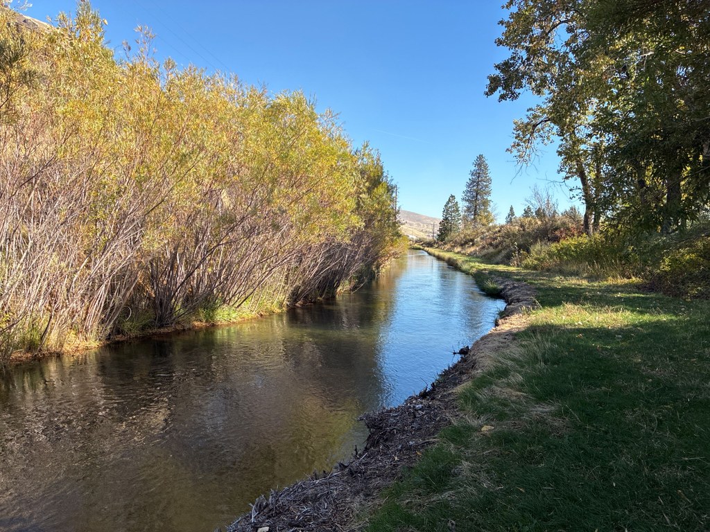
Coyote willows and cottonwood trees line the banks of the Selah Valley canal. Photo by Mary Hartman. Full-size image
  • Dogs allowed on leash
  • Good for kids
  • Rivers

Parking Pass/Entry Fee

Discover Pass

Munch on a Washington apple as you stroll along one of the irrigation canals that helped it grow. Continue reading

Rating
3.00 out of 5

Hiking Selah Valley Canal

Incorporated in 1916, Naches-Selah Irrigation District operates a network of canals and pipes that irrigates fruit orchards in Central Washington. A section of the Selah Valley Canal adjacent to the Oak Creek Wildlife Area provides a pleasant walk through willows and cottonwoods.

From the Waterworks Canyon Trailhead parking area, you’ll need to walk across a small bridge on WA 410 that crosses the canal. Take care, as there’s no shoulder. Immediately on the east side of the bridge you’ll see a mown path along the south side of the canal. Walk along the canal to the east for about half a mile and you’ll cross the Old Naches Highway. Continue another half mile and you’ll get a nice view of the Naches River on your right.

A bit farther, you’ll reach some irrigation district structures including a wasteway that drains water to another canal several feet lower. The Selah Valley Canal continues eastward through private property, so it’s time to turn around and return to the trailhead.

WTA Pro Tip: Caution — water in the canal runs swiftly, and the sides are steep. Keep control of pets and children!

Toilet Information

  • No toilet at trailhead

More information about toilets

Wheelchair Accessibility

The path is wide and level, but willows and weeds are continually trying to break through, so it is likely too rough for wheelchairs.

Hike Description Written by
Mary Hartman, WTA Correspondent

Selah Valley Canal

Map & Directions

Trailhead
Co-ordinates: 46.7486, -120.7980 Open in Google Maps

Before You Go

See weather forecast

Parking Pass/Entry Fee

Discover Pass

WTA Pro Tip: Save a copy of our directions before you leave! App-based driving directions aren't always accurate and data connections may be unreliable as you drive to the trailhead.

Getting There

Park at the Waterworks Canyon Trailhead, which is on WA 410, 0.5 mile west of its intersection with US 12. The turnoff is on the north side of the highway. It’s unsigned and is west of a small bridge over the irrigation canal. There’s room for 5 or 6 cars.

There’s also a smaller turnoff on the east side of the canal bridge.

More Hike Details

Trailhead

Central Washington > Yakima

Washington Department of Fish and Wildlife, Naches-Selah Irrigation District

Guidebooks & Maps

USGS Tieton

https://n-sid.org/district/district_map/

You can improve or add to this guidebook entry!

Selah Valley Canal

2 Trip Reports

Hiked here recently?

Submit a trip report!
 
Loading trip reports...
Trip Reports