Trails for everyone, forever

Home Go Hiking Hiking Guide Palouse to Cascades Trail - Crab Creek

Alert: On Oct. 1 the federal government began a partial shutdown that will impact National Parks, National Wildlife Refuges and U.S. Forest Service lands in Washington. Here's the latest information we have for hikers and campers


Palouse to Cascades Trail - Crab Creek

Central Washington > Potholes Region
46.8354, -119.7388 Map & Directions
Length
6.0 miles, roundtrip
Elevation Gain
0 feet
Highest Point
600 feet
Calculated Difficulty About Calculated Difficulty
Easy/Moderate
Nunnally Lake and the Saddle Mountains from the trail. Photo by David Hagen. Full-size image
  • Dogs allowed on leash
  • Good for kids

Parking Pass/Entry Fee

Discover Pass
Saved to My Backpack

This hike offers easy walking above the lakes and wetlands of Lower Crab Creek Coulee. You’ll have expansive views and a chance to see spring wildflowers and flocks of migrating waterbirds. Continue reading

Rating
0.00 out of 5

(0 votes) Log in to rate

Hiking Palouse to Cascades Trail - Crab Creek

East of the Columbia River, the Palouse to Cascades Trail runs straight-as-an-arrow up Lower Crab Creek Coulee beneath the towering escarpment of the Saddle Mountains. The coulee is laced with lakes and wetlands which host hundreds of migrating water birds. One favorite is the walk along the bluffs above Nunnally and Merry Lakes.

From the trailhead, cross the Palouse to Cascades Trail and head north on an old two-track 0.4 mile to the low bluffs overlooking Nunnally Lake. From here, wander east as far as you like on a clear hunter/fisherman/hiker trail. The ground is sandy at first and there are many opportunities to drop down to the lakeshore. 

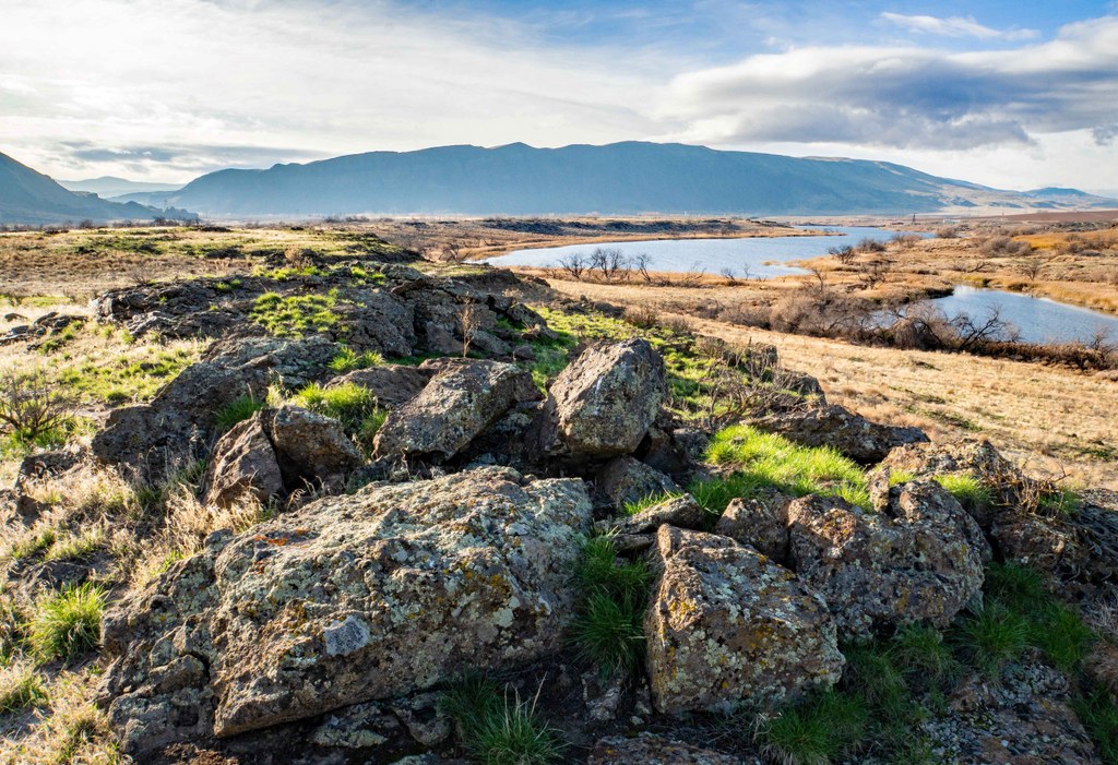
As you walk east, the bluffs get higher and more and more basalt begins to appear — slabs, boulders and larger outcrops all festooned with colorful lichens and mosses. Along the way, there are views to the north across Nunnally and Merry Lakes to the bluffs on the north side of the coulee and south to the dramatic 1,700-foot escarpment of the Saddle Mountains. 

You can walk the bluffs all the way to Lake Lenice (2.5-3 miles), but you may prefer to find a nice spot above Merry Lake to stop for lunch. Wherever you stop, when you’re ready to return you can either retrace your steps or make your way over to the Palouse to Cascades Trail and walk the railroad bed back to your car for a nice loop hike.

WTA Pro Tip: There is no shade or water on this hike. If you go on a warm or hot sunny day, but sure to have sunscreen, a shade hat and plenty of water.

WTA Pro Tip 2: Looking for a place to stay nearby? The Grant County PUD Sand Hollow Recreation Area has first come, first served camping. 

Hike Description Written by
David Hagen, WTA Correspondent

Palouse to Cascades Trail - Crab Creek

Map & Directions

Trailhead
Co-ordinates: 46.8354, -119.7388 Open in Google Maps

Before You Go

See weather forecast

Parking Pass/Entry Fee

Discover Pass

WTA Pro Tip: Save a copy of our directions before you leave! App-based driving directions aren't always accurate and data connections may be unreliable as you drive to the trailhead.

Getting There

From I-90 at Vantage, take exit 137 southbound to Highway 26. Continue for 1 mile and turn right to remain southbound on Highway 243. In 7.2 miles, turn east onto Lower Crab Creek Road SW in Beverly and drive 1.9 miles and turn left into the Public Fishing Access.

More Hike Details

Trailhead

Central Washington > Potholes Region

Washington State Parks, Washington Department of Fish and Wildlife

Guidebooks & Maps

DNR Priest Rapids

https://www.parks.wa.gov/DocumentCenter/View/19023/PTCT-Temporary-Map---Beverly-to-Idaho-border (PDF)

You can improve or add to this guidebook entry!

Palouse to Cascades Trail - Crab Creek

17 Trip Reports

Hiked here recently?

Submit a trip report!
 
Trip Reports