Trails for everyone, forever

Home Go Hiking Hiking Guide Old Kettle Falls Trail

Alert: On Oct. 1 the federal government began a partial shutdown that will impact National Parks, National Wildlife Refuges and U.S. Forest Service lands in Washington. Here's the latest information we have for hikers and campers


Old Kettle Falls Trail

Eastern Washington > Selkirk Range
48.6000, -118.1204 Map & Directions
Length
2.6 miles, roundtrip
Elevation Gain
0 feet
Highest Point
1,300 feet
Calculated Difficulty About Calculated Difficulty
Easy
Bridge on the Old Kettle Falls Trail. Photo by Holly Weiler. Full-size image
Saved to My Backpack

With an interesting history, this path wanders through the old Kettle Falls townsite and makes a good choice for a late fall or winter walk. Continue reading

  • Dogs allowed on leash
  • Good for kids
Rating
0.00 out of 5

(0 votes) Log in to rate

Hiking Old Kettle Falls Trail

In the early 1900s, Kettle Falls was a town of 300 people on the shores of the Columbia River.  Today Kettle Falls is a town of 1,600 people near the shores of Lake Roosevelt. So why did the town move? The construction of the Grand Coulee Dam 100 miles downstream was the reason. 

In all, 11 towns would be inundated by rising waters as the reservoir filled behind the dam.  Many of the Kettle Falls residents and businesses moved to higher ground to the present-day site of Kettle Falls. Buildings and other objects were removed before the reservoir filled, but a few remnants of the old townsite remain near the lakeshore and can be seen from the Old Kettle Falls Trail.  

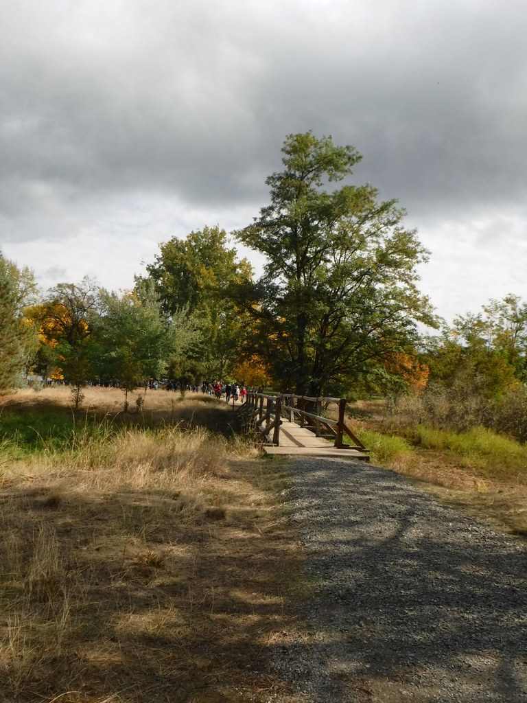
From the trailhead, walk south and pass the boat launch access road. You’ll soon cross a bridge over a marshy wetland area.  Keep your eyes peeled for birds. Before long, the trail veers left reaching the road to the Locust Grove Group Camp.  Continuing across the road, you’ll soon come to signs of the town that once was.  Old homesteads, pastures and orchards give a glimpse of what life in Kettle Falls used to be like.  

After just over a mile, a junction is reached. Stay to the right, traveling along a forested bluff until the trail ends at 1.3 miles. Enjoy the view of the lake and imagine what the landscape looked like before the dam was built. When you are ready, return the way you came.

WTA Pro Tip: Sandy’s Drive-In along US-395 in Kettle Falls makes a great stop for a pre-hike breakfast or a post-hike lunch.

Hike Description Written by
Lindsay Leffelman, WTA Correspondent

Old Kettle Falls Trail

Map & Directions

Trailhead
Co-ordinates: 48.6000, -118.1204 Open in Google Maps

Before You Go

See weather forecast

WTA Pro Tip: Save a copy of our directions before you leave! App-based driving directions aren't always accurate and data connections may be unreliable as you drive to the trailhead.

Getting There

From Kettle Falls, travel west on SR 20/US 395 for 2.2 miles. Turn left onto Boise Road, continuing for 1.6 miles. Here the road forks; stay to the right and come to the Kettle Falls Campground. Park near the ranger station for the trailhead.

More Hike Details

Trailhead

Eastern Washington > Selkirk Range

Lake Roosevelt National Recreation Area

You can improve or add to this guidebook entry!

Old Kettle Falls Trail

2 Trip Reports

Hiked here recently?

Submit a trip report!
 
Trip Reports