Trails for everyone, forever

Home Go Hiking Hiking Guide Oak Creek Wildlife Area - Naches River

Oak Creek Wildlife Area - Naches River

Central Washington > Yakima
46.7482, -120.8036 Map & Directions
Length
1.6 miles, roundtrip
Elevation Gain
25 feet
Highest Point
1,665 feet
Calculated Difficulty About Calculated Difficulty
Easy
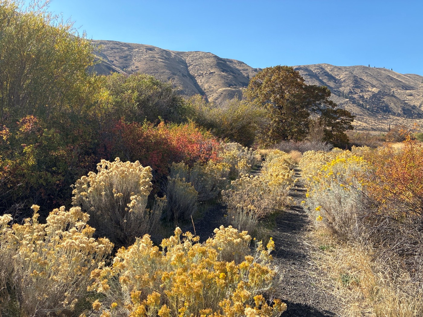
Glorious autumn colors along the Naches River. Photo by Mary Hartman. Full-size image
  • Dogs allowed on leash
  • Fall foliage
  • Good for kids
  • Rivers
  • Wildflowers/Meadows

Parking Pass/Entry Fee

Discover Pass

This short, easy hike takes you through a beautiful example of mixed pine and oak shrub-steppe. Continue reading

Rating
4.00 out of 5

Hiking Oak Creek Wildlife Area - Naches River

The Naches River is a major tributary to the Yakima River in central Washington. It flows through the Oak Creek Wildlife Area, where an unused gravel road provides a lovely route along the river. You’ll see sagebrush and other shrub steppe flora, but also Oregon white oak (Garry oak), cottonwood, pine, sumac and wild roses… and some riparian plants to boot. The area is especially vibrant in the fall when the sumac is blazing red and the rabbitbrush is brilliant yellow.

Pass around or under the gate and walk west on the gravel/dirt road, parallel to the Naches River. The road goes on for about 0.8 mile where it intersects WA 410. Turn around and see what new things you can observe on your way back to the trailhead.

WTA Pro Tip: Parts of the trail may be overgrown with brush. Watch out for ticks in the spring!

Toilet Information

  • No toilet at trailhead

More information about toilets

Wheelchair Accessibility

The trail is wide and level, but parts of it are overgrown with brush. 

Hike Description Written by
Mary Hartman, WTA Correspondent

Oak Creek Wildlife Area - Naches River

Map & Directions

Trailhead
Co-ordinates: 46.7482, -120.8036 Open in Google Maps

Before You Go

See weather forecast

Parking Pass/Entry Fee

Discover Pass

WTA Pro Tip: Save a copy of our directions before you leave! App-based driving directions aren't always accurate and data connections may be unreliable as you drive to the trailhead.

Getting There

The unmarked turnoff is on the south side of WA 410, 0.5 mile west of its intersection with US 12. It’s just west of a small bridge over an irrigation canal.

Drive into the area about a quarter mile till you reach a gate barring motor vehicles. Find a place to pull off, and don’t forget to hang your Discover Pass.

More Hike Details

Trailhead

Central Washington > Yakima

Washington Department of Fish and Wildlife

Guidebooks & Maps

USGS Tieton

You can improve or add to this guidebook entry!

Oak Creek Wildlife Area - Naches River

1 Trip Report

Hiked here recently?

Submit a trip report!
 
Loading trip reports...
Trip Reports