

Mount Spokane's Trail 140 is the only trail route extending from the base of the mountain near the park entrance all the way to the summit. With several access points and multiple connecting trails, there are numerous ways to enjoy a visit to this trail. The full one-way trail distance of Trail 140 is 6.1 miles, but this hiking guide entry focuses on the middle portion, a 2 mile segment that connects between Smith Gap and Saddle Junction.
Since Middle Trail 140 is on the interior of the Mount Spokane State Park trail system, it is necessary to choose a connector trail to access this section. The most popular access point and route is from the Lower Kit Carson Loop Road Trailhead, where visitors frequently choose the “Christmas Tree Loop” by connecting portions of trail Trail 100 and Trail 110 with Middle 140 and the Lower Kit Carson Loop Road to create a route that looks remarkably like a Charlie Brown Christmas tree on the map.
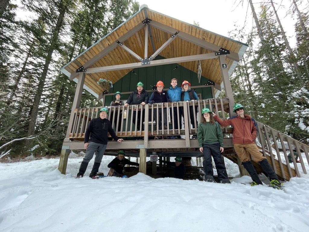
Regardless of how one arrives at Smith Gap, the lowest portion of Middle Trail 140, it is worth a stop to enjoy the amenities at this location. There is a CXT toilet and a picnic table adjacent to the Lower Kit Carson Loop Road, and a short hike up the hill above the CXT leads visitors to the cozy snowshoe warming hut. The hut is open to day use year-round, but is an especially welcoming location in the winter. The small cabin has a lovely picnic table hand-built by park volunteers out of a western white pine that fell on the Nordic trail system several years ago, decorative nature panels and historic park signage on the walls, and a small woodburning stove that helps warm park visitors.
From Smith Gap, walk approximately 200 feet west on the Lower Mount Kit Carson Loop Road and watch for the Trail 140 sign on the north side of the trail. This middle section of Trail 140 was rerouted a few years ago to improve the trail grade, and features long sweeping climbs and turns as it continues to ascend the mountain. This portion of the trail crosses a drier ecosystem on the mountain, where lodgepole and ponderosa pines are numerous in the lower areas, and are gradually replaced by grand fir and Douglas fir up higher, along with a few western white pine and western larch. This portion of the trail climbs approximately 837 feet in 2 miles and comes out at Saddle Junction.
Saddle Junction is another major trail intersection for Mount Spokane State Park, featuring an outhouse and bench. In addition to Trail 140, this is also the junction of Trail 110 (leading to both the Hairpin Turn parking lot and the Park Entrance trailhead), Trail 130/160 (leading to the summits of Mount Kit Carson and Day Mountain) and the Upper Mount Kit Carson Loop Road. To continue on Trail 140, cross the Upper Mount Kit Carson Loop Road and continue climbing toward Mount Spokane's summit.
 Trailhead


